

7/8 February 2021
It was always there. The sun set behind it. The sun rise glowed orange against its broad flanks. It stood sentinel over the plains. You could see it for hundreds of miles before you came upon it. And then, one summer, in 1995, I lived beneath it. And because it was always there, and because you could see it from everywhere, I just had to climb it.
That mountain was Pikes Peak.
You can drive to the top. You can take the cog railway. There’s a visitor’s centre on top that, at least at the time, was famous for its cinnamon donuts.
Pikes Peak is a rather large mountain – a fourteener in fact (a peak over 14,000 feet tall). The trail from its base is 13 miles long and gains more than 7,000 feet. Supposedly, it’s the trail with the greatest elevation gain in the state. So it’s nothing to sneeze at.
That summer, I worked on a landscaping crew at Colorado College where I was taking a Wilderness Management and a Nature Writing course that summer. All the old guys in the workshop tried to convince me not to climb the mountain. They said it was one of the hardest fourteeners to climb and that I should cut my teeth on something easier. After all, there are 54 peaks over 14,000 feet in the state.
But none of those peaks were RIGHT THERE. And because it was right there, of course I had to climb it. I think that’s why Hilary climbed Everest, so it’s not an uncommon reason to want to summit a peak.


Now, at the time, I had a boyfriend. Of sorts. He was a lot older than me. And an alcoholic. And not very reliable. He said he’d climb the peak with me. He was super-fit – maybe because he worked in construction and had to ride a bike everywhere because he’d lost his driver’s licence. Yeah, he was not the best choice ever.


However, fine quality specimen that he was, when it came down to it, he didn’t want to go. And so this meant I decided to go do that big climb on my own.
I did not have a car at the time. So the hike began with 10-mile bike ride with a 1500 foot elevation gain. I rode those 10 miles on a very crappy Huffy ten-speed I used as a commuter bike. I carried my big pack with me, as I wanted to take extra gear (e.g. sleeping bag, warm clothes) in case I got stuck and had to overnight somewhere.
On the big day, I got up super early, rode my bike to the trailhead, locked it to one of the trailhead signs and started hiking. And hiking and hiking. But I was young and fit and it really wasn’t that big of a deal. 13 miles; 7,000 and some feet – yeah, all in a morning’s work. You can do just about anything when you are 19. Yeah, I had to crouch down and wait out a thunderstorm above treeline, but even then it was a very popular trail, and I was not the only one up there doing so.


Not wanting to walk all the way back down, I had booked a seat on the cog railway to take me back to the bottom. The only problem was that I had booked the last train of the day at 5pm, allowing me the maximum time possible to complete the long hike. However, I had summitted by noon. Luckily, a kind railway driver took pity on me and let me ride back down with him sitting in an emergency jumpseat. I just had to duck down to the floor when we passed the other train so no one knew he’d allowed it.


The adventure did not end at the bottom of the mountain. I still had to get home. The crappy Huffy was still there when I returned, but promptly decided to flat a tyre just a couple miles down the road. Undeterred, and without a patch kit because I never rode with one back then, I started pushing the bike home. I do not recall even considering something else. Sure, I can walk another 8 miles. (Nowadays, I would have called a cab and ditched that $25 bike!).
Some man in a pick-up took pity on me and offered me a ride, as I shuffled along with the bike and pack down US 24. Nowadays, I would never ever get in a vehicle with a strange man on Hwy 24 in Colorado Springs. But my guardian angel got a pretty huge workout in the first 25 years of my life.
I accepted the ride with the man in the pick-up. We threw my bike in the back and stopped for petrol along the way. Nowadays, I would never have a stranger drop me off at my place. I would ask to be dropped off a block or so away. But this guy, who was a bit drunk after a day of fishing up at the reservoir near Woodland Park, dropped me and the crappy bike right at the front door of the very crappy apartment building I lived in that summer. That may have been one of my nine lives. The one thing about getting old is that you do accumulate some wisdom along the way.


So, here we are, 26 years later, and there is a peak behind my new place in Wodonga that sits there and looks at me while I eat dinner in the backyard. Weekends in January are full of packing, moving and cleaning the new place and cleaning the old place and just trying to get settled.
But still that peak back there keeps demanding to be climbed. It’s not really a peak. It’s a hill. In fact, it’s named Huon Hill. It rises to 417 metres. The summit is 3.8 kms and about 220 metres uphill from my place.


So at the first opportunity, the guys and I go climb it on a warm Sunday afternoon. From our place, we walk uphill past all the homes in the neighbourhood built in the 1980s. Then we walk along the footpath in the new “Silky Oaks” Estate (my part of the neighbourhood is not expensive enough to ever have had a name). The Silky Oaks homes were all built around 5 or 6 years ago and are pure environmental vandalism – small blocks, houses not sited at all to take advantage of air flow or roof top solar, black roofs that make hot houses even hotter, windows that don’t open very much, no crossflow of air in the design of the home, and no eaves for shading. You are totally reliant on heating and air-conditioning year-round to be comfortable.


Once past those homes, we join the old highway (bypassed now by the Bandiana Link from the freeway) and walk past all the big box stores and fast food outlets. Bunnings is a cultural institution in Australia – it’s Australia’s most trusted brand and where everyone goes for hardware, garden and home improvement stuff. The sausage sizzle fundraisers held outside by a different community group each Saturday morning has become part of Oz’s shared history and identity. At one point, there was so much debate about whether the onion should go on top of the sausage or underneath, that the Prime Minister (Oz’s version of the POTUS) weighed in. Hilariously, the day that this was our top news story, America was dealing with another mass shooting, or something equally hideous, and here we were debating sausages!


And here is the debate about the onions: https://www.sbs.com.au/news/pm-weighs-in-on-bunnings-sausage-sizzle-debate


So once we get past the big box stores, we pass a pub – a very working class one that has an attached motel. Then we cross the 4-lane divided highway and work our way up through a new neighbourhood with equally environmentally-horrible home designs packed onto the side of the hill.


And then, finally, we make our way up into the reserve, past all of the water infrastructure for the city and then commence the steep climb to a saddle. It’s 28C with a moderate breeze. It’s a bit warm, but it really is gorgeous for this time of year. I can’t believe no one else is out and about. It’s just the cows and the kangaroos and us.


After the steep pinch to the saddle, there is another uphill along a road cut into the side of the hill.
We then pop around the hill and get good views over to the Mitta Arm of Lake Hume. It’s pretty cool to be able to see three river valleys (Murray, Mitta, Kiewa) from here. We walk up to the top (the mobile phone tower is fenced off) and have a look around and try to identify various hills, streets and other geographic markers.


This link has a good explanation of the history of the reserve and shows all the trails I’ll eventually check out:https://www.parklands-alburywodonga.org.au/explore-your-parks/Huon-Hill-Parklands.asp
The really nice thing about this is that I work out the last of the pain in my legs. The combination of crap that I deal with means my calves swell and are often very painful. It’s neuropathy and the best thing for it is to ride or walk and then put my feet up after. One of the ways I know I’ve extended myself too much is that the neuropathy gets worse. It also gets worse if I sit around too much. There’s a Goldilocks place in between too much and too little, and for the past month I have not hit that at all. But today we’ve got it!
I’ve never had any desire to live in Wodonga. I like Albury much better. Wodonga has no soul – it’s main street just feels like a suburban shopping strip. Albury is on the river and has gorgeous parkland that takes advantage of it. It feels like a city and it just feels so much more sophisticated than Wodonga. It’s main street has a vibe – a good, laid-back but provincial vibe. Wodonga doesn’t have any of that. Wodonga is a bit more like Albury’s suburb of Lavington – it’s a lower socio-economic area with lots of bogans (and lots of diversity since immigrants and refugees tend to have lower incomes). Wodonga also has a sizeable army logistics base on the edge of town at Bandiana – and all the military people give it a conservative, bogan vibe, too.
So even though I’ve never been a big fan of Wodonga, I found a good unit there that has modern split system air-conditioning. I’m 2 kms from the city centre, the southern shopping centre and 1 km from the rail trail that goes out to Tallangatta. The unit is up the back of the four on the block, the shared wall is shared with the neighbour’s garage instead of a living space, and the unit backs onto a nature/utilities reserve and has lots of trees around. It was also quite cheap. So here we are in Wodonga.
And here we are at the top of the hill looking down and feeling so, so fortunate to live in such a beautiful location. Towns in Oz really do punch above their weight in terms of amenities, public spaces and recreational opportunities. Local government does all the heavy lifting in Oz, and for the most part, do a great job given all the constraints, responsibility and lack of funds.
We make our way back down the hill, past all the big box stores again and then back through the neighbourhood. I meander a bit to give you (mainly, my parents, so they can ‘place’ me) a tour of the amenities. Really, I just wanted to show off the basketball court a block away from home. Outdoor courts are hard to find in Oz. There was one in Corowa where I lived for a couple years, but it had net and the concrete was way too narrow, so you were constantly chasing the ball into dirt and gravel and trying not to turn your ankle on the edge of the concrete. But this court looks great AND the timing is good. It has only been in the last 2-3 months that my frozen shoulder has enough range of motion that I could actually shoot the ball. So I will have to invest in a ball again.


I need to take it a bit easy Monday to preserve some energy for the week ahead. It looks super busy and stressful. This weekend has been my first four-day weekend after going to three days a week of work. But looking ahead, I am not sure how I’m going to manage 4+ days of work in 3 days. I’m managing projects worth hundreds of thousands of dollars with more than a dozen stakeholders in each project. We got a new staff member, but I was only able to really hand off one project which probably just wouldn’t have gotten done had she not joined our little team. But I’m still juggling way more than I can reasonably do in four days but will now need to do in three. I’m not sure how it’s going to work out, or even if it will.
But still, I have contract negotiations and two project kick-off meetings this week, so I need to go in feeling a little refreshed. So instead of a long ride Monday, I decide I’ll just ride around the CBD (central business district) and a nearby park and take some photos to show where I live.
As I said before, Wodonga is not very impressive. However, the city has done a HEAP of work over the past decade to fix up the downtown area and make it more pedestrian-friendly. They have done a really nice job of making the civic precinct and downtown area have a much better feel.
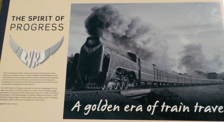
Key to the timeline of fixing up the city was when the rail-line was removed in 2010. This used to run right through the middle of town, but with its move out to the floodplain on a bypass, the city was able to turn the old station area into a dining and park precinct. And, across the road, on the site of the old tracks and an old department store, they were able to build a new shopping centre with Coles and Kmart as anchor tenants. It’s the best, and largest, Coles supermarket in the region.


Here are some images from Junction Place, the dining and recreation precinct they’ve fixed up on the old railway station site.


And here are some images of the main street that they did a heap of work on over the past seven years and the civic precinct that sits one street back.


And here are some pics of the park that’s a couple blocks away. This would have been wetlands at one time, but is now a series of ponds with walking paths around them. It is close to where House Creek runs into the Murray River. The freeway also runs adjacent. If you go under the freeway and over the creeks, there is a bike path along the Lincoln Causeway through the flood plains that leads to Albury from here.


So I’m sorry there was no great adventure this week, but hopefully this will give my parents (and you, if you were interested) a feel for where I’m residing for the next 12 months. And hopefully, going back to 3 days a week at work will give me more energy for fun adventures as we move into better temperatures in the months ahead. I felt really, really scrappy for most of January and spent all of my energy on moving and cleaning. But I’ve got hope going forward that I can settle into a routine that involves more time on the bike out exploring and enjoying all that the region has to offer.