

Sat-Mon, 14-16 Oct, 115 miles (185 km)
There was a ride on my map that I was terribly disappointed not to accomplish before I left Australia permanently. It was the “Around Lake Eildon” ride. It has beckoned to me from the map and streetview for a long time. But because it’s a two -hour drive away, it just didn’t happen. But through the crazy paths of life, we find ourselves back in Oz, and the weekend weather forecast is perfect. So we get a second chance for the ride that almost got away.
Day 1 – Mansfield – Howes Creek – Goughs Bay – Piries – Jamieson – The Pines
There are mornings where it would be easiest to just roll over and go back to sleep. Today is one of those. I’m still tired and wanting more sleep at 6.00am.
BUT, the weather forecast is perfect. I have a long-dreamed-about ride to do. I haven’t been out for an overnight in almost two months. It is time to go, you lazy, crazy chick!
And so I roll out of bed, roll out the door and roll down the road (in the car). It takes us 1 hour and 45 minutes to drive to Mansfield. I can load up the bike in five minutes and I’m rolling at 7.55am. I leave the car in the all-day parking lot that leads up High Street. We’ll see if it is there when I get back….
The road leads out of town on undulating land with quarter-acre blocks giving way to lifestyle blocks and then into open paddocks. Higher hills ring this valley in the distance. We will roll through gentle hills for our first 20 miles as we travel first on chipseal and then a few miles of gravel. There’s a bit of traffic to start – most going the other way for their morning coffees, brekkies and papers in town. We pass immaculate, large homes on 20-40 acre blocks carved out of larger, pastoral properties. It is pleasant riding, though the lake is only in view a few times in this distance. I think about how people get the money to own properties like that and ponder why they would spend so much money on a massive home and not other things like travel. Maybe they’ve got enough money to do that, too.


We roll along through the hills, then through a flat valley and then a gentle climb up to the main road from Mansfield. The sun is out, the sky is clear, the magpies aren’t too numerous, the slight northeasterly headwind doesn’t slow us down much and it’s dying off as we go. Yeah, life is good.
At Piries (a CFA shed and an old homestead), we turn south on the road toward Howqua and Jamieson. It’s a “C” road. I’m not a big fan of those – they usually have a fair bit of traffic and no shoulder. But there’s no alternative. It is a little busy – a car every 1-2 minutes, but the only potential squeeze is negated by a polite driver in a Kombi van who waits until it’s safe. And so it goes, as we climb a 5 percent grade over several kilometres to Martins Gap at 450 metres. It’s easy to miss this at a quick glance at the elevation profile, but you certainly don’t miss it when you are on the road!

We fly down the other side of the gap -it’s just the first of four or five that we will climb today. We zoom down between trees and through moderately-tight curves, taking the lane to avoid the rough stuff on the inside. Ahhh…. it was worth that early start already!

We roll over the Howqua River where it enters Lake Eildon. I think the dam is 70-something percent at the moment, so these upper reaches are pretty low. A magpie swoops persistently and aggressively on a short, steep hill. The bastard is coming at me from the side – directly toward my ear – instead of the subtle ‘from-behind’ approach that most take. I throw my arm out to keep him from hitting me. Thankfully, there are no cars passing as I ward off that nasty bird.
Not long after I’ve had the worst bird encounter of the trip, I see three touring cyclists with varying set-ups and facial hair indicating they may identify as hipsters. There’s enough traffic that we just wave and I yell out, “Maggie at the top of that hill!”

There are more hills, more views of the lake, more caravan parks, and more big, forested hills to back it all up in the distance. The traffic thins the further we go toward Jamieson. We climb another forested hill to Corduroy Gap and fling down the other side. Then we come into the Goulburn River valley and ride along the upper edges of the valley above the reservoir on a gentle grade.
I stop and look at the hill on the other side of the inlet. Oh, there is the road cut. Yep. We are going up that. Hello, legs. Time to start getting back our fitness. Time to go climbing. Time to spin. Time to do that thing I am so addicted to – elevation gain and pedal revolution. I love climbing as much as I do descending. I’m not particularly graceful nor fast nor sporting good form. But I love it. And that is all that matters. It is meditative for me and does as much for my head as it does for my cardiovascular system.

Just before the climb is a well-placed brewery. It used to be the Lakeside Hotel, then the Jamieson Brewery. Both of those places eventually ceased business. Now, the Wrong Side Brewery has recently reopened in the building. They’ve done a bunch of remodeling on the inside and offer food as well as brews. There’s an open fireplace and cozy tables and booths plus large windows overlooking a large lawn area. Most importantly, it has toilets and deep bathroom sinks where you can fill water bottles. I have no idea where I’m going to camp tonight or where the next water source will definitely be, so I am going to fill up 4 litres and ration as required. 4 litres is heavy enough to haul up more than 1500 feet of climbing.
But first, let’s have a beer. The one thing I dislike about Oz craft breweries is their focus on pale ales. I find them too hoppy; some even make me sneeze. It’s hard to find a porter or a wheat beer over here sometimes. This place is no exception. Heaps of ales and varieties of pale ales. I get a Raspberry Pale Ale. It’s good – crisp and light. The guys enjoy it, too. I’m dehydrated already, so it goes down a treat. Quickly, too. We bask on the picnic bench on the large lawn area above the lake for about 10 minutes, but then we get ready to head out. I don’t want the muscles to get too cold and stiff.

The climbing up the ridge starts pretty immediately. If you’ve done the Mt Buffalo climb, this one will remind you a lot of that… just with drier veg, rougher and narrower chipseal and a whole lot less traffic.
I get in the groove pretty quick. While there are steeper or gentler moments, this is a very consistent 6-7 percent grade for 10 kilometres. The climbing never ceases, and you can never stop pedalling, but it is super easy to find a gear and cadence you enjoy and just keep going and going in that groove.

Up, up we go. I love this. I love this road. All afternoon, on a beautiful Saturday in spring, I will only see one vehicle or group of vehicles (lots of motorbikes on this road, and they usually travel in groups) every 10-15 minutes. The lack of traffic, the climb, the glimpses of the lake getting smaller and smaller below as we gain elevation, the lack of flies and just the joy of being out amongst it all on my own… it all adds up to a perfect afternoon. I’d prefer it to be about 5 degrees cooler, but I am not complaining. It will be HOT soon enough.
Some guys on road bikes pass me while I’m having a snack – I haven’t eaten yet today and it is past noon. You cannot ride on beer and water alone. They wave, but they are roadies, so it’s a different mentality. They’ll be in Eildon in several hours. I’ll be there tomorrow around 11.30am.
The snack break is the only stop, though. The climbing this morning over the first 30 or so miles to Jamieson doesn’t look like much, but it put nearly 2000 feet of climbing on our legs before we even started this climb. Yet, I’m not hurting. AT ALL. It must be the mountain bike gearing… easily the best upgrade on the bike I’ve ever done. I’m just spinning away and heading up and up. I’m in love with the world this afternoon. Soon enough we are at the lookout – gazing down at the lake and old river course through the old standing tree snags. Life is awesome today.

The climb continues after the lookout at that same consistent grade. The steep-sided slopes are all dry sclerophyll and rock – the road carved into the side of the slope with long drop-offs on the downhill side. Eventually we gain Cummins Gap, enjoy a few hundred metres of gentle downhill and a few moments where we don’t have to pedal, and then there’s another bit of climbing to Bald Hill Gap. It’s mid-afternoon and we’re having the time of our lives – turtle included.

I stop in a pull-off area at Bald Hill Gap and study my map. I could head up the seasonally closed track off to the right and find somewhere up there. I’ve got the water to dry camp. I prefer to camp away from other people for many reasons, but the prime ones being noise and campfire smoke (it really bothers my asthma). Yet, the topo lines don’t look promising up here. So we climb a little bit more and then get the nice, long downhill back toward the lake.

Our downhill is interrupted with more small uphills we must pedal, so I surmise this section would be easier to do from the other direction. Still, I get lots of zoom zoom and tears tearing back from the corners of my eyes at times. The trees flash by and we get great views through the gaps in the trees over deep, gorge-like valleys to tall, rounded mountains in the distance. We feel deep in the forest here.
I stop one more time where a track takes off from the road. If I don’t camp up here along this one, I’ll have to camp down the bottom along the Big River. I’m not excited about camping in a developed area, but that is looking like our only option. And no, there’s nowhere good up that track, so down we go.

The light traffic, the deep forest, the mosaic of burn patterns, the continually twisting and winding road and the lack of flies have made this the most perfect day. I could not ask for anything better – well, no magpies and those two drivers that passed me with just a foot to spare being banished to hell… but really, it is a PERFECT day on the bike. My butt never even hurts. Or my legs.
We finally reach bottom and roll up and down the end of the ridges where they meet the river flats or reservoir edge. There are seven or so camping areas along this section of river. I end up at The Pines simply because it seems to have the least steep access road of the first three I come across, and only two other groups camping. It will do. Not my first preference, but I can find a flat spot that should prevent anyone else from crowding in, so that’s it. Our perfect day is done. These camping areas are just open areas with a pit toilet – no fees, no defined sites, no tables, no fireplaces. Primitive yet developed – but still not my idea of ideal.

The toilet here is gag-reflex bad – maybe it just needs to be sucked out. But oh my god, it is bad. And the massive fire ring near my tent site is disgusting and filled with all sorts of stuff chucked out by the previous campers. I can’t believe how disgusting people can be that claim to like being outside and camping. What do their homes look like if they trash nature? Yeah, rant over. It’s been a perfect, perfect day with a whole heap of climbing and very scenic views. I just need to never camp in developed areas!! Still, I’m so tired from a fair bit of sleep deprivation and a big day on the bike that I fall asleep early and sleep deep and hard. And that is the perfect end to a perfect day. You cannot ask for more than that.
Day 2 – The Pines – Eildon – Skyline Road (approx. 750 metres past the lookout)
We pedal off in the shadows of the mountains which are cloaked in places with clumps of fog. It is cool, not cold, and absolutely silent. Wisps of fog float in cirrus-like tendrils down low. It is a beautiful and perfect early morning.
And then I promptly swallow a moth.
The moth takes its place in that awkward spot where you can’t swallow it down and can’t cough it up. And so I hack, drink, swallow, drink, swallow and then finally, breathe, as I make my way up the gravel entrance road back to the main road.
We roll along the edges of the valley and wind over the river and through the woods. We’ll follow the Big River upstream for a little bit today, passing several more camping areas and informal sites along the way. There are people in all of them, but it is not crowded. School holidays here would be nuts – this road joins the main highway to Melbourne south of Eildon. This weekend is right between school holidays the week before last and Melbourne Cup loooong weekend (4 days) in early November. Most people must be waking up for kids’ cricket matches down in Melbourne today instead.

The climbing is gentle to start as we head up and down and up some more. We follow the Big River a bit further and then follow the Taponga River for a while, then cross feeder creeks. I can see my breath in that moist air, but it’s still warm enough to only be wearing a tshirt.

Eventually, the climbing starts to steepen a little, and those gentle, rounding curves take on a bit tighter radius. I am so in love with this road. I am thankful for whatever prevented me from riding this until this weekend – it would never have been as good as this.

There is an occasional car, oh, once every 30 to 45 minutes. In between those short interruptions of noise and internal combustion, I am all alone out there pedaling beneath the tall trees and steep ridges. I’m listening to the creek, and then up on the ridge, I’m listening to bird call. I am feeling my legs propelling my body, bike and bags up to a divide. I don’t have a detailed map for anything beyond last night’s campsite, and I am minus a cycle computer on this trip, so we’re as low tech as it comes. My smartphone has no coverage here. So I don’t know how fast I’m going, I don’t know how far I’ve ridden. And I don’t care. There is only one paved road, so there is no chance of error. And the rest doesn’t really matter. As long as I’m at work on Tuesday, the hours until then may unfold however the universe intends.
Up and on up. None of the climbing is all that steep this morning. We pass by several dirt roads and tracks that take off south into the Big River and Rubicon State Forests. But other than that, it’s just the forest, the road, the bike, the crew and me intermingling in a mesh of carbon, aluminum, wood and rock. I’m gliding up – it’s not often you can say you feel like you are ‘gliding’ when you are gaining elevation.

Those first three hours of the day will stick in my memory for a long time. Em on a road in a forest climbing to a divide is near perfection in my list of likes in life. Eventually, we gain a ridge, drop, think we are getting a downhill, and then get another climb. The vegetation is lusher through here, and I don’t mind the little climbs interspersed with more downhills. I enjoy riding through the shadows as we curve up into a feeder valley and then popping back out into dappled sun on the way out of each valley – curving in and out as we head up and down.
Originally, I had thought about taking the gravel Jerusalem Creek Road down toward the lake and then into Eildon. But I already know I’m coming back. I’m already plotting how I could join that road with some of the other dirt roads I’ve passed today. Plus this road is so much fun. So I just stick to the pavement, and when I finally get the good downhill, I just giggle and smile and slingshot downwards on a speedy roll. The last bit of the run is on a long straight… and if that sort of speed and long lines of sight don’t bring you joy, well, we’d just meet up in town later…. Zoom!
I speed by the golf course and then pedal the main road into Eildon. The pondage below the the dam has a walking/biking path all the way around, and there are very attractive, grassy picnic areas all along the way. There are plenty of deciduous trees, so this would be beautiful in autumn. Plenty of fishermen are staked out around the water.
The town itself is pretty small, and it reminds you of Mount Beauty and Khancoban and all those other former State Electricity Commission dam-building towns. Lots of old worker cottages, a planned shopping centre and nice parks and public areas. The two motels both look pretty run-down which is a bit surprising to me. Maybe it’s because everyone comes up to camp or houseboat?
The town is busy but not over-crowded – lots of people getting supplies for a day on the water. I grab some food at the supermarket for tonight, and then get a spinach and ricotta pastry at the bakery. The guys and I head down and enjoy lunch and sunshine and lack of flies down by the pondage.
After lunch I head up to the park where I can get some shade, send a couple emails, use the toilet, fill my water bottles and get ready for Part II of today. I lounge around in the shade. It is very unlike me to hang out and relax for two hours in the middle of the ride, but I’m in no hurry. It’ll all happen – yep, work on Tuesday is a distant commitment now.
Eventually we set off on Skyline Road. You know what any road named “Skyline” involves. Yes, the climbing starts pretty quickly as we make our way out through the lifestyle blocks on undulating hills. And then the road begins to cling to the side of the hill on roadcuts and the climbing gets seriously steep at times. The traffic is one vehicle every 5-10 minutes, and everyone is giving me room. It’s pretty warm, and I’m sweating a fair bit, but not grossly or profusely (in my opinion!). We climb. We climb. We grunt. We push hard when the grades go over 10 percent.


As we gain the ridge outside of Eildon, the road climbs 600 feet in about 2.5 miles. Yes, there is a bit of effort in that. But it’s gorgeous and I’m not hurting. The mountain bike gearing lets me climb walls. My old crankset would have seen me walking a few of these climbs, but the new gearing gets me up there. Slowly. Oh, yes, slowly.
After the first steep climb to the ridge through open sclerophyll forest, we round a corner into more open and cleared areas. We get views back down to the Eildon valley and are impressed at how high we’ve climbed in such a short distance.


But, oh, there’s more. The climbing kicks it up again, we get a bit more forest, and then pass a few monstrous homes with commanding views. One house that looks almost like a ship with an angled prow of huge floor-to-ceiling windows and two stories of glass has 270 degree views. As I’m crawling past this mansion, and looking at the other one across the street, I notice a woman raking leaves on the tennis courts. Wow – she is not what I would expect for someone who had a house like that! Then, I have to readjust my thinking and realise, “oh, that’s not the owner most likely, that’s the hired help!” That makes more sense.

Just beyond these gargantuan homes where we’re crunching out an 8-10 percent grade, we start getting views down to the lake. As we round a curve and the road kicks it up even more (when I thought I couldn’t go any slower!) on open slopes, we get views off BOTH sides of the ridge. Phenomenal. Beautiful. Gorgeous. Perfect. No flies. Low traffic. And the views, oh, the views. Thank you, universe, for giving me this ride, and giving it to me on this most perfect weekend.


We get a short downhill. We skirt the mobile phone tower. We’re high in the landscape and life is grand. There are pull-outs and views the whole time. We round another corner and climb again on a road cut with views right down to the abrupt escarpment of the Cathedral Range. We passed underneath it last March on our way to Marysville. More steep. More climbing. Then a downhill to the intersection with the UT Creek Road coming up from Alexandra and the turn-off for the Fraser Bay camping area.
We head straight on up the Skyline Road. And we start climbing again. This isn’t quite so steep. We enter the national park again and the forest grows tall on both sides of the ridge. The spurs are open, though, and the views are gorgeous. We climb and descend and climb some more on that narrow ridge-top. Have I said this was the perfect ride yet? Awesome, awesome, awesome.

I’m looking for a place to camp. We’ll run out of national park within six kilometres, and I’m not feeling like I want to ride all the way to Bonnie Doon. I don’t think there are any camping options before then (there is one, but I will tell you about it tomorrow). So when I see a gated “Road Closed” sign and an old two-track heading up a knob about 750 metres past the lookout, I slip my bike between a tree and the gate and head to the top.
It’s only 2pm, but we are done for the day. There are views to the lake and to the Alexandra valley through the trees, and we are far enough away from the road to not get gravel dust from the cars. There is a flat, grassy spot for the tent. This is it. No other people. No campfire smoke. No disgusting fire rings. Why would you ever want to travel except by bicycle? It opens up so many opportunities that vehicles cannot access.
I eat, I drink, I revel in perfect conditions and my ability to climb all that steep stuff this afternoon. I enjoy the views, the quiet, the not-searing-summer sun. I listen to music. I reeeeelaaaax.

I watch the sun set with the guys, enjoying each ridge line that appears as the glare of the sun gives way to muted pastels. We can see over to the end of the Black Range (much of it burnt fiercely in the Black Saturday fires) and over to the Strathbogies. I love how I know this country from previous rides, and I’m adding to my geographic and topographic knowledge with this ride. It gives a sense of place when you so intimately know the landforms.
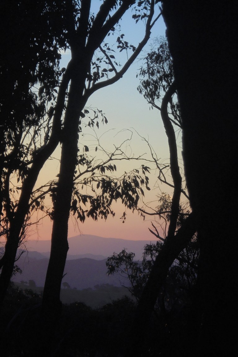
The sun is going. Going. Gone. Up here on this ridge with that dome of earth turning from white, to light blue, to pink to dark blue, I feel like I’m in a snow globe of colour with all of those pastels flowing down the edges of the sky to meet the dark ridges below. No fluttering flakes wafting to the bottom, but colours sliding down as the day drains out.

There’s still a breeze. It’s still warm. So I leave the tent fly off. I leave it near the tent, in case fog rolls in and I want to put in on later. I crawl in the tent and lie on my back. I turn on some tunes and watch the stars appear. The Milky Way slowly emerges in its translucent smear of stardust and cosmos. The satellites appear above the tree limbs to the southeast and disappear to the northeast. A few shooting stars burn up overhead. And sleep floats in on that gentle breeze.
Day 3 – Skyline Rd – Sonnberg Drive – Bonnie Doon – Mansfield
The early hours are warm and a breeze stirs the leaves long before I stir. I’m still up around 6am, happy to have a dry tent to pack. But that warmth and that breeze portends a warm to hot day. I look down into the valleys. Fog stretches up the lake inlets and coats the valley floor near Alexandra. But we are warm and dry up here.
I watch the sun rise opposite to where it set yesterday. This campsite, on what I will always think of as ‘Miscellaneous Knob’, is ideal for sunrises and sunsets – you can watch both from the comfort of your tent!
I’m rolling not long after sunrise. We climb for a bit more on the gravel and start to pass farms carved out of the bush, clinging to those steep slopes. Small dams reflect the deep blue of the sky midway down the slopes in the dip of small gullies.
I see two cars in the first 10 minutes, and then I don’t see another for two hours. I pass plenty of homes on small acreages on cleared blocks cozied up in all the bush, but they must be weekenders, or the people don’t work in town. It’s a little Zombie-like to see a fair number of properties and ride a wide gravel road but still not see anyone.
We can look down to the fog-filled valleys in places between sections of bush – it truly makes us feel on top of the world.

I think of one of my CA bike friends – these treed ridges and small farms make me think of his area. There are even mirrors at the end of the driveways to help the drivers look for oncoming vehicles on those tight twists and turns. I try to take a mirror selfie, but alas, there’s not enough light yet for them to turn out. Still, if any group of people could empathize with my friend’s recent experiences, it would be these people. They are on steep-sided slopes surrounded by bush in one of the most bushfire-prone places in the world. It would be terrifying to be up here in a fire.
But today… well, it’s a gorgeous spring morning with a warmth that hints of summer. We’ve actually had a spring this year and the flies are late. I’m soaking this up as much as I can before the heat and insects hit.


So in my mind, when I was mapping out the route earlier in the week, I would have a bit of climbing on the ridge today, then I would get a general downhill and then a very steep down. But out here on the road, with my very vague map and no GPS or phone coverage, that is not the case. We have downhills, but they are interspersed with plenty of uphills. And it’s all steep. We zoom down a steep bit and ride that into a steep bit heading up. Then we are pushing hard and trying not to wobble or spin a tire on the steep up. Sheesh. It is hard work. I wasn’t expecting this.

When I get home and look at the topo map and the elevation profile, it really doesn’t look that bad. But I can tell you, between those topo lines, the road is not flat. It is a bit of a Mr Toad’s Wild Ride of short, steep ascents and descents. My legs have recovered well today, but wow, this is way more effort than I thought there would be.
We are on a good downhill with gorgeous twists and turns and picturesque home settings when the road branches. Hmmmm… I don’t know which way I’m supposed to go. Neither of the names are familiar (Conundrum and Sonnberg) – I thought I was just taking Maintagoon all the way to the valley floor. I’m laughing inside that I’ve got no clue in a place with a road named Conundrum. Neither road looks more trafficked or wider or smoother than the other.
So I do the most logical thing. I head UP the one that goes very steeply up. Of course, I could have gone down the one that sloped down. But for some reason, the road with the rear-tire-spinning grade and deep corrugations on the inside corner, calls out some siren song and we literally grunt our way up that very steep curve.
We stay high. There is thick bush. There are homes built on the very edge of the ridges. There are driveways that disappear into the trees. And there are a zillion more steep ups and downs – short but sweet and steep. It is definitely Mr Toads Wild Ride this AM. The road is good and wide, though, and that is the only thing that gives me any confidence that we are going to end up where we hope. At one point, the bush gives way to views off the ridge and for a moment I’m a bit worried. I can see the lake below on both sides of the ridge! And then I can see the road at the bottom of the valley a long, long way away. Oh dear. I guess I should have taken Conundrum. But no, this road is in good shape and we can’t really go wrong. At some point, we’ll get off this ridge, and hit the lake. And wherever we hit the lake, we turn left.


Eventually the road comes out of the trees and I can tell where we are. We are not on the road I think we should be on, because where we are on my map has no road, but I can see where we are going to hook into it all. We are just about 5 kms further south than I thought we would be. And it’s fine. Because we have the GRANDEST views you could ever imagine. And there are no cars. Let the road lead wherever it may go.

Finally, the road flattens out and we come around a corner and the very end of the ridge. There is an overlook here with phenomenal views. Okay, it was soooo worth going up instead of going down. Sonnberg Drive has some tremendous views for sure. And I don’t see any “NO CAMPING” signs at the lookout, and there is a flat grassy area. If you had sufficient water, this would be a pretty great spot. For me, it’s a great place for a break and just some time to soak it all in. Totally, totally awesome.


Then it is time to head down. Seriously down. The average grade is 17 percent for two kilometres. There is no messing around on this one. I start down, but I quickly realise that this isn’t wise. I won’t be able to stop if I need to and I won’t be able to get over for a vehicle. It’s been two hours – surely I’ll see someone soon. The surface is great, but I’m too old to do stupid shit and too young to have lost my judgement. So I drag my feet and come to a stop. I dismount. And I walk down the steep grade. I have no shame in walking DOWN – and I am very proud to say I climbed every single bit of up on this trip.


We soar down the last bit of the gravel after we remount and fly down the upper valley between more big, immaculate homes and well-tended blocks. The steep-sided, forested ridges lessen and the valley widens. I pass two b-double gravel trucks going uphill. Glad I didn’t meet them somewhere up there on Mr Toads Wild Ride!
We progress down the valley and eventually meet with the edges of the lake. The road is a gentle down with small climbs around the ends of ridges that squish into the lake. We pass lots of private club caravan parks (e.g. Melbourne Outboard Club) where there are lots of little cabins that must be packed out in school holidays. The sun shines down, the wind swirls around and we progress down valley as yet another road delivers us light traffic.


We pass a little cluster of a township where there are a few residential streets climbing up the lower slopes of the valley hills. If you have ever seen the Australian movie “The Castle” (and you should, it’s a classic), and you’ve seen the cottage they go stay at in Bonnie Doon, well, this is where it is. It’s not down on the highway with the rest of town – but out here on the way to Peppin Point. “We’re going to Bonnie Doon.”
Just before we hit the Maroondah Highway and the end of new roads for us, the guys demand we stop for a float. Verne insists, “We’ve ridden all the way AROUND the lake, but we’ve not yet gone IN it. Two of the three of us are water creatures, and you are a water zodiac sign, so we are STOPPING to float.” Yes, sir.

While the guys float and bob on pretty big waves for the size of their watercraft, I check in with friends by texting: Bonnie Doon. Safe.
Then we cross over the highway and hit the rail trail. It’s well-done and the gravel surface is good. But it just runs through the valley and I’ve ridden it before. So it seems a wee bit boring. It is incredibly mundane compared to our last two days. Plus we have a headwind. And we encounter six magpies in 12 miles through here – we didn’t have any at all yesterday!
So those last twelve miles to Mansfield, I just push it hard. I turn on my iPod and pound it out. I fling myself up to the end of the ride. Once again, I get my lower legs covered in that black trail dust. I pass two different groups of retirees out for a ride. No ebikes among them… but I know that is coming soon to a trail near you, if you haven’t gotten the previews already.


I roll into Mansfield and stop at the public toilets to wash up, wash off, freshen up, brush my teeth and DRINK. One litre of water was less than I would have preferred this morning. Then I head to the bakery and get a Caramel Milk (350 mls go down in one gulp I think) and a chicken pie (just average – why do I ever bother with pies!).
And then I head back to the car. It is still there. It has not been vandalised. If it were stolen and torched, it wouldn’t be the end of the world. It’s insured for more than I could sell it for, and the old girl needs to be retired. But she’s dutifully and safely transported me for 11 years and she gets us safely home today. Poor thing. She sat in a parking lot all weekend while the bike, guys and I went for the most perfect 3-day ride EVER.