

Saturday, 18 Feb, 103 miles (166 km)
Day 1
There is a big, gaping blank spot on my ‘roads ridden’ map. And it’s really close to home. There is a section of land that occupies the middle of the “C” at the nearby massive Lake Hume that I just never get around to riding.
This weekend we are going to take care of part of that. The weather forecast this weekend is great – three days with highs in the 20sC – the first time that’s happened since last November. It will be a bit windy but it won’t be brutally hot! Let’s go!
We take our standard route up to Wymah that I’ve written about many times. We head out through the 2-5 hectare lifestyle blocks where I assume the residents have worked hard and/or had more opportunities than some and/or are in debt up to their eyeballs. Then it’s over the freeway, past the Ettamogah Pub, down the always-corrugated-and-horrible dirt Burma Road, then over the one-lane bridge over Bowna Creek, and then down the frontage road and along the old highway. It is our first time in several months that we can ride the Burma Road – the lake level has been high enough for it to be underwater until a few weeks ago. I take some photos of a few things along this route that I’ve neglected to before.


Then it is over the toy bridge where people have affixed plastic toys to the railing. Barbie is gone from the jaws of the TRex – only a few strands of blonde hair remain. The Hulk holding the Rubik’s cube is gone – only his glued foot remains. There are new toys but nothing outstanding or creative this time around.
Then we start into the climbing up toward Mt Wagra. There are two creek valleys to climb in and out of before we make our way to the ferry over the Murray Arm of the Lake Hume. The cranky ferrymaster is not there today – I get the nice guy who always wishes me a good ride when he opens the gate on the opposite shore.
Next, we start heading back toward Albury on the Murray River Road. We ride this for 11 kilometres along the curving shore (it is an outstanding ride). Traffic is still light. There is one climb in there that is a little steep, but mostly it’s just great views out over the reservoir as you wind in and out of little creek inlets among trees and grassland.
Finally, we turn off on Georges Creek Road. I drove this once in 2006 when I was more or less teaching myself to drive on gravel (I did not get my driver’s licence until I was 30 and had never driven on gravel before moving to Oz). I remember the road vaguely. I do remember it having one really steep part. And I know if it seemed steep in a car, I may be hoofing it with the bike for a bit today. But still… it’s a new road, so it must be ridden.
It starts off with horrible gravel and big rocks from a section that was redone after being washed away in floods in the past few years. Then it climbs a couple small hills to deposit us in the Foster Creek valley. At the top of one of the hills, I note that we are surrounded by hills. I start to ponder which one we will have to climb over. Ah…. look for straight lines of trees… that’s always a clue in Oz. Yep, there it is. Oooh, that looks like it will be tough.

I get to the base of the climb. They’ve sealed bits and pieces of this road that my old map say should be gravel. The steep climb itself is all sealed. I stop for a snack – I haven’t eaten yet today. I down some ibuprofen. I’m still feeling a shoulder injury inflicted late last month. Once it starts being painful – now – about 30 miles into a ride, I just numb the pain and get on with things.
And so we climb. It is very steep. But I am able to pedal it all. Slowly. In three parts. I rest at each bend. My cardiovascular fitness is better than I thought for how little loaded or long riding I’ve done in 2017. But my muscles definitely tell me we are way behind where we were at this time last year. But still, we make it. It’s our big climb for the day.


Once we crest the hill, we find ourselves in another creek valley with nice views to the forested slopes of Mt Granya to the east and the fire-scarred forest slopes of Jarvis Creek Regional Park to the right. There are fresh roadworks that had to have been worked on in the past week – everything is bare and smooth. It actually looks like they will be sealing this bit to join up some other sealed bits.
This is pleasant. Traffic is very light. We undulate along through this high valley surrounded by the ridges on either side. Then we start to drop down into the Georges Creek valley. It’s very scenic and we don’t start to pick up a higher concentration of homes until the downhill recedes and we reach a flatter floor. The wind has been strengthening, but it’s a quartering tailwind through here. Life is good!


Eventually, the sheltered Georges Creek valley spits us out into a larger creek valley that is far end of one of the arms of Lake Hume. We round the corner to the west in that bigger valley and get to fight into that 30kph wind. Phew!
We pedal hard into the wind through the remains of Old Tallangatta. The homes higher on the hill remain – the lower parts of town were all relocated in the 1950s when the dam wall was raised and the lake flooded town. (If you look at the map above in satellite view and zoom in, you can see the old town foundations and street layout- the satellite pic was taken when the water was lower!) There a few really old and gorgeous brick homes, the Presbyterian manse (former – currently for sale) and a dilapidated but huge old Butter Factory.
We push on into the wind and up the slight uphill gradient all the way to the new Tallangatta on the rail trail. The temp is great but the wind is not… so there aren’t many people out on the trail today.

Lunch in the park in Tallangatta. Wow – my legs are telling me they are flabby! The IGA has the local Gundowering ice cream – too bad the BLC hasn’t yet started! They are also selling pints of Ben and Jerry’s for $12. Sheesh!
It’s 1pm. My plan for today was to get here and then assess how I feel. Check the weather forecast. My original plan, when the weather forecast was for three good days, was to use Sunday to loop down to Mitta and then back to pick up another new road.
But the weather forecast has changed. Instead of three good days, we get windy again tomorrow and rain at night. Then windy again on Monday. Ummm…. I ponder for a bit. I decide I’ll ride back out the rail trail to where the Yabba Road takes off, and where I would head down for the extra loop.
So I do that. I sit there for several hours in the sun and shade. I nap. I look at the trees. I watch the birds divebombing for fish from the air or ducking down from the surface. I watch one egret-looking bird struggle to swallow one whole.

I decide to axe the extra loop. 5mms of rain tomorrow night after fighting the wind all day and then fighting the wind all the way home on Monday doesn’t sound like fun. Maybe it’s okay in a 4-month tour, but a three-day ride should have at least some fun!
So, as the day and the shadows grow long, and I still haven’t seen anyone on the trail, I decide I’ll just camp here in a spot out-of-sight of the road. It will set me up well for an early start to beat the wind tomorrow.
I set up the tent around 6pm – so I can be inside by the time the mozzies come out when the wind dies down. We are having a record outbreak of Ross River Fever (a virus transmitted by mozzies that can cause months of fatigue and joint pain). So I’m keen to not get bitten.
I listen to music, I watch the layers of clouds scooting by. I enjoy not having to talk to anyone or deal with anyone’s crap (except Verne – but I’m used to that stuffed little turtle these days). Ahh…. I love overnight rides. Other than a kangaroo that goes thumping by at 4am, we have the whole trail and this little grassy spot all to ourselves.

Day 2
I hear the wind rustling leaves at 4am. Then, just after I fall to sleep again, a kangaroo goes thumping past. The sound of something on the gravel wakes me with a start, but the distinctive sound of hopping marsupial is quickly apparent. I drift back to sleep, but then wake at 5.30am to the alarm. The wind is forecast to be 30-35kph again today from the west. That is the direction I’ll be heading along the open expanses of the lake, so I want to get as far as I can before the fight starts.
So I’m packed and on the road at 6.15 am. First light is not until about 6.25 am or so. Sunrise is about 6.47am. Off we go, rolling down the gravel in the last remnants of night. It is quiet except for fish flopping in the water down below. We roll back over the causeway and through the remains of Old Tallangatta. Then it’s onto Lake Road – a new one for us. It follows the lake edge for about 20 miles, occasionally turning inland to climb a ridge. It is a gorgeous ride when the lake is this full. Still, it is very exposed to the wind and sun, so it’s not a ride for the heat of the day.

We climb gently up and down and curve in and out. This is soooo good. The wind hasn’t begun yet. The first part of this road is sealed, but eventually, on a nice downhill we get flung onto corrugated gravel. The gravel on this road is pretty corrugated in many places, and sandy in others, so it’s not as nice as it would be when freshly graded in late winter or spring.
I’m still very excited to be picking this up on my ‘roads ridden’ list. I’m just cruising up and down with great views, shared only with grasses, cows, ducks and some trees here and there.


After one climb on loose corrugations, I come to a rise. As I start to descend, I look to the next prong of land. Where is the road? Oh. Up there. The signs up there on the curve are glinting in the sun. Oh my. That looks steep. Ugh. Oh well, what better way to get my flabby muscles back into condition? Let’s go!

The only bad thing about a steep climb on gravel is that it is impossible to get started again if you stop for a breather. Your back wheel just spins and you can’t get the momentum to get that second foot on the pedal. Attempting to start at an angle across the road doesn’t work, because the tire scoots out sideways. So, this means we crawl up that slippery gravel with deep erosion gutters, dips and corrugations all in go. Slowly. Trying not to teeter. Or totter. Or give in to the urge to put a foot down. We make it. Heart thumping, lungs heaving…. but not as bad as it looked like it would be from the bottom.

The views are great. We are looking down on the area called The Narrows where the lake is constricted between close ridges on each side. Poor Tallangatta can go years without any water in the lake below their town when the water level is lower. They have tried, without success, many times to get the lake authorities to build another dam at the Narrows so they would have water for the tourist trade more often. But, besides the cost, the engineering difficulties of building another weir within a weir, and the frequency that stretch would be subject to blue-green algae… well, the costs outweigh the benefits.
We head on down the gravel with great views over to the main part of this massive lake. We then cut inland through a few nice farms. Some ways inland, we have the choice of turning to continue on Lake Road, or heading up and through the little town of Bethanga. My map says Lake Road is gravel, but enough people with enough money have moved out here that the road is now sealed. We have another climb over a ridge, but this one seems like nothing compared to the last one.

After this the road undulates up and down on short steep hills a little ways in from the water. There are plenty of really expensive homes out here mixed with the original farm cottages. A couple of the places are so ostentatious they make me feel a bit sick to my stomach. Surely you could live somewhere just a teeny bit more modest and donate that extra money to charity or something. And don’t give me trickle-down economic theory…. that they are contributing to the community by hiring a gardener, buying the fancy plants and fencing and intercom system. That stuff doesn’t reach the most vulnerable, but donations to homeless charities and other programs do reach that front line. Off the soapbox and through more hills.
The last 7 miles into Bellbridge fly by. We can look over to the dam wall and the fishermen that are already out and about. The motorboats and waterskiers will be out in force by mid-day. We roll past the reserve where Nigel and I used to come out in the mid-2000s. The drought was in full swing then, and the lake very low – only 4% at one point – so it was a long walk from the shade to the water’s edge. Nigel would sail all day on his catamaran and I would hang out reading lots of journal articles for my PhD. It makes me sad to remember those times – when Nige still had some fight left and still enjoyed being out on the water. And so it goes.

They have fixed up the waterfront in Bellbridge these days. There is a walking path, landscaping, turf grass, picnic tables under shade shelters, and seating areas. It used to be just free-for-all parking on dirt and scattered grass down to the water’s edge. There is a cluster of houses here, a small shop and waterski club (the sailing clubs are on the other side near the dam wall).
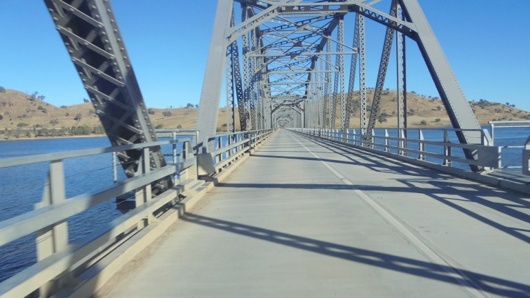
We are rolling across Bethanga Bridge early. This bridge was re-decked 5 or 6 years ago – so it’s a smooth ride. But it is very narrow – it is even a little nerve-wracking in a car when a big boat trailer passes going the other way. So, in order not to be abused by bogans with big boats, early or late crossings are recommended!

They are currently upgrading the highway between the bridge and the junction near the dam wall. This used to be very narrow, incredibly curvy and very dangerous. I wouldn’t ride it – too many blind corners and impatient drivers. This is an incredibly popular road on the weekends to get up to the dam. So even though they haven’t paved it yet to make the lanes any wider, they have knocked out all the major blind curves. So this early in the day, it is fine. Once the whole upgrade is finished in late 2017, then it will be a safe ride all the way from Albury to the bridge. It’s only about 25 years later than it should have been done – but road infrastructure is not really Oz’s strong point.
The wind starts to pick up as I head down off the hills and into Albury. It’s good timing. I’m glad to get away from the open water before that invisible force began its not-so-subtle push. I stop for a few moments to eat some food at the end of the runway in Albury. I watch a few planes come and go, and listen to the low growl of an old warbird as it lifts off, circles, lands and lifts again. I think of my Grandpa, and feel close to him – he was an aviation nut and built his own biplane. I spent a lot of hours at fly-ins, airshows and balloon launches with him as a kid. Like all the other grandkids, I also spent a lot of time sorting nuts and bolts in his workshop and sitting in his biplane pretending to fly and shoot down the Red Baron.

The rest of the ride is suburbia and wind. And broken glass. You forget about those urban obstacles when you ride in the country all the time! Then it’s the final push up Jindera Gap into the pesky wind. It will get strong enough after I’m home that I’m happy to have ditched the third day. I’m especially happy I’ve done so when it rains a fair bit at night and is then windy again on the Monday. I’m very happy to have gotten in an overnight ride finally. It really does rejuvenate me and give me the oomph to tackle another week of everything that life might decide to hurl my way 🙂
