Where’s the car with the thumping ‘doof-doof’ bass?: Henry Angel Trackhead to Stacey’s Bridge Campground, Nariel
Sunday February 28, 2016, 64 miles (103 km) – Total so far: 371 miles (598 km)
I’m slowly spinning my way up out of Burra Creek in the grey stillness that is predawn. Far in the distance, kookaburras chortle back and forth across the valley then break into fits of laughter. Right here though, it is quiet. Still and quiet. I’m not riding fast enough for my tires to even hum.
Then I hear a car approaching from the east, its transmission thunking back a gear somewhere over the hill. That’s good news for me, because the first four miles of the day are mostly uphill. I grin. A downhill is coming.
The car comes over the hill and brakes sharply when the driver sees me. He stops there, in the middle of the road, just over a blind crest on a curve. I ride to the middle of my lane as the driver first rolls down the rear window, then corrects, and rolls down his window.
“How far is it to the highway?” asks a 30s-something guy that looks and sounds like the Australian comedian Akmal Saleh (whom is Egyptian by birth, I believe).
“Ah, it’s still quite a ways, ” I reply. I’m assuming he’s asking for the Hume Highway – the main highway between Sydney and Melbourne.
He looks very disappointed, then says, “I’ve been driving forever. It’s just trees and trees and trees. I’m trying to get to Melbourne.”
I’ve got no idea where this guy has come from, or why his GPS says he should come this way to get to Melbourne, but all I can figure is that he was on the Snowy Mountains Highway and it’s sent him over from Cabramurra along the Elliot Way. And yes, there would be a lot of trees, hills and curvy bits in that.
I say to him, “Well, when you get to Tumbarumba, you need to take a left as you come into the main street. That road will take to you to the highway.” (Actually, there are two ways to get to the highway, but I don’t know which ends up being shorter without looking it up – but a left turn there will give him both options).
He sighs, “Oh, I’ve been driving forever. Where is the nearest petrol station?”
“Oh, you are close. There’s one in Tumbarumba about 12 kilometres from here. Just keep going on this road and it will take you into town.”
He seems to brighten up for a moment. But then I say, “But I don’t know what time it will open. It’s a Sunday and it’s a small town.”
His smile fades and he asks, “Where is the next one after that?”
“Oh, out on the highway at Holbrook – it would probably be another 45 minutes to an hour of driving,” I reply. (Actually, I don’t really know how long it would take to drive – I’ve never driven it – but I figure it is about the distance that I would ride in a day which is usually about an hour’s driving.)
He sighs again. Frustration emits from him like energy coming off a radiant heater. But knowing he’s not going to run out of petrol seems to have helped a bit. There’s not much else I can do to help him, but he is very happy to have gotten some sort of information out of some random cyclist on the road. He says, “do you need anything? I’ve got water. Juice?”
I tell him I’m fine and have all I need, but thanks and good luck to him. He then says, “Do you know where you are going? It’s all just forest up there.”
I laugh and tell him that yes, I’m fine. Some months ago, a local farmer pulled me up and asked me the same question when I was heading up into a national park on a gravel backroad – was I lost and didn’t I know it was just forest up there. It saddens me that this is how people see these magnificent reserves of flora and fauna.
Then it’s back to the pedalling, after the five-minute conversation at 6.20am in the middle of the road, on a curve and blind crest. I finally get that good downhill the car transmission indicated. Then there is another climb through misty forest where the dew and moisture are giving up their grasp on leaves and trees and heading towards nothingness in the sky.
There’s the drop to Paddy’s River and the packed-out riverside campground. I’ve never understood why the caravan people pack this place out when the site at Burra Creek is so much more pleasant. Nevermind.
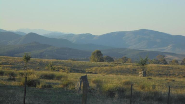
My legs are warmed up now. I think I’ve hit the high point for the day as I do the short climb up the Tooma Road. There are cleared pastures on gently rolling ground in the near and middle distance and steep-sided ridges of pale green bush all around in the far distance. We are high in the landscape here.
The road narrows, and there is a sign: Trucks Use Low Gear. Then we go walloping down through the state forest through incredibly deep road cuts. The road is just like a narrow, deep gash through these hills – the walls of rock reaching 20 feet above the pavement on both sides. It is mostly a straight drop down, but the road condition is not all that great, so I can’t let it fly with abandon. I’m on the listen and lookout for roos, too. It’s a roo time of day. It would be catastrophic to hit one at this speed. But still, I gain enough speed for the wind to pull tears out of my eyes and to be glad I’m not trying to ride the other direction. It would be a slow, steep climb to say the least!
After a few kilometres down between the walls of earth, the road spits us out on a ridgetop with pine trees closing in. We get great glimpses of the higher ranges in Kosciszko Natational Park before pine plantation envelopes us for a few kilometres. Then there’s more climbing to another ridge from where we can get wide open views to the national park ranges and the Maragle Valley far down below.

The road wanders around up on these high slopes and the views are tremendous. But so are the flies. The land here is all cleared and full of cattle. Beef prices are the best in a very long time, and the beef people are stocked up at the moment! I stop for a few moments at a lookout to apply sunscreen, but it’s too fly-ridden to want to stay longer.
From here, we get another steep, trucks-use-low-gear grade that sends us flying down through the bald, rounded hills and down along through the shade of Possum Point ridge. Yee-ha!!! That is so fun!

The road spits us out at high speed in the locality of Tooma. There are a few houses here, a pub, two bridges over a pathetic little river (water levels are controlled by dams in the national park), and a swathe of poplars and willows which have given up on this year’s chlorophyll production and started to drop their dry, crunchy and pale leaves to the ground.
I don’t really get a good look at Tooma because I’ve got all that speed off the hill, and it’s not worth braking if you don’t need to stop to drink or pee. However, my memory of Tooma will be this blurred, fast-moving combination of pub building, houses, river and trees, combined with this stationary image of a middle-aged, slightly pudgy but not fat, man ambling across the parking lot of the pub in his Speedos. Nothing else. At 7.30 am.
The river is not deep enough to swim, and certainly not deep enough to require swimwear. But in my mind, there he is, the glimpse of this man in my peripheral vision as I sped through town. Please, men, I don’t care who you are or where you are from, unless you are an Olympic swimmer, forget the Speedos. Wear trunks or go starkers. Speedos are grimace-inducing at all times on everyone – even out of the corner of a cyclist’s eye moving at high speed through town on an early Sunday morning.
The road curves around the hills following the river high up on a hillside. We have to negotiate a mob of cattle being driven down the road toward us, then wiggle around through all the associated fresh cow pats for the next 5 kilometres. Eventually the road turns away from the river and we climb up a feeder creek through more open pasture and dry, brown ridges. This road totally reminds me of the road that leads into Baggs, Wyoming. The feel, topography, dryness and remoteness all weave past memories with fresh ones.
More climbing over another ridge ensues to get us back into the main river valley. We cruise down to the river again, then cruise along the river flats through the wide flat, valley. The Tooma River is not far from meeting the Murray River here.
But then, because Aussie road engineers seem to like to build roads over hills and ridges instead of around them, our road curves away from the river flats and starts heading straight up a ridge. A few curse words may have been breathlessly flung from my mouth, as I start into the grade and continually flick the flies away from my face as I crawl up that hill.
About halfway up the climb, I stop for a rest to get my breath and let my poor office worker legs have a bit of a break. There’s been a fair bit of climbing yesterday and today. As I’m standing there straddling the bike, looking back down the hill, I can hear this thumping bass. I’m confused. Where the heck is the car with the doof-doof music? I’ve only seen four cars today in total, and it’s not exactly the time of day for one of those drivers to be out and about. I can’t hear any cars coming, but there is some crazy thumping hip-hop/dance/party music going on. It’s a steady, rhythmic – doof-doof-doof-doof bass.
Then I realize… that doof-doof bass is my heart thumping in my ears!! The doof-doof car is me. Now how silly do I feel?! The good thing when your heart is beating in your ears like that is that you know you have no arrhythmia and your fitness is good enough to sound like dance music instead of a battle drumroll.

Over the hill and back to river flats to Towong. We stop for a snack break on the Murray River where the flies are not too bad, then we head into Victoria. The road cruises down a wide valley with distant hills to the southeast and the tall ridge of Mt Mittamatite rising steeply just to the northwest. There’s a bit more traffic on this road, but everyone gives me space.

Corryong has a main street with mostly one-story buildings and no new construction since the 1950s or 1960s. I’ve always found it a pretty sad little town. It doesn’t seem to have much character and never seems to have much vibrancy. It’s just a small, conservative redneck town – or so it has always seemed to me in the past and still seems to me today. You have two takeaway options, two coffee shops, two pubs, one petrol station (another has closed since I was last through here) and an assortment of other odds and ends. I am looking to stock up at the supermarket. Unfortunately the IGA here is pretty crap – Tumbarumba (and Omeo and Eskdale to come) are significantly better even though they are smaller.

I take a break in Corryong – eating, drinking, filling water bottles and pondering where to stay tonight. I decide I’ll just keep riding up the Nariel Valley and see how I feel. It is about 34C (94F) this afternoon and my legs are tired from the two days of climbing.
There is a bike path out of town to Colac Colac. There is a very shady caravan park there that has always looked appealing, but I’m hydrated and have a damp shirt (I wet it down and put it back on before leaving Corryong) and some oomph left in my legs. So we continue on into the Nariel Valley.

The road seems flat, but is probably imperceptibly climbing as we follow the river upstream. The high ridges close in as we head upstream and the tidy homes and weed-free paddocks of the lower valley give way to the unkempt homesteads of the ‘back blocks’. The original, rusty, tin-roofed cottages with indoor furniture on the outside verandahs, are still occupied. There’s never been enough money up here to build the new homestead. Even the cattle look more scraggly up here. Sitting alongside the road is an old, 1970s caravan with flat tires and all its windows vented open as if it’s let out a long sigh and just collapsed in age and resignation.

Eventually we pass out of the hillbilly back blocks and the road hugs the cliff wall as the river courses against this side of the valley. Once the road flattens and we find ourselves in the narrowest part of the valley, the weekender and hobby farmer blocks take over – goats grazing small paddocks, rock borders outlining gardens of agapanthus and other hardy exotics, well-established shade trees planted for aesthetic, as well as utilitarian purposes. The wealth here has not trickled downstream.
Finally, we get to the camping area. On the picnic area side of the road I find a deep swimming hole and promptly jump right in to cool off. It’s been a hot afternoon – I’m not a fan of riding when it’s in the mid-30s C. Ah, how nice that feels!
Later, a working-class family with obese parents and six pudgy kids all clutching cans of soft drink come up for a swim. The father is impressed that I’m going to ride the Corryong-Benambra Road on a bike, but he assures me that the climbing is only steep in the first five-to-six kilometres. He does say there are some ‘whopper’ hills on the other side, though. One of the kids tells me he likes to hunt pigs, but it’s sometimes hard to tell them from wombats. I’m really not sure what to say to that! They play in the water for a bit before heading back to Corryong for school and work tomorrow.
Then it is all quiet and peaceful. The camping area is open but shady and has a nice groundcover of grass. I have the whole place to myself. I figure it must have been busy on the weekend since all of the bins are full. But my answer comes just after dusk when four locals arrive at slightly staggered times to come dump their rubbish in the public bins. They all roar in, then turn off their headlights and stay quiet for a few moments before the clink and clunk and rustle of garbage bags being wrestled out of boots and ute trays gives them away. Really, the shire Council should just take the bins away. Most campers are used to carry in/carry out rubbish policies in most camping areas these days.
I settle in for the night. Do I want to take a rest day here tomorrow to let my legs have a rest before a 1,000-metre climb first thing out of camp? I figure I’ll see how I feel in the morning – but I’m thinking I’m good to go and would get bored just hanging here. It’s nice to have such inconsequential decisions weighing on your mind as you drift to sleep. So much of life leaves you tossing and turning with far heftier problems each night, so it’s nice to fall into the rhythm of the road and not have a whole lot of worries to chase you into dreams.