
Trucks and bicycles use low gear: 1 km south of Big River Bridge to Eskdale
Thursday March 3, 2016, 52 miles (83 km) – Total so far: 518 miles (833 km)
The Big River valley bathes in silence and shadow. There are no noisy native birds or human early birds breaking that silence – well, one human early bird clacking some tent poles as they go in the bag, but it is still generally peaceful in the cool, dew-laced morning.
The road runs flat along the valley floor and over the Big River Bridge. There is a national park camping area here that I’ve never thought very attractive. There are four caravans there this morning. And from there, the climbing starts. It is fairly gentle to start, curving to the right through tall trees and private property. This area was once a big mining area – these days it is called the Mt Wills Historic Area and it still has many private inholdings down this low.
The climb passes an old wooden cottage with a tin roof and verandahs on two sides that overlook a large cleared paddock. Far down below, the Big River runs away and into the hills as we climb into a different drainage. To the west, the lumpy mountain tops include the tallest mountain in the state, Mt Bogong. Those mountains are cloaked in dead alpine ash whose stark white trunks reflect the rising sun like a million, individual fence palings against the grey and brown background of undergrowth.
We pass by the weekender and back blocks which sit close to the road through the Glen Valley. Then the climb gets steeper as the creek we’ve been following peters out in its upper reaches and we must make our way up onto a ridge without the aid of gentle valley climbing. Wow, when that road turns right after the guesthouse at Glen Wills, the road gets serious about gaining elevation!
Here we go… climbing through lush forest with ferns and brackens at ground-level and smooth-trunked trees that grow to huge heights. The trees’ bark hangs in long strings at the top of the trees but appears bald down below where the trees have sloughed off the outer layers. This area was burnt in 2003 but is starting to look quite lush again. The layers and lushness of green are pleasing and create a beautiful backdrop for all of the slow climbing.
Up, up we go. The road first heads east, then does a long, sweeping curve to head back west. I love the quiet. The only words being thrown at me come from myself. In a life where so many words have wounded, I seek out quiet and silence whenever I can. I’ve found the deepest pains have come from the careless hurling of words or from stony silences where the words are unspoken but just as wounding. So I like it when there is no one around to throw words like daggers, and the only sounds are silence.
Well, it’s not totally silent. This climb is steep enough that my lungs are heaving and my breaths are short. The expulsion of air from my lungs is forceful and gasping. But I’m pedalling. In granny gear. Hard. I’m concentrating on the pavement in front of me at times, the tops of the trees at others. I am trying not to look at the road in the medium distance – trying not to look at that grade. I tell myself it is easier than it seems and that it is just my lack of touring fitness that makes this seem so hard. (I discover later that there are, in total, seven kilometres of grades between 8 and 12 percent between Glen Wills and Christmas Creek).
Normally, I would break the silence talking to myself. I don’t mind when I hurl words at myself – it’s like the tough talk you get from a sports coach. It sounds mean, but really it’s just encouraging words that push you to test yourself and break down your physical boundaries. It’s not angry, sword-like words meant to hurt and charged with emotion.
So normally, on a steep grade or a tough section of road or in the pouring rain, I would be talking out loud to myself. I’d be saying, “C’mon Em, let’s go! Let’s go! Push it! C’mon get your butt up there! C’mon. Pedal it out. Push! Let’s go!” But today, this climb is steep enough it takes my breath away as my diaphragm squeezes in and out in violent heaves like an accordion. There is no breath left to pass through my larynx to form words. So I yell at myself in my head and crawl up the hill.
The road appears to curve back to the right ahead and there is lightness among the trees instead of shade and shadow. We may finally be gaining our first ridge. There will still be a lot more climbing, but the first one may be finishing. Push it hard. Let’s go, Em! Let’s go!!

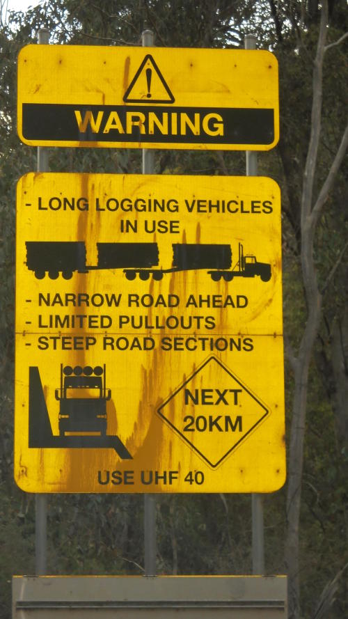
Indeed, there is a brief respite where the Razorback Spur Track takes off up a dirt hill. The logging truck sign here is even more detailed than the one yesterday. You can even see an air horn on the truck cab!
So there is more climbing, but it is gentler. A “Trucks and Buses Use Low Gear” sign and a “Caution: Steep Descent” sign reassures me that the last two kilometres were maybe as steep as my heart and lungs indicated. Now our climb weaves along the ridge, still ascending, but gently. The forest is more open and we can see the ridge ahead at times, the sunlight glowing orange on the tree tops in the distance. In other places, the stands of burnt alpine ash stand bright white against the dark clouds and green slopes behind.

Then we get a couple kilometres of descent. NOOOOOO!!!! I worked too hard to gain that to lose ANY of it!! But the other side of my brain goes, “Hee-heee-heee-heee! This is fun!” The curves are tight, and there are hairpins in it, as we go galloping down that hill like a herd of spooked horses. We use both lanes when we can see ahead and cut corners in our descent. We see an old guy towing a caravan – he doesn’t even smile or wave. I don’t wave. I do smile, but not at him – but because there is a certain thrill in centrifugal forces on a bike. If that doesn’t make you grin……

But all too soon, we have to start climbing again through that magnificent forest. This is steep, too, but I’ve got my game face on now, and I just crank it out in granny gear. It’s steep enough I’m mashing it in granny, and stopping every 500 metres lest I burst a lung or artery or something, but I’m climbing it. There is no walking today! I am so pleased with how well I’ve been climbing on this short tour!
Two Telstra trucks pass by me with inches to spare on a blind corner. If they had just waited maybe 10 seconds, we could have cleared that corner, they could have seen way ahead and given me the space I deserve. I feel like, “Hey, the only reason you should pass me that closely is if you are going to throw an arm out the window to hand me food or water!” Seriously, I could feel the heat off the second vehicle as it went by up that hill – that is just too close!
Lungs heaving, diaphragm playing something silly like polka in its accordion-like compressions, heart pounding, soul soaring. It’s another steep bit of climbing, for sure. But it’s all paved these days, so the challenge is not as great as it would have been in the past. The road became fully sealed in 2014. There are sections through this bit that still look a bit scraggly from the 2003 fires (but much better than when I was last this way in 2011) and sections that have been logged in recent times. Some sections are just tall, open forest where the alpine ash survived.
Another “Trucks use low gear” and “Caution: Steep Descent 3 kms” sign is somehow some perverted sort of reward at the top of that next steep bit. I read the sign to say, “Well done. That was some steep shit. But you made it”.
The views start to open up to the east and we roll along past “Miscalculated Spur”. Then there is just a bit more gentle climbing on a weaving, twisting, gorgeously open bit of road to the road high point. It surprises me. I had purposely not studied the topo map too intensely, because I wanted a general idea of what was coming, but not too much info since tightly-spaced contours can play bad mind games. So I’m thinking the road high point is at Christmas Creek Saddle two or three kilometres ahead. But no, the road high point arrives where Christmas Creek cascades down a rock, ducks under the road and heads down into that jumble of creeks and ridges below.
Woo-hoo! We’ve done it! And we rode every inch. Verne may have even given me a compliment. Then we take off on the downhill with views over to the Bogong High Plains to the left and the winding road down below. This side of the saddle is a much more gentle ascent. It is also much longer and starts at a lower elevation. Pick your poison – long and gradual or pretty short and steep.


The long, gradual descent is gorgeous. Why doesn’t every touring cyclist that visits Oz not ride this road? It’s gotta be one of the best in Northeast Victoria. There is so little traffic and it is so beautiful with its tall forests and its thousands of twists and turns. It is a bit remote but supplies are available either end. Seriously, come ride the Omeo Highway! It is so much fun!
The descent is shallow enough that I don’t need to use the brakes much at all. There are a couple of tight corners to feather the brakes into, but most times I’m just zipping along at about 30 mph and leaning through the turns. The pavement is pretty good – you just have to watch for the transitions between old asphalt and new asphalt that’s been added where the road has slumped away. Down, down we go, just a steady 30 mph and no need to pedal for kilometre after kilometre. The forest wooshes by and I couldn’t imagine being anywhere else right now.
Finally, the road catches up to the Lightning Creek drainage and the grade flattens out for a bit. It is still deep green forest but now there is a creek running alongside and high rock walls on road cuts.
I stop at the Lightning Creek campground to use the toilet – but they are closed due to illegal rubbish dumping. Okay, didn’t really need to go anyway. The camping area doesn’t have much shade and all of the picnic tables are fairly close together – I didn’t remember it seeming so stark. There are also three grey nomad caravanners here, so I would be looking for a bush campsite along here instead. No toilets, several people, no shade, no thanks. I head over to the picnic area side of things and get my first food into me for the day. But the flies AND mozzies are both obnoxious, so I don’t linger.
The rest of the ride out of the hills has a bit of climbing here and there where the road is cut into the hillside far above the various creeks the road follows down. There are some fairly flat sections, too, that require pedalling. But the general trend is down. It’s beautiful over on this side, too.
Finally, we come out into more open areas with cleared land and distant hills near “The Walnuts” camping area. No one is here and the toilet is open. Thanks! More down. More cleared sections and more tall forest. More joy in my heart.


By the time we get to the old mining ghost town (all that’s left is a church) of Granite Flat, we’ve lost enough elevation and the day has progressed far enough that it is very warm. I’m ready for lunch and a cold drink, but it’s still a bit longer to get to Mitta Mitta. I pull over once to let two caravans pass me (they wave thanks) but as I go speeding into Mitta on the downhill, they are there in town having a break. Sorry, you are just going to have to overtake me again.
For whatever reason, I don’t feel like stopping. I’m low on water, I’m hungry and I could use a break. But I just keep going. Sometimes I don’t know why I do the things I do. So there we go down the wide Mitta Valley past the airport (just a long runway in the grass) and then into some medium-length climbs up road cuts high above the river below. The valley is flat dairy country backed by these steep green hills. There is little traffic, so I just stick to the main highway, but there is a back road on the other side of the river if you prefer.
It’s only 13-15 kilometres to Eskdale and soon we are rolling into the 60 kph zone. There is an IGA Express store here where I luck out on ‘reduced to clear’ cottage cheese (one of my favs when riding), Colby cheese slices, and beetroot and feta dip. I also pick up a chocolate milk, some bread rolls, and bananas at the perfect stage of ripeness. Lunch is cheese and beetroot bread rolls with chocolate milk and bananas for dessert. Delicious!

I head down to the info centre building and public toilets on the north side of town. I ponder my options. The cloud of this morning is clearing off and the heat is becoming oppressive. I check radar and forecasts. Ugh. High of 38C (100F). I could camp at Pigs Point about 30 kilometers down the road but there would be grey nomads there running generators, etc. I could do 45 kilometres to Tallangatta and camp at the caravan park there. I could see what a couple of the informal sites look like between here and Pigs Point, but with no facilities and my desire not to dip in the river this far down among all the dairy farms… that sounds like a hot afternoon. I would need to carry a heap of water from here. It is 1 pm now. I don’t like the sound of any of that.

So I roll back into town to see what the local caravan park charges. The office is just the old caravan and annex of a permanent resident. There are a lot of old caravans on permanent sites around the place, but few people occupying them at the moment. A short, rounded man with long, grey stringy hair comes out in a singlet and flip flops. I ask about an unpowered site for the night.
Ten dollars! He can’t be serious. The caravan park just up the road in Mitta now charges $35 for a site. But ten dollars it is. My accommodation budget is loving this trip – $25 total for two caravan park stays and free bush camping sites the other nights. Nearly unbelievable for Oz!
The old guy is kind and tells me to help myself to the camp kitchen and to play in the creek that runs past the unpowered sites down on the floodplain. I roll down there and though there is minimal shade, there is no one down there camping, so I can snag the only good shaded site. I immediately head to the camp kitchen and squeeze some water bottles in the freezer amongst a whole bunch of loaves of bread that are already squished in there. Then I spend the afternoon sitting on a rock in the creek with my calves submerged in the cool water. The creek is not deep enough for full submersion, and it’s murky enough I wouldn’t do that anyway. The shower block is old but clean, and the water pressure good. The camp kitchen is fantastic. I almost feel guilty for only paying $10!
What a fantastic trip this has been! Tomorrow we will roll back into Albury in the 38C heat, but this afternoon we just revel in the beauty that is bike touring and the simplicity of life on the road. What a shame I’ve got to return to work next week!


