

Near Big River Bridge – Tallangatta: My favorite road – Part 2
Monday April 3, 2017, 79 miles (127 km) – Total so far: 713 miles (1,147 km)
The day starts early. Really early. I wake up around 1am and can’t get back to sleep. Finally, around 3.30am, I give up on sleep. The clouds have given way to that phenomenal night sky. I unfold the extra plastic sheet, put on another layer of clothing, and then pull my sleeping pad and bag out of the tent. I lay the plastic sheet over the dew-covered grass and then place my gear on top. I slip back into my bag and drink in the night sky.
I watch the slow spin of the constellations and the satellites doing laps. I make the same wish on each shooting star that I have for the past 15 years: please just make everything be okay. I don’t think it is too demanding. And that is really all I’ve ever wanted. Comfort, security, stability and a million other things are preferable, but really all I need is for everything to be okay. Somehow, it always has been and always will be. But that’s not helping me sleep this morning.
That sky looks like the remains of my heart. Up there it’s a shattering of energy and material. Entropy. Everything falls apart. My heart, too, is shattered. Instead of a million points of light spread across a thick soup of universal darkness, my heart is a million tiny broken pieces lying shattered across the dark parts of my soul. You don’t need sticky-tape or glue to mend my heart, you need a broom and a dustpan to sweep up what’s left. It’s what remains when love is not enough.
Slowly, the spin of the earth tears us away from the dark side. The coming light erases each star and fills it with deep blues and purples. The landscape begins to be revealed in a flat grey. I tell myself, “C’mon Em, it’s all gonna be okay. You are going to be fine. Get it together. Stop feeling sorry for yourself. Stop being a girly girl. Stop being a weepy wuss. Stop being a sorry shit. You are tough. You are resilient. You are a scream of triumph waiting to be released. Now, let’s go, we’ve got a mountain to climb this morning.”
I pack up all the gear and get rolling as the sun inches closer to the top of the hills. Night is gone, the cycle of sadness concluded for now. Let’s go.
There’s only one caravan at the Big River Bridge camping area and a dozen kangaroos. As I pedal the last of the flats, the kangaroos all look up. Their ears twitch, a couple take a tentative hop, and then they all resume breakfast. See ya, up we go.
The climb curves up a feeder creek past the old mining area of Glen Valley and Glen Willis. The trees are tall and the understorey looks healthy. It’s all damp and dark now, but the sunlight will filter through as the day goes on.

Last year when I did this climb, I was fitter and would have been carrying a bit less gear. Yet, the climb seems easier today. I just churn and churn up, with no real thought in my head. I’m just out there. Climbing. Enjoying all the vegetation and the quiet road. Last year, I had to yell at myself in my head to get up the 8 and 12 percent grades. I’m sure part of it is that I know this climb now, and I know what to expect. The other, bigger part, is that I have a few easier gears. I can spin, rather than mash. I much prefer to spin. I go so well this time that I don’t even stop on that first long climb up to Razorback Spur.

The sun greets us at the top of that first climb. A bit further along is one of the old mining localities. It’s called Sunnyside – back in the day, those guys huddled in canvas tents up here would definitely have seen the sun a whole lot earlier than their peers down in Glen Valley.
But then we lose the sun to thick fog as we get a bit higher. The trees concede. They drip the weight of the cloud onto me as I ride further up. It’s the opposite to light rain – the wet patches of road are underneath the trees instead of where it is open to the sky.
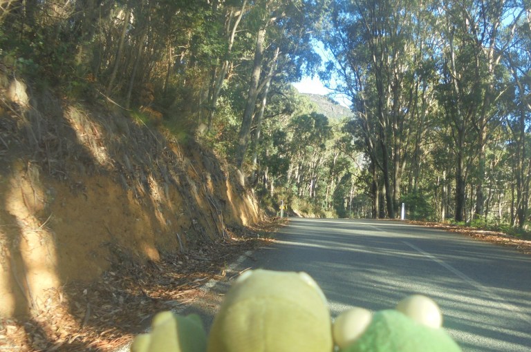
We slip through the moisture – Verne and Kermit’s heads get fuzzy with little droplets of water on the rough texture of the fabric. My breath is visible and contributes to the cloud. Our world is reduced to this ridge. It is quiet and clammy and cold.
We drop some elevation as the fog lifts. Within minutes, the sun has returned. The tall trees and droopy leaves turn green again from grey. And we climb. On we go. This is just so fun. I loooooove this road.

Spinning away, just spinning away. Up. 5.6 mph. Up. I love the rhythm and simplicity. I love the interaction of my heart and lungs with my bicycle, that oxygenated blood pumping to my muscles, my muscles pushing the pedals, my pedals spinning the cranks, the cranks propelling us forward. There is such beauty in meshing muscle and machine. I’ve never studied Buddhism, but I feel this must be some level of zen when the bike feels like an extension of your body and you can’t imagine being anywhere else using any other form of transportation. It’s reassuring to feel whole for a time when life has you feeling pretty shattered.
It feels like we reach the top in almost no time at all. Time has clicked forward. The earth has spun. The sky has embraced the sun. But it feels like it all stood still as we moved slowly through it. I don’t want this to end – I love this road. How can we already be at the top? I haven’t even seen a car yet!

The downhill commences – 20 kms of twists, curves and bends down through picturesque forest. It’s steep enough to descend at 25mph for long periods but not so steep that you have to use your brakes much. It’s just freewheeling joy almost all the way to Lightning Creek campground.
You are a bit out-of-luck, though. I don’t take any photos. I took a few last year which is sufficient for my stocks. So this year, I just have fun going as fast as I can and practicing bike handling and road reading skills. I’m working on picking the best line, braking before the curve, finding the apex, pedalling out of the corners, positioning myself to be in the right place to attain maximum speed. If you really need some pics of this part of the road, I’ll provide the link to last year’s ride at the end of this entry.
What a blast!! I soooo love this road. We do see a few vehicles on our downhill, but it’s early enough that the caravan folks aren’t yet on the move. Lightning Creek Campground is closed at the moment to replace the bridge, so The Walnuts campground is crowded with internal combustion engines and the humans dependent on them. I stop to pee and apply sunscreen. There’s one old guy in an old bus totally giving me the stink eye! What is up with that? He better not skim me later!
I’d hoped my early start would get me out of the narrow, curvy bits of this road before whatever trucks and heavy equipment being used on the bridge project became active. I see three b-double gravel trucks heading up the road around Granite Flat. This gives me the energy and oomph to pedal hard the final bits to Mitta so they don’t catch me on their return.
The lower bits of the road to Mitta have some short uphills and flat bits. It’s sunny and open in longer sections. It is less scenic but still very pleasant. It’d be easy to slow down through here. But I’m racing gravel trucks to Mitta and I’ve got a head start. Yee-ha – pedal hard, sister!
I zoom through Mitta Mitta. I’ve beaten the trucks. Or they are just going up and aren’t doing runs. Who cares – we’ve just had a fabulous run on our favourite road.
From Mitta Mitta, I take the Mitta North Road because I took the main highway last year. It’s another new road I can mark off on my map. It’s flat and sealed. It meanders through the flood plain through dairy farms down below the steep and forested hills. I get passed by two cars and three tractors. This is definitely the way to go. The highway on the other side of the valley sticks to the valley wall – it’s got a lot of climbing through cuttings and a lot more traffic.
Eventually the Mitta North Road runs into a ridge and is forced along the bottom of it. It’s a serpentine section pressed between cliffs and old river oxbows. Gorgeous. There’s a camping area packed out with caravans not long before the road climbs over the river and back up to the highway. We left the Big River heading south early this morning. The Big River turns into the Mitta Mitta River at Anglers Rest. Not long after that it heads east and then back north in a long u-shaped course. We cut directly over the hills…. cheaters!

I stop for a break in Eskdale. I’ve been riding pretty much continuously for several hours. Last year, I got some great deals on ‘reduce to clear’ items at the little Eskdale IGA Express. No such luck this year. The only cooked meat I can find is ham. I don’t really like ham, but I want some protein to go with my milk carbs. So ham it is. At least it’s filling. I don’t need to eat anything but a couple handfuls of nuts the rest of the day.

We roll out of Eskdale after an hour break charging my iPod at the powerpoint in the enclosed information booth. We refill enough water that we can dry camp tonight or stay at Pigs Point. I’ve got my eye on Tallangatta, but eyes have been known to stray when other, spontaneous camping opportunities arise.
We take off down the highway. The road snakes its way between the various ridges that send the river this way and that. There is a bit of uphill, but it’s mostly down. It’s all pasture and dairy farms and a decent amount of traffic. Most of it turns off for the Lockharts Gap Road – that’s the quickest way to Albury-Wodonga.
This year I stick to the main highway down the lower half of the Mitta valley. Last year we used the Yabba Road on the other side of the valley. So now we can mark another road off our list. The highway is much easier than the Yabba Road. There’s a lot less climbing. There are still climbs through cuttings when the river has meandered to the western side of the valley and forced the road to the hillside, but overall, it’s much easier.

We cruise along the cuttings in the shade of the hills beneath the tall trees. Then we pop out into open areas and cross long flats that are uppper terraces of the river or extensions of the hills. The wind is behind us today, so we just scoot along under an afternoon autumn sun. The traffic is light. It doesn’t get a whole lot better than this on the road.
Further down the valley, past Fernvale, the road climbs through more cuttings, slicing its way through forest and around rocky hills. I have to bail once for a garbage truck on this winding section, but he never was on my arse or anything. He patiently waited behind me and I got off the road for him as soon as I could find somewhere suitable. Sharing the road is so completely possible!
Zoom. We head on down the valley. Even though I’m working on minimal sleep, I’ve still got legs and energy as we get near Pigs Point. This is a riverside camping reserve that usually has at least a few caravans parked there. You probably don’t want to drink the water there, so I always think of it as a dry camp. I’ve lugged enough water along from Eskdale that I could camp there tonight if I wanted. But, I’m feeling good, so I think I will continue on to Tallangatta.
As I approach the camping area, I note it is all in shade from the shadow of the hill it is tucked beneath. No thanks. Then as I pass by the entrance, I see a large man with no shirt on with his head cocked back swilling a can of beer. I also see about 10 vehicles, six of those circled around a campfire like wagons warding off Indian attacks. I also hear an angry, yapping dog. Nup. Don’t think so. We cruise on.
We climb the final hill around Tatonga Inlet to the Murray Valley Highway. It’s getting to be late afternoon. The cycle is circling. At the t-intersection, you can get on the rail trail heading west by turning left. Ride up the shoulder. Just as the turning lane for the eastbound lanes starts, and your shoulder starts to end, cross over the road. You’ll then see a little vehicle track that switchbacks down to the rail trail. There’s no signposting for this on the highway.

I stop at the first bench for my first break since Eskdale. I’ve just been pedalling for many miles at a time today. I don’t know what’s gotten into me. It’s just felt good to fall into a rhythmic trance and cadence – spinning along on a trajectory toward home. I’m so lucky to have lived in such a beautiful landscape for the past 12 years.

We head into Tallangatta on the rail trail. It gently climbs through cuttings and along the edge of the massive Lake Hume. It’s warm enough we even manage to send a large brown snake slithering up an embankment. Crap – I didn’t even see it! They are deadly without anti-venom, so thanks to it for slithering away instead of rearing back and striking!

I stop for an ice cream in the main triangle (it’s a planned town, so the main ‘street’ is two streets with a park in the middle. One of the two streets is elbow-shaped). Then we roll down to the caravan park. It was built in the late 1950s/early 1960s when they built the town. The old Tallangatta went underwater when they raised the height of the dam. So they developed this town and moved everyone here. Consequently, the infrastructure and public buildings are all very 1950s. The caravan park has not had many improvements since then, but everything is clean. It is mostly full of ‘annuals’ – permanent caravans with annexes that are used during holidays by people from the cities.
The owner comes up to me as I lay the bike down. I ask if she has an unpowered site for the night. She tells me to come inside the office.
“Is it just you?” she asks.
“Yeah. I can’t convince anyone else to come do this sort of holiday,” I reply.
“Ha! I don’t blame them. Do you just have a swag or something?”
“Yes, just a small tent. I don’t need power. I guess I am the power with this rig.”
She laughs. Then she says, “Well, all the sites are powered. If you don’t want power, just don’t use it.”
She seems to look me up and down and then says, “So how about $10?”
“Yes. Thank you.”
She says I can set up the tent anywhere I like. It’s a nice conclusion to a long day. I get the tent set up where the sun will dry out all the damp stuff. I then head down to the edge of the lake to hang out with the guys. We’re on home turf now. It’s all familiar.


I head back up to take a shower. It’s always a treat to feel clean and refreshed. Then we head back down to the lake to watch the sun set. The guys goof off. How could I ride without them?


Then it’s time for bed. We’ve pedalled beneath an entire cycle of the sun from first to last light. And so it is lights out for us. 80 miles, a couple thousand feet of climbing and three hours sleep means we are done. No rest for the wicked, but sound slumber for the ‘only-slightly-evil-on-rare-occasion’. Good night.