

Blue Mesa Reservoir to Killdeer Creek (FR 788): Just out there in the forest
Thursday August 10, 2017, 46 miles (74 km) – Total so far: 181 miles (291 km)
Nature has timeframes for her plans today that do not exactly match mine. Well, the timing is the same – the plans conflict. At 4.58 am, there is an unmistakable rumble of thunder. At 4.59 am, splats of rain assault the tent simultaneously with tent door-flapping wind. At 5.00 am, my watch alarm goes off. My plans to get going early to beat traffic and afternoon storms are thwarted.
I roll over and go back to sleep as the storm rolls over. After it passes, I look out of the tent. Rainbow and clouds to the southwest in the early dawn; dark, broody clouds to the northwest. I again roll over and go back to sleep. The passing storms and showers seem to have mostly moved off by 6.45 am. I can see a couple that might hit me on the other side of the reservoir – but I’m hoping by the time I get over there they will already have moved on to the east.
And so we pack up a soaking tent, as I watch the Japanese family throw all of their remaining wet wood on their fire to create a smoky, smoldering mess that they promptly leave unattended as they drive away. Sheesh. They graciously brought me over hot dogs last night after I helped them source wood from some other sites’ fire pits. I don’t eat hot dogs, but we had a nice chat with their limited English and my non-existent Japanese – they just thinking camping is the greatest thing ever and think Colorado is ‘very beautiful, very tall’.
I am off about 7.30 am – a full 1.45 hours after I’d hoped. But today I get lucky – Nature has inverted her schedule and the only showers I’ll see today were those in the pre-dawn hour. Thanks – it’s much appreciated, particularly in monsoon season.

I head back toward Gunnison and head over the long bridge on the road to Lake City. Jen and I rode this in the opposite direction in 2013, so I know I’ve got a long climb coming. We bombed down it at 45 mph among thunderstorms back then and even commented how we were glad we weren’t climbing it. But climb we will, today. It is a sunny, cool morning now, though, and I know the climb is ‘stinker-long’, so I settle into a comfortable cadence as soon as the road starts the climb away from Blue Mesa reservoir.
Somehow, I’m immediately in the groove. Nothing hurts. Well, my ass hurts. Specifically – not the soft tissue but the skin where my butt meets my groin area. Once it gets irritated… there is not much you can do but stop riding, and we are not going to stop riding. So I will say it now and won’t mention it again – the chafing of my arse skin hurts this whole tour and I shift around on the seat a whole lot more than I normally do.
So into the groove we get. Everything comes good today – my muscles remember what this whole bike touring thing is all about and perform as they should. We have two climbs today, and there is nary a whimper of won’t. My cardiovascular fitness isn’t great, but I never get too puffed on the steep bits and my heartrate is acceptable. There is nothing better than feeling in the groove and like you belong to the road like a true wanderer.


Up, up we climb. The traffic is heavier than I expected – from both directions, so it’s not a commuter run into Gunnison. There are cars every 1-3 minutes to start. By the time I turn off at Powderhorn, the traffic is passing one way or another less than every minute. When Jen and I rode this in 2013 in the afternoon, I recall the traffic being light. I would not call it that today. I am so over Colorado and its summer traffic.
The climb is all on open hills – there is a false summit with a large pull-out before a short downhill, a series of curves and then one more climb. The views are fantastic back toward the Elk Mountains and forward to the San Juans. Finally, we reach the top and get a very fun, several mile downhill to the Powderhorn turn-off through a sharp-sided valley. The wind was so ferocious when Jen and I climbed this in 2013 (our fourth big climb for that day) that it blew us both off the road with different gusts. Today there is no storm closing in – and I get my only stretch of 40mph + speeds for the day.

I stop for a few moments to apply sunscreen and snack just beyond the turn-off. Yippee – it’s another new road and it is scenic from the start. County road 27 passes almost exclusively through private land – but right here at the start is a small outcropping of BLM land where you could camp. You might also be able to camp at the public hall up the road. Further up is a small, three-site campground on a patch of Forest Service land, and there is a state wildlife area towards the top of the valley (which may or may not legally allow camping).
I immediately love this road. It is well-maintained gravel with small-diameter rock or packed dirt. There is very little traffic. Almost every single vehicle that passes me from behind (about 7 over 2.5 hours) is a local – I see those vehicles in driveways or at properties further ahead. Only one RV passes me on this whole road. The valley is scenic – Cebolla Creek flowing fast and high at the base, healthy pines (no pine beetle here) and firs, large floodplain meadows of tall grass and happy cattle, and various volcanic rocks sculpted into tall, rocky cliffs above. This is a great road, and I love these couple of hours making my way up this valley.


Towards the top of the valley, the Fish Canyon tuffs are just spectacular caprock. Even if you aren’t interested in rocks, you’ll be impressed by their thickness and beauty. This tuff was spewed out as an outflow tuff (i.e. welded ashes outside of the caldera) here about 27.6 million years ago as part of the massive eruptions from the La Garita caldera. That caldera is 35 x 75 kms in size and the Fish Canyon volume is huge – not just for this volcanic field but in all of Earth’s history. The volume of this tuff is around 5,000 cubic kilometres! That massive caldera collapsed in three or so northward migrating segments – this tuff was erupted at that time. After the collapse, seven additional explosive eruptions and calderas formed within the La Garita caldera over the next million years. We’ll flirt with the boundary of the La Garita caldera and one of its subsequent calderas – Cebolla Creek – but won’t actually ride in either today.

So near the top of the valley, I stop for a snack and reapplication of sunscreen. I stand there and look at the Fish Canyon tuff. Here it overlies two other flows (which you can pick out even if you aren’t a nerd). Underneath the Fish Canyon tuff are two lava flows – one of dacite and one of andesite – that came from the volcano cluster 30-35 million years ago which predates the caldera phase.
At the junction of County Road 27 and Forest Service 788, you turn right to head toward Slumgullion Pass and a series of forest service campgrounds. You turn left to head to Los Pinos Pass. The view here is a very scenic amphitheatre of hills. The ones directly in front of you are the topographic rim of the Cebolla Creek caldera – one of the seven post-La Garita eruptions that formed within its bounds.
From here we head along the ranches and around one of the andesite Conejos lava flows. Then the road to the pass starts to climb steeply away from the valley. We switchback up on open hills and then curve right up a narrow and steep valley (this is actually a fault). I can hear a vehicle coming, so I have an excuse to stop on that really steep section. Around the corner comes a bright yellow Jeep with stickers from all over the world. The single guy waves, and then I’ve got no excuses for not resuming the climb. While I’m waiting I have a look at the rocks composing the hill on my right – there is Rat Creek dacite tuff at road level, capped by Rat Creek rhyolite. These ash-flows were the first to be spewed in the La Garita complex. They have the least areal coverage and are the smallest in volume, so it’s pretty cool to be able to see a fair bit of it on our climb. We’ll climb through more of it closer to the pass.
The climb backs off and we meander upward through large meadows. Lava and tuff sheets form the mountains in the background. Up we go. There have been a lot of cattle through here very recently, so I’m glad I filled water back down along Cebolla Creek. The surface is pretty good and we just spin our way upwards. This is very scenic and I’m loving it. The only drawback is that the mountains to the south have been annihilated by pine beetle. It’s all so brown over there, it looks like it’s been burnt. But no, that is all just standing dead waiting for a future inferno.

I stop for a few photos and two guys in four wheel drives stop to say hello and to tell me I’m almost to the top (I still have 1.75 miles). They are contractors working on logging a bit of the pine beetle kill up at the pass. Then I keep climbing – up into aspen and out along the mountain edge with fantastic views into the old La Garita caldera and to points west. We also get to ride through some dacite of the Cebolla Creek tuff (27 mya).


A final climb on a rough road takes us up through another meadow and the boundaries of the Cebolla Creek and La Garita calderas (inferred here – no surface evidence). There is a pick-up truck at the top of the meadow. I can’t tell if they are parked there or are waiting on me to weave my way on both sides of the road through the rocky bits. If they are waiting, it’s going to be a bit – I’m doing just 4 mph! I wouldn’t mind a break – but pride pushes me on to keep going. Shame on me.
I pass the pick-up. A guy is sitting inside on the phone. He doesn’t acknowledge me AT ALL. Okay, then. I keep going. The pass summit is just ahead. It turns out that guy is part of the group working on the logging project. He is sitting there because it’s the only place with phone reception I surmise. He passes me just after the pass and stops ahead by the two tents erected at odd angles next to the road where they have a bunch of logs waiting to be picked up and a bunch of piles of debris.
After a quick photo stop at the pass, I head down. I’m on the brakes most of the time, working my way through the rocky areas and the eroded areas. Where they are logging, the road is completely gone and is just a rutted jumble of tire tracks, dirt hills, and the remains of dragged logs. This is a few hundred feet of mountain-biking – but that unfriendly guy is watching me, so I pick a line at speed and just ride it out. I don’t get squirrely and it was actually quite fun! It’s just a shame that that entire forest is dead – call it Los Pinos Muertos Pass!

We flow on down through meadows and forest. We’ve had a tailwind helping us up the pass – now it is blowing us down the other side. I’m out of the saddle and just flying along through curves, around rocky bits and along the creek. Any time we see somewhere to camp, we are ready. I didn’t have any plans on where we would stop today. But it’s mid-afternoon, so it’s all fair game from here on out. I would rather not camp on the main creek, because it is full of beaver ponds. That’s not my ideal water source – they call giardia ‘beaver fever’ for a reason!

This is so much fun! I’ve definitely found the tour groove today. Right now we are heading down a graben – a down-dropped block of land between two normal faults. This graben formed as the adjacent La Garita caldera subsided. This graben was then filled with various ash-sheets and lava flows. Even if you aren’t geology-minded, you can feel something is a little bit different about this area than the areas you just rode through. There are parallel high ridges in the distance on either side of the creek, but large areas of open meadows interspersed with forest between.
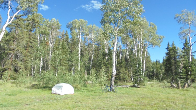
We have a short climb from the creek to go around a hill and then another downhill through forest. We pop out into a meadow and I can see an open area with aspen just ahead. There is a feeder creek (Killdeer) which is too small for beavers, so I have found our home for the night. It is perfect! I immediately fill water bottles to treat and get the soaking tent set up to dry in the wind and the last of the sun. I eat, I drink, I sunbake. It is cool up here at 10,000 feet, so sun is good. I scout for a tree to hang the food bag from – there are some claw-like marks on some aspen further up the old jeep trail where I went to get water. I’m not sure if it is a bear or just some campers having fun – but the succession of marks over time make me think bear.

We close out the day watching the sun make its way to the horizon. While I only saw four vehicles (the jeep and the three associated with the logging) while I was on the road to and down from the pass, a procession of vehicles pass over the next two hours. My illusion of being away from the CO crowds is dashed. Within two hours, I will see ten different groups of vehicles mostly heading west (cars, pickups, motorbikes and a couple on mountain bikes – this is the route of the Colorado Trail for bikes since they have to go around the La Garita wilderness). That is a heck of a lot of traffic for some Forest Service road that doesn’t really connect much! Yeah, I’m pretty much over touring in Colorado, at least in summer.
We are approaching the Perseid meteor shower, but there are a bunch of early arrivals tonight. I bundle up and sit out in the meadow to watch the sky late into the night. Streaks of brilliance flash here and there through the whole north and east of the sky. Some of them even approach Australia brightness. I just lay back, all alone out there in the forest, gazing upwards and outwards to the universe.
Inwards, I feel soooo good, so whole, so connected. It’s been the shittiest summer I can remember in a looong time – and now that I’ve accepted failure and made the decision to go back to Oz, I feel so much relief. I can sleep again. I can see a path forward. A week out on the bike post-decision just heals all the heartache and sadness that I could not find a way to financially survive in the US.
I am heartbroken that I cannot be closer to my aging parents. It also leaves unresolved how we will deal with their care needs in ten, maybe seven or so, years time. But now I can go back to where I belong and where I can have a much higher quality of life. I don’t know what happened to America in the 17 years I’ve been gone, but it hasn’t been good. America moves to my list of “nice place to visit, but I wouldn’t want to live there’. I would have sacrificed my cultural preferences for my parents, but I could not find work that was going to allow me to even meet the rent, let alone pay for car costs, health insurance, utilities, etc.
So I made the decision a couple weeks ago to use the return portion of my airline ticket and go home to Oz – where I can work 4 days a week and not only meet all expenses but actually save dollars, too. So I am okay with this decision – my parents are, too. It doesn’t make it easier, and it makes 2017 the most fucked up year of my life since 2005 (which I still vote as the worst year of my life so far). But I am at peace. And I’m really at peace tonight – I’ve surpassed my expectations for the day and now I’m just out in the middle of nowhere enjoying meteors and connectedness to the past, the present and the future, whatever it may be.