

Euroa to Molesworth via Strathbogie and Merton
Monday April 25, 2016, 54 miles (87 km) – Total so far: 1,342 miles (2,160 km)
About 375 million years ago, things were a lot more exciting in what is now Euroa and Violet Town. The earth was very active and readjusting its stores of magma. Today we are again going to ride up into the remnants of that activity.
Yesterday we rode up and over the Strathbogie batholith – a blob of magma that hardened underneath the earth as it cooled. Today we are going to ride up into the adjacent Violet Town volcanics as we traverse the long-collapsed cauldron of a volcano. Batholiths and volcanoes often go together, and here they butt right up against one another.
Today, the nerdy among us will stop at the road cuts to look for contact points between the granites and the rhyolites/rhyodacites and enjoy looking at the different kinds of rocks found on different parts of this plateau. This area is part of a larger region called the Central Victorian Magmatic Province. That just means there are a bunch of old volcano calderas and sheets of volcanic rock found over a large swathe of land in this part of the state (we rode through some of this on our Tatong-Tolmie Road ride a couple weeks ago).
I don’t need an alarm today. There are plenty of folks passing by my tent early as they walk to the War Memorial for the ANZAC Day dawn service. I’m on the road after first light but before sunrise. The road follows the base of Balmattum Hill on the wide, flat valley floor. We head southeast and make good time over the dry paddocks… we need rain so badly!
Not long before we get to the base of our morning climb, we come across the bushfire warning sign. I’d never seen these anywhere before the horrendous Black Saturday fires in 2009, but when every ride I undertake passes through fire-scarred areas, it seems an important reminder.

The climb starts at about mile 7 for the day. We curve up and around a hill on fairly steep, but manageable, grades. The forest here is scrubby regrowth on those thin, rocky soils. Down below the road, above what looks like an old mine shaft, I spot a wombat ambling along above his burrow hole. How cool – I rarely see wombats, so it is apt to see one on our climb of Mt Wombat.

We gain elevation quickly and then get a right-hander that sends us into some steep, lung-busting stuff. Luckily, for the nerdy, there is a great reason to stop midway up that section – there are cool contact points in the rocks to ponder… if you can think about anything other than getting oxygen inside your body.

The steep stuff recedes to ‘still steep but manageable’ as we ride past some very expensive homes – one is being built on top of the hill, the other is for sale. Both have modern architecture and don’t really fit into the landscape.
Up we go. Onward. Puffing, pedalling, straining, but still going. A rather fit-looking older guy passes me slowly on a road bike – he is huffing and puffing, too!
We ride through evidence of bushfire as the climb flattens out a bit at Kelvin View. The climb was challenging, but I’ve still got legs, so I turn off onto the gravel Mt Wombat Road. This road is pretty steep in parts again, and the gravel is thick and loose in spots, but there are great views back from where we’ve come.


We then turn off on the Mt Wombat Lookout Road. It is just a narrow two-track type road that traverses gently uphill through open forest. There have been burns through here in the past few years, and much of the forest is just tall trees and bracken. There are only a couple of spots that are rocky and on the verge of unrideable.
The only downside to this nice morning ride is the concentration of sulphur-crested cockatoos blasting my ears with their screeching. You just don’t get decibel levels like this with many other birds – there’s a sample of their screeching on this road in the video below.


There is a parking area and then the road condition deteriorates for a few hundred metres as the large sheets of rock come into view. Not too far beyond this, the road gets so steep that they’ve concreted it. There’s no way to pedal that – so we park the bike against a tree and hike up the final 150 metres or so.
The summit is full of navigational beacons, communication facilities and a fire tower… so it’s not exactly a wild and pristine summit. However, the views are great, even in the haze of autumn burns. It is well worth the extra effort to get up here. The summit sits at 800 metres (799, I think!) – the ride from 200 metres in Euroa to the summit is about 11 miles, though the climbing is concentrated in the last 4 miles.

I am really enjoying looking at the rock. I’m not into rock types all that much, and I don’t know if that is rhyolite or rhyodacite, but I can tell you that those boulders are most definitely volcanic with big-ass pores. What is really cool is that the rocks are speckled with small, but bright red garnets. Very cool!! We’re standing on the remains of a 375-year-old volcano at 8.45am on a gorgeous autumn day. Have I ever mentioned that I am one lucky chick?


We retrace our path back down through the screeching sulphur-crested cockatoos. I see two shiny SUVs heading up, so I pull off to the side of the road. The first vehicle slows for a second when the driver spots me – he looks VERY surprised – but then speeds back up. The second vehicle doesn’t slow down at all. No courtesy there! It is so dry and dusty, c’mon!
The rest of the Mt Wombat Road from the Lookout Road to the junction back to the main road is really crap. There’s lots of sharp, exposed bedrock, corrugations, exposed tree roots and mounds of gravel that have been heaped over the exposed bedrock. It is rough and requires considerable concentration. The views through the forest and out over open paddocks is pleasant, and there are likely koalas to be spotted in the trees here, but I’ve just got to keep my eyes scanning the road ahead and weaving my way down the crap. Maybe it would be better in spring.
We get back to the main road and have a sustained downhill into Strathbogie through lots of small farms. It is a little bit greener and more hospitable-looking up here, but even up here, you can tell they are really hanging out for rain. The creek, Seven Creeks, is flowing though. This is the same creek that runs through Euroa.
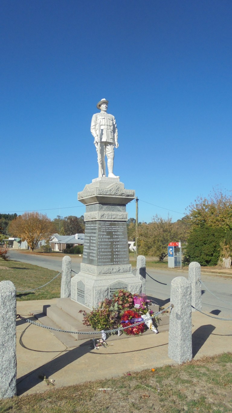
We cruise up into town before coming back to the creek for some food from the panniers. The main street, and really only street, of Strathbogie has a school, church, small store (closed this morning), Memorial Hall and a phone booth. There is a War Memorial and a merino sheep statue (this area was important in the developing wool industry way back when) in the grassy road median. And that is Strathbogie. There is a recreation reserve and golf course out on another road – where I think you could camp (not legally but probably without hassle).


After some food, I ponder a route for the afternoon. My original thought had been to ride around up here on this part of the plateau today, then stealth it at the recreation reserve tonight. But this puts me on a busier road tomorrow when everyone goes back to work and there will be more heavy vehicles. It is also quite windy today, so riding around on the plateau in the open bits won’t be all that pleasant. Plus, the wind will give us a push if we continue on to Merton today. So that is what we decide to do. We’ll definitely be back to ride up here again in the spring, though!
So we drop down to the forested creek on the other side of town, then climb back out and through more open paddocks on the plateau. There are good views back over to Mt Wombat past the grazing cows and forested slopes. The Seven Creeks drainage winds through the gently-sloping paddocks in a tree-lined course. We are on the Galls Gap Road, and it is scenic but a bit narrow.

We drop down to the broad, rocky slabs of Seven Creeks at Polly McQuinns weir. There is only a dribble of water over the weir wall today, and the water behind it is pretty low. The water coursing through the jumbled rock creekbed below the weir finds paths through the vertical fissures – it would be more impressive in spring. Still, there are several families here enjoying the unseasonably warm weather by splashing in the creek and rock-hopping. The pond below the creek reflects the trees in its waters – there’s not so much wind down here!


Then we begin our drop off the plateau. The road here is a bit rough and pretty narrow, so you can’t let it fly. You’ve got to keep on the brakes a fair bit since it is quite steep. I only hit a max of 33mph through here. But it is beautiful – it is a narrow creek valley that falls away like a physics experiment demonstrating slope and acceleration. Trees overhang the road as it is cut into the hillside. The narrow gash down out of the ridge is sooooo fun – though the section with 16 percent grades would be tough going the other way!
We make it down to the valley below – where we again meet back up with Seven Creeks. It’s gone around the other way on a rocky, cascading fall through an even narrower gash too deep and narrow for vehicular travel.
Now we join up with the Euroa-Mansfield Road – it’s a C-road, and I avoid these when I can as they tend to be quite busy and shoulderless. But I’m hoping it’s not so bad on a public holiday. The views are great back up to the rocky outcrops of the plateau. Down at road level, it is all trees and some open paddocks. At one point, there are a series of yellow warning signs as the road significantly narrows, gets windy and takes two corners in very sharp curves. The traffic isn’t horrible, but there is a car from one direction or another every 1-2 minutes.
I pull off at the Gooram Falls Picnic Area. The guys and I go down and check out the creek, but we don’t bother with the 400 metre walk to the falls since the water levels are so low. My understanding is that ‘falls’ is a misnomer anyway – ‘cascades’ is supposedly a better description.
The guys and I check a dilapidated picnic table for creepy crawlies that inflict painful bites (i.e. redbacks). All clear. I eat a bit more food and then take a half-hour nap. It’s about noon. I’m hoping that the traffic will die off this afternoon. Well, that’s what I tell myself. Really, I’m just procrastinating about that next big climb with all the traffic…..

Around about 1.30pm, I decide to just go and get it over with. The traffic is not going to die down, so let’s go. There’s a little bit of gentle up and down through the trees to get you warmed up before you drop down to Watchbox Creek. Then it’s a climb of 350 metres (1150 ft) in about 3.75 kilometres (2.33 miles) back up to the plateau. Oh, it’s a beautiful, curvy road through the trees with views over to open ridges and rocky tors. But, oh, is it tough!


The road has been pretty freshly chip-sealed which means it’s not too bumpy, but it is a little bit gritty with chip. There is a tiny bit of a shoulder on the uphill I can use, and everyone gives me room, so the traffic isn’t really an issue. But, oh, those grades! It is lung-busting, stomach-heaving stuff. I haul my butt up there, but I’m on the verge of vomit by the time I reach the top because I’ve been pushing it so hard. It is still a good sense of achievement, though. Excuse me for a moment, while I let things settle back down……….

And now we get to go down… yippeeeeeeeee…….! The road is not fresh chip over here, so it is faster and smoother and we just let it rip. There are no steep, sharp corners, just a great straight drop down to start. We just cruise without pedalling for several kilometres. Eventually, we get back down to flatter bits in a wide valley. Woo-hoo!
However, it is only 2.30 pm. There isn’t an official place to camp at Merton – I was just going to camp at the Rec Reserve and hope no one kicked me out. But I don’t feel like hanging out. That climb and descent has the endorphins kicking! So we stop at the petrol station to get our 10th Guntonneuring Milk and then sit underneath a gorgeous exotic tree to get some liquids in. It is another gorgeous day, and even though nothing has gone as I thought it might on this trip, you couldn’t get a better ride.


So what do we do now? After some pondering, I decide that maybe we should try to kick ass down the rail trail and ride all the way to Yea. This is the next town downriver from where I’ve left the car. If I ride to Yea, I will get to see the Cheviot Tunnel – one of the highlights of this particular rail trail. Then I can camp in Yea and just do the 17 kilometres back to the car in the morning. The only problem is that I’m really going to be racing the sun to the west, and I’ll likely get into Yea as darkness falls.
So, let’s go for it. I’ve got no idea what sort of speed I can average on the gravel rail trail, but after the initial climb to Merton Gap, it will pretty much be downhill. If we get to Molesworth and we’re really low on light, then we can just call it a day there and head back to the car.
Our first problem is getting across the highway. We’re only a couple hours from Melbourne here. At least half of the 3.5 million people in that city must be up here. The line of traffic heading back toward the city is almost constant. I am not kidding when I tell you that there are strings of 15-17 cars passing by with gaps of less than 30 seconds in between. Thank goodness we don’t have to ride that road!
We can only manage 9mph on the gravel climb to the Gap where there are great views out over the river valley, feeder drainages and the ridges and plateaus. Great stuff! Then we are rolling downhill at speed. Once we come off the gap, the downhill is much more gentle. However, I’m still pushing it hard and keeping the speedo between 14.5 and 15 mph all the way down the gravel. The rail trail is pleasant and the surface acceptable. We crank it down!

We don’t see anyone until we get to Cathkin – where all the picnic tables are full with day riders snacking. We then pass a woman out for a walk and then spot a wombat down below the embankment just beginning its evening grazing. Crank it, crank it, the sun is gently subsiding, sinking away to the west and back behind the distant ridges.
Then, again, just when I think I’ve got a plan… it changes. About 3 kilometres from Molesworth, I feel the rear tire starting to get a bit squishy. I stand and pedal hard, taking some weight off the rear and hoping I’ll have enough air to get me back to the car.
We make it. But it also makes the decision for us. We won’t be riding to Yea and checking out the Cheviot Tunnel this week. I’ve done two big climbs and ridden like a banshee down the rail trail – I don’t have the oomph to fix a flat now. I’m as deflated as the tire. And even if I had the oomph, the time it would take to fix the flat would rob me of the daylight needed to get to Yea.
So I pack up the bike, swig some Coke and hop in the car for the 2.5 hour drive home. We’ve been on the road since before sunrise – now we just trade modes of transport. I watch the sun sink below the horizon and fire up the sky in bright oranges as I drive. The backlighting on a row of trees that line a barren ridge is just spectacular – you can almost pick out the outline of individual leaves in the silhouette of those stately soldier trees. Battle on, you gorgeous eucalypts!
I pull into the drive at 8.00pm. It has been a long and fantastic day. As usual, I checked off another ride on my ‘to-do’ list, and then added at least two more. That sure is a nice problem to have 🙂