

Jindera – Wagga Wagga
Sunday July 17, 2016, 90 miles (145 km) – Total so far: 1,782 miles (2,868 km)
The past month has been WET. Drizzly. Misty. Rainy. Foggy. Crappy. We rode under perpetually grey skies. We rode in light rain. We made the most of the delightfully cool temperatures even though they were accompanied by so much moisture. Some highlights are documented in the video below (it is missing its audio here since I uploaded it to youtube without the copyright music).
But, finally, we got a fantastic weather forecast. Two days in a row of sun, light winds and temps of 60-65F. Even better, those days coincide with a weekend. I immediately made plans for a big ride. We are going to throw down some miles this weekend and ride some new roads! To ensure that I actually make the most of the weather and ride a bunch of miles, I’ve booked a non-refundable motel room that, in a car, is about 1.5 hour’s drive away. It should come out to about 100 miles of riding on back roads.
However, we are missing the Commander. His eyesight has been slowly deteriorating over the past eight years. Somehow he scuffed his good eye riding in the pannier a couple weekends ago when it was raining. So I finally conceded it was time for surgery. He went in Tuesday, but surgery was postponed until Thursday. He went it Thursday with the promise of being home on Friday in time for the ride. But, no. The artist surgeon is good at his work but not reliable. And so Verne was left all alone, cold, blind and shut away in the artist’s cupboard for the weekend. We will have to go without him (though Kermit and I will fret the whole time about our poor turtle crew member’s condition).
We take off in the fog early Saturday morning. Long rides in winter are hard because you are constantly racing daylight. There’s never much time to stop for a break – you’ve just got to keep pedaling continuously to beat the sun to the horizon. And so today we pedal and pedal on chip-seal and gravel, subsisting on four Ryvita crackers and one chocolate wafer cookie that we gobble down in less than five minutes.
The first 40 miles are on roads known to us, but just outside of Henty we start in on all new roads. There is little traffic – just a few cars here and there towing trailers with occupants out looking for firewood on the roadside. In winter, that’s the bulk of vehicles I meet on the back roads.
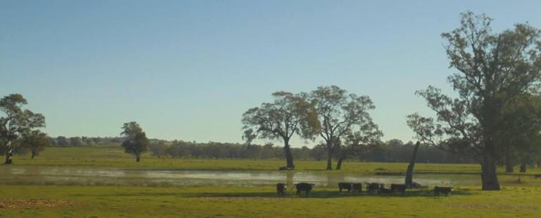
The fog lifts. The sun feels magnificent after so many weeks of rain. We absorb our Vitamin D. The gravel is in good condition and life is good.

We then get to a road junction where we had been hoping to go straight. My map (and google later) indicates that the road connects up ahead with Broughtons Lane. I’m sure it did at one time, but it is now a “No Through Road” and has been subsumed into someone’s farm. Crap. The road that goes right is rough and rocky – a clay mixed with big diameter gravel. But we’ve got no choice, so we curse our way down that one. It is sending us back out to the main highway. The main highway is a busy one with lots of trucks and a crappy shoulder. I had no plans to ride any of it today. But that is where we’re heading….
However, when we get to the junction with the highway and rail line, there is a laneway heading north that does not say “No Through Road”. I gamble. If worse comes to worst, we can always figure out a way to get over the fence, over the rail line, through the mud and slop and over to the highway. I’m hoping the laneway is used as an access/maintenance road for the railway and, consequently, will not abruptly end. And so we head north on this undulating gravel road. There is a clean line down the edge of the wrong side of the road, so it’s not too lumpy and bumpy. It would be a really nice little road if it weren’t right next to the railway and highway. Luckily for us, that little road does go all the way through to Yerong Creek. Phew. No cross-country bike carrying is necessary.

Yerong Creek is dead. Lifeless. Not a soul stirring. I can hear a radio somewhere, but other than that, it is a depressing little place. I stop for a moment to down the chocolate wafer, then on we go.

We start up a long, gentle hill and watch two young girls come flying down on their BMX bikes, faces all grins. I wave and smile. Not far out of town, I turn off, pass the peaceful cemetery and roll through a nice stand of roadside trees. I turn off onto Vincents Road and we start getting nice views of The Rock and its long sinuous ridge that trails along to the south. There are no cars, the gravel is good. As we climb up onto the gentle flanks of the uplift we get great views out to the west and northwest. Very fine indeed.


The gravel gets crappier as we get closer to The Rock and the smaller property allotments. We see our first vehicle in about 45 minutes here, too. It’s a 4WD that doesn’t bother to slow down at all – just showering me with dust and gravel. Thanks. For nothing. However, the road does become chipsealed up ahead sooner than indicated on my map. We roll up and over a hill and down to the road that runs between Lockhart and The Rock. This road is always busier than I think it should be – maybe it is quicker to get to Wagga going this way than to go the other way through Collingullie?

The good thing about the road into the town of The Rock is that its been freshly resealed. It’s nice to ride some relatively smooth road after all the gravel so far today. It would be a perfect day to climb The Rock, but I don’t have the daylight on hand to do so. I’ve climbed it once before about 10 years ago – it’s an easy hike with nice views. You would probably be able to see the snow-covered mountains off to the southeast today, too. But we’ve got a date with Wagga and not a whole lot of sunlight left to get there. So after 4 Ryvita crackers stuffed down while overlooking Burke’s Creek, we head out on the Old Trunk Road. This is a very pleasant and undulating road that weaves along through the trees above and along the creek.
When I get out to the junction with the highway, I turn onto the Bon Accord Road. There should be a laneway not far along, but I never see it. So I ride the rough, awful gravel of the Bon Accord road that parallels the highway for a bit. This road finally curves away from the highway and meets up with the laneway we never saw. It looks like another road that’s been subsumed by a farm. We head north through the wheat and canola with a long ridge to our left and undulating fields between us and the highway some ways to our right. We roll up and down and come to another junction where the road used to go straight but now does a big dog leg around a property. At the end of this dog leg, a kelpie comes out to meet us near a property entrance. He races along, periodically looking back to make sure I’m still coming, then peels off into the homestead gates. See ya, buddy.
Onward we roll. We’re making good time, but 75 miles of gravel and rough chipseal just beats you up, no matter how good your bike fit. My wrists and butt would like a break, but as always in winter, we are racing daylight. I roll on down the hill, past gorgeous open woodland in the pasture along a creek, over the creek and into the edge of Uranquinty. But I don’t go on into town. No time for a break.
I turn off toward the showground and head out of town on Churches Plain Road. The scenery is pleasant. The road shoots up between two long ridges – one treelined, one cropped. We head up the gap between these low ranges. However, the road is all big gravel without much of a tire track to follow, so it is rough and slow-going. At this point in the day, I am over it! I had been thinking I might come back this way tomorrow on the way home, but forget that!
As I roll along the roughness, artillery fire starts up. One of the things I really love about living in Oz is the strict gun control laws. Oz just doesn’t have the culture of violence that the US does, and you never ever worry about guns. It just feels so much safer here. So, it does seem odd to hear gunfire. But there it is – a succession of popping like fireworks, and some droning voice over a loud speaker that, from this distance, sounds like the teacher in a Charlie Brown cartoon. We’re passing by the Kapooka Army Base and the rifle range is not all that far from the road. Still, it creeps me out to ride along the edge of a military base. Always does.
Finally, we survive the rough gravel and can see the Sturt Highway in the distance. We’re only about 8 kilometres out of Wagga now and we’ve got daylight to spare. Good stuff- we’ll be able to ride into town and get some food before it gets dark. I’m starving!
The Sturt Highway is an “A-road” – the equivalent of a federal highway in the US. This is the main highway to Adelaide. You’d think it would have an acceptable shoulder. Yeah, you’d think that. But it doesn’t. Oh, it’s good for the first 500 metres, then it narrows down to about 2 feet with only about 10 inchs of that rideable. Then it narrows down to nothing!!!
Oh, Australia, there are many things you do very well. But major road infrastructure is so not one of them! I pedal as hard as I can, and ride over on the 6 inches to the left of the white line when I can. But the reflector cases are embedded over there, so they are yet another obstacle. Luckily, it’s a weekend, so even though the road is busy, there are fewer trucks. I am lucky to get through the shoulderless bit without encountering a truck. B-doubles are incredibly scary to whoosh by your shoulder at 100kph on a shoulderless road.
Eventually, the road gains a climbing lane as we head up and over a gap. The road surface is such a large-diameter chip that I feel like I’m riding over cobble, but thankfully, there is a sufficient shoulder down the other side of the gap into town. Phew! Okay, we will NOT be going back out of town that way in the morning.
I pass the intersection with the highway to Albury, then cut over onto local roads through Ashmont. There are two hills to climb on weary legs, but my stomach is set on food, so I power through. We roll down Dobney Street, through the two roundabouts where people are doing stupid things that defy logic and road rules (we are near a Bunnings – like Home Depot – on a weekend so maybe that explains it) and then down to the main drag where there’s plenty of traffic but also two lanes each way. I can use a lane and it’s not a big deal.
Soon I turn off of the main road onto another local road and make my way to a takeaway shop. Instead of a burger I get a piece of fish with the hand-cut chips and roll down to a nearby picnic table along a retention basin. Yum! I am so hungry! I eat half the fish, most of the chips and then decide I better get my butt back to the motel as the light is waning quickly.

I booked one of the cheaper motels that is out on the edge of town so it would be easy to escape in the morning. The room is quite fine, the shower hot with good pressure. There’s heat and free wifi that’s not too slow. The walls are thick enough that the screaming child who is racing back and forth across the room next door is just a dull roar and not too annoying. Sleep will come easy tonight. 90 miles total with a significant amount of gravel means I’m pretty darn tired. My wrists and fingers are finished. The day is done.