

Corowa to Chiltern via Woolshed Valley and a bunch more of Chiltern-Mt Pilot NP
Sunday November 15, 2015, 59 miles (95 km) – Total so far: 834 miles (1,343 km)
I’m feeling fruity. Some of my friends might suggest I’ve always been a bit fruity. Or maybe a bit of a nutcase. Riding a bike over hill and dale just for the fun of it probably confirms suspicions in their minds.
However, this is a different sort of fruity. I have a bunch of fruit in my fridge that needs to be eaten, and the thought of having fresh cut fruit on the road sounds like a treat. Since cut fruit doesn’t travel well, I normally only eat it on rest days on tour.
So I cut up a couple pounds of fruit and double-bag it. I learned my lessons early in life when backpacking about not double-bagging liquid-y things!

I decide to mix things up a bit on the ride today. Instead of taking the old bridge over the river and the rail trail to Rutherglen like usual, I ride over the new bridge instead and take the Carlyle Road. Exciting stuff, I know! However, I would advise not using the Carlyle Road. It is now fully sealed, but the new sealed stuff is very rough and really just one step above gravel. Ah well, it pulls us up to our first hill of the day where the old water tower stands (which has been fixed up to look like a wine bottle).
Then it’s back down familiar roads to get to the other side of the freeway near Chiltern. 23 miles before we get to anything new. But then we are cruising slowly up the gravel on Settlers Road toward the park. We don’t see any cars for about 35 minutes. It’s just the crew and me and the white noise crunch of gravel beneath the tires and the occasional ping as a rock goes ricocheting off a rim or the chainstay. The gum trees arch over the road and provide a nice canopy of shade in places.


Not long after Browns Track joins Settlers Road, and just past the horse stud, a SUV comes up behind me. I move over and stop to let them past. They wave… then they turn into a driveway only a couple hundred feet up the road. The man gets out to open the property gate while the woman leans her head out the window and says to me, “Where are you going? Are you lost?”
I reply, “No, I’m heading up over the hills to the Woolshed Valley.”
She says, “Oh. But you do know there is nothing up there but forest, right?”
I smile and say, “Well, that’s the point.”
She is taken aback. She lives on a property that abuts the forest and can’t seem to understand why anyone would ever want to go up there. She then says, “Well, you must be very fit if you are going up there.”
I respond, “No, I’m just very persistent.”
Her husband has been smiling at me the whole time. I don’t know if he likes my plans, my responses, or he is just staring at my helmet thinking I’m silly for wearing tinsel. He doesn’t say a thing. You must remember that I have an accent to them and they likely think that I’m a tourist from America or Canada.
The woman says, “Well, good luck to you in that.”
(Twenty minutes later, as I pant and grunt my way up the big-ass hill I think, “she must have been thinking about this hill when she wondered why I was heading this way. Fit? My ass!”)
I leave the man and woman behind and proceed not to see another car for the next 1.5-2 hours. I spin away up the gentle incline until I reach the national park sign. From there, I can see the road start to angle up.

The forest is nice and open through here. There are regrowth gum trees and an open, grassy understory. My guess is that this area was backburned against the main fire front up the hill during the January 2003 fires. It all looks healthy and attractive as we pedal up the small creek valley.
The road pitches up to 5 or 6 percent and we spin our way through the dappled shade and the sound of bird call. But then the road turns back on itself in an effort to get out of that valley and up on a ridge. The first switchback picks up the grade to probably around 9 percent. Holy crap, am I not in touring shape!! But I’m in much better shape than I was two months ago, and I’m able to grunt it up and around the corner where the grade backs off to 7 or 8 percent. Okay, we need a break for a second.
As we stand there covered in flies, looking ahead, I see the next switchback and think, “Things always look steeper from a distance than what they really are, but if it’s this steep here, I’m probably going to be walking that!”

And so I commence forth with a commendable cadence up toward the switchback. As we get close to it, I spin hard into the steepest, lowest section. This would be a lung-buster on pavement. On slippery granite gravel, the front wheel is slipping all over the place, and I’m afraid I’m going to slide into the ditch with the way the road angles into the inside curve. So I try to turn toward the outside of the curve so I can traverse back and forth up the hill instead of trying to tackle it head on. But no, the tire is just slipping everywhere and now I’m fighting the incline vertically and horizontally. I lose momentum in all this and have no choice but to dismount.

I stand on the outside of the curve, regaining my breath. I’m proud I made it through the steepest bit, but I’m not so proud to think that I have to pedal through the rest of it. So I just walk the bike and push up around the corner for about 100 meters. The grade then backs off to 8 or 9 percent. I’m able to then remount and tackle the hill in short bursts of pedaling and panting. According to our topo maps, from the park boundary, we just climbed 150 meters (490 feet) in about one kilometer (.62 of a mile). From the 300 metre line on the map to the 475 metre line is about 1.5 kilometres. That is steep for me on gravel!!

Once along the ridge, we turn left on the Old Coach Road through more open forest. We still have a bit more climbing to do, but it is all at manageable, spinning grades. Then we turn off onto the Reedy Creek Road. I know from the topo map that this road is even steeper than what we came up. However, the first couple kilometres are just rolling good fun. The surface is pretty good, and we just go speeding down the declines before gentle inclines slow our speed. The forest here is less attractive. The 2003 fires must have burnt through here with some heat, because there is a lot of spindly regrowth and some sections without many large trees left.

Just after the intersection with the Kangaroo Track, the road starts to drop. Like a bomb. I go down toward the first switchback somewhat cautiously, but still faster than I should. I get to that curve and find considerable erosion. There are also big dips and big water bars built by nature through a few storms. The ditch leading into these would not be good to hit at speed.
I commence the first super-slow descent of what will be many over the next kilometre. I death grip the brakes, then release. Scary speed. Death grip the brakes. Release. Scary speed. Negotiate all the rocks and runs of erosion. Get to a slightly flatter section and breathe. This section of road drops 200 metres in less than a kilometre.

The views are tremendous. The massif that Beechworth sits on falls down to the valley with thickly forested slopes and rock outcrops. The ridge lines are a jumble in the distance. But I must concentrate on the road, because it is pretty gnarly. At one point, I decide the “Road” should be called a “Track”. There is not much ‘form’ left in the formed road.
At another point, I have to get off and walk the bike down. It is just too dicey. But walking is not straightforward either. Both my feet are sliding down the hill. Luckily they are mostly sliding in the same direction. I’ve got the brakes fully applied as the bike slides down the gravel, too. The back end keeps threatening to come around to the front and sideswipe me from behind. Sheesh!!

Back on the bike, I do the death grip-release-death grip-release action again as I point the bike downward. I start to understand the different handling characteristics and the effect of different frame geometries between touring bikes and mountain bikes. As I’m barreling down a slightly less steep section leading into a bunch of deep erosion ruts parallel to my direction of travel, I come to the knowledge that you don’t really steer a touring bike at that speed, you just aim. There are no quick movements to be had on a bike made to be long and stable instead of quick and nimble. You don’t casually bunny hop a small branch or unweight and lift the front wheel to skim a hole. Obviously.
I survive those ruts only to find a large sheet of exposed granite off to the left of the road. It radiates the light and heat. It also must shed a lot of water in storms, because there are erosion paths going every which direction down below it. I’m carrying a bit of speed into this… we’ll say… um, 20 mph. I catch some rocks, then a rut, then some sand. There is a very sharp jerk to the left with the front wheel, and I think the back wheel might have jumped right. I don’t know. I just know for a second or so, I was absolutely certain I was going down. I have no idea how I recovered out of that one and stayed upright.
Finally, where the road meets up with a small creek, the grade finally backs off. It is the first time ever that I don’t think Verne requested that I go faster. I say to the guys, “well, that was a little bit crazy now, wasn’t it?”
I stop for a second because my fingers are on fire. The arthritis in them is normally a bit painful with standard shifting and braking. The last few kilometres have caused significant pain. And they are sorta stuck in a claw position. I can’t straighten them for a moment. Three of them are stuck extended at the middle joint, but bent at the top joint (I am ‘double-jointed’ so this is quite possible). F**k, does that hurt!! Slowly, the searing pain dies away and I can uncurl my grip.
We then finish up the rest of the road as it runs down deep beneath two ridges. The road then pops out on the Woolshed Road. This road is more heavily traveled and has considerable washboard. It also has a rough, rocky base, so it is hard to find a good line. It is also quite dusty. The valley is quite scraggly and scrubby in places – but this area was heavily flogged for many years. It’s been subject to considerable goldmining, clearing, firewood collection and bushfire over time. So it’s not a ‘pleasant’ ride, but it is visually interesting, and the history here is extensive. There are very thorough and entertaining interpretive boards along the route.

We all really need a break, so I stop at the first clearing along the creek. The guys get in some habitat enjoyment and I consume heaps of fruit. It tastes so good and is so juicy, it really is a treat.

We head on up the valley as it opens out to some pasture on private land. The pasture runs into the steep-walled ridges in the distance. We cross over the creek onto McFeeters Road and follow the creek upstream as it gets further and further incised. There are plenty of places to whack up a tent between here and Woolshed Falls. There are lots of lumps and lines of earth from the extensive mining of the past, but there is plenty of shade and open grassy areas to pitch a tent upon.

I ride down to the falls, just to get a picture for you, dear reader. I’ve been here many times before. There are quite a few people here, and it is a big change from not seeing anyone at all in the forest for a couple hours and only one car on the Woolshed Road. There are couples arguing. There are fancily-dressed families who smell like soap when they emerge from their shiny Toyota Prados. There are young teens with provisional licence plates and scraped-up and dented first cars who have come out for a swim. There are several very overweight families waddling out to the overlook and back. I just find a picnic table in the shade and eat more fruit.
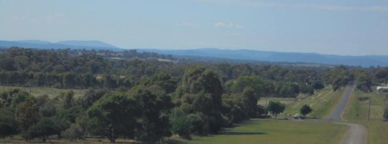
Then it’s down the main road a few kilometres – not fun with all the Sunday sightseeing traffic impatient to overtake on a road with no shoulder and limited sight distances. We take off into the forest again on the track we rode a few weeks ago. But this time, instead of turning off onto the Pine Gap track, we just keep flying on downhill and enjoying some new roads. Again we see no-one on the road for the next 1.5 hours, even after we have left the park and are riding down the valley between fields and farmhouses.

We roll into Chiltern around 5.00 pm. It’s taken us about 6 hours of pedaling to cover 59 miles. We’ve been on the road for about 8.5 hours today. So we are a bit tired. I want to stay here tonight and check out the caravan park. I would like to move down here so that I’m closer to the mountains and on the train line. This way I could take the bike further afield and ride home on weekends. I’m tired of living so far from where I want to ride. Alas, there is not much on offer to rent in this town, and pretty much no apartments, so I want to see what the caravan park is like.
Well, the owner is friendly, and there is sufficient shade, and the amenities block is nice and clean. But it has a lot of permanent residents and the vibe just isn’t right. I wouldn’t want to live here. Still, it’s nice for the night. The shower is fantastic since I’m covered in multiple layers like sedimentary rock – a base layer of sunscreen, a layer of sweat, topped with a layer of dust.
After a walk around the lake to dry my hair, the guys and I take up our sleeping positions in the tent and call it an early night. I love days like today when I push my own boundaries of what I think I can do on the bike, and discover more of the bike’s boundaries, too!

