

Ignorance is bliss: Yampa to Glenwood Springs
Tuesday July 30, 2013, 87 miles (141 km) – Total so far: 3,381 miles (5,442 km)
“Two? Are you sure you want two”?, says the cook behind the counter in the 24-hour diner.
“Yes, please. I’m hungry,” I reply.
The cook shrugs his shoulders and reaches down to get the pancake batter out of the fridge. The manager walks in from the darkness outside. He asks me if it is my bike outside. Upon learning that it is, he asks a portion of the standard six questions. He remarks that the USA Pro Challenge has come through here, and is coming again this year, and it certainly is pretty neat to see all those riders clumped in a group and riding so fast. He prefers mountain biking, though. He fills me in on all the good rides around the area. He also confirms that the Colorado River Road would be a problem on a bike if it is very wet. His suggestion is to ride down a little bit. “If it’s tacky at the top, it’ll be shitty at the bottom.”
The cook plops down two huge pancakes in front of me. He’s about 20-years-old. He’s got a headache. He’s got a hangover, and he’s just all around down on his luck. He tells me all about it, as I attack the pancakes. It is 4.45 am, so there is no one else in the place.
I finish off the two plate-sized pancakes. The manager looks over and says, “Holy cow, you really did eat all of those”.
I’m ashamed to say I probably could have eaten half of another.
I reply, “Oh yeah, I eat absolutely gross amounts of food. It’s like I’m a machine though. I just shovel it in. I’ll be hungry again by 10.”
“Yeah, I suppose you would burn a lot of calories,” he says.
I’m looking at my bill. They have only charged me for one pancake and the hot chocolate. I’ve just managed to put in enough calories for about 3 hours of riding for $3.29. So I leave the down-on-his-luck cook/waiter $2.00 to cover the tip AND the pancake.
And I’m still on the road, heading gently uphill to Toponas, before dawn.
I’m feeling happy today. The air is cold. The sky is clear. I actually might not get rained on today if the forecast holds. In the end, my route elevations today go something like this:
Yampa: 7892 ft
Toponas: 8260 ft
2-mile climb to a ridge, then 10+ mile descent
State Bridge: 6740 ft
Multi-mile climb to a ridge
Wolcott: 6960 ft
Eagle: 6600 ft
Glenwood Springs: 5746 ft
But I don’t know any of this, as I set out. I don’t know anything about the road. I don’t even know where I’ll end up tonight. I just know I’m out for a ride and hoping to hit the Colorado River Road. Ignorance truly is bliss.
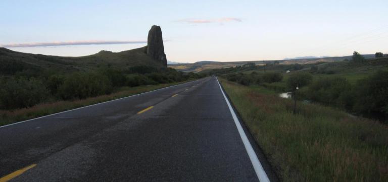
The rain from the day and night before has left the pavement damp. It makes my tires sound noisy against the silence. The moisture in the air has also condensed. There are fog banks here and there obscuring sections of the mountains in the distance with thin lines of white cloud.
After a nice descent from Toponas, we climb into the fog bank. The grassy hillsides and forested mountain slopes disappear. The fog forms droplets on my helmet and cycle computer. The world goes quiet and gray. Then we pop out of the first fog bank into a bit of sun.

There is more fog at the top, but it is thin, as if I’m seeing the world with old age eyes where the world is slightly hazy but there’s still enough vision to navigate without concern.


This is followed by a rip-roaring descent more than 10 miles long. I was not expecting this, so that makes it twice as fun. The road serves up a heap of twisties and curves. I go from completely clear sections with long views of the valleys and distant mountains to sections where the visibility is extremely limited. It almost feels cartoon-like. Ride through nothing, nothing, nothing. Pop out into seeing everything, everything, everything. Fog bank coming – nothing, nothing, nothing. The speed I can gather makes the fog banks almost terrifying, because sometimes the curves come out of nowhere. As I descend into McCoy, some of the curves are actually hairpin turns. It is incredibly eerie when car headlights suddenly appear in the misty gloom. Luckily, by the time the traffic picks up down by State Bridge, the fog has pretty well lifted.

In the middle of all that foggy fun, I did stop at the turnoff for the Colorado River Road. This was the one section in all of Colorado that I definitely wanted to ride. But I’ve been warned to stay away from it by four different people now. This area has had above average rain for the past 5 days. Still, I give it a look. It is tacky where there is fine gravel. It is slippery in other places. There are patches of mud. Crap. Everyone says the surface gets worse as you get down to the river bottom. Crap. I decide to give it a miss. I like to think I’m adaptable. So off we go into the complete unknown. I’ve done no research for any alternative routes.


After the long and thrilling descent, State Bridge appears as a bustling centre of activity. There are heaps of cars, heaps of people, heaps of vans pulling rafts on trailers. I pause long enough to ride down the very steep gravel road to the toilets. Then I take a picture of the river and start off into a long climb out of the river valley. I knew there would be a price to pay for all that descending.

This road is pretty busy, but I’m also getting lots of goodwill from the drivers. At the top of the climb, all I can see is is a whole lot of down. I can’t actually see where the road goes in the maze of valleys and peaks below, but I’ve got a good feeling about this.
And it is a good feeling indeed, as we fly downward for about 10 miles. I’ve got to be a little careful about traffic here, but for the most part we can just let it rip downhill through the grassy slopes.


I’m not quite sure what to do at Wolcott. Highway 6 heads west, but I don’t know how long it lasts, or if I’ll have to get on the interstate at some point. Who knows, let’s just go for it, and see what happens.

We parallel the interstate down the Eagle River Valley. Most of the time, we are right next to the river while the interstate traverses the far side of the valley. Bright red cliffs tower above the interstate. The scenery is impressive. It is pretty much all downhill to Eagle. I see about 6 roadies going the other way. They all wave.
Eagle is a busy place with tons of road construction going on by the interstate. I make it to Wendys with my life, though I did resort to the sidewalk at one point. Fueled with a baked potato topped with chili, I head west again. There is a bike path from the western edge of town to the eastern edge of Gypsum. It is still mostly downhill. I stock up on food in Gypsum since I still have no idea where the day is going to end, and if that endpoint will have food.
I continue west down old Hwy 6 out of Gypsum. At Dotsero, I see where the Colorado River Road comes in. Ah, wish I could have ridden that! Never mind, there is plenty of fun to come today. I follow the old highway west from the new roundabout to the Glenwood Canyon bike path trailhead parking.
There are some people getting ready to ride the trail. They see me and start to hurry, as if they need to get ahead of me on the trail. They don’t even say hello. Whatever. I take off down the trail and never see them again.
Glenwood Canyon is an extraordinary 16-mile ride. The interstate through here was finally completed in October 1992. It has won over 30 awards for engineering excellence. There are 40 bridges and viaducts, three tunnels (you don’t go through these on the bike path) and 15 miles of retaining walls. For most of its length, the interstate is up there on the viaducts, the eastbound lanes separately cantilevered to the westbound lanes. The interstate stays on the north side of the Colorado River. The rail line occupies the south bank.
And the bike path? Well, the bike path hugs the retaining walls at times. Sometimes it runs right under the west-bound decking. Sometimes it runs between the east and west-bound lanes. And sometimes it just follows Old Hwy 6 when the road passes through the tunnels. It is amazing, even to someone like me, who doesn’t always appreciate human engineering marvels all that much.
This ride is such a rush. Heading west-bound, it is all a gentle downhill. I’m consistently pushing 18-20 mph, even into a 10 mph headwind. I get a thrill out of the times the path hugs the retaining wall and the road level is not much higher than your head. The semi trucks look like they’re coming right for you. This is just SO much fun with the canyon walls rising vertically, the river running right below, and the interstate travelling above or right next to you!

There are four rest areas in the canyon for the interstate. I know I’m coming up on one of these when I start to see a whole bunch of people cluttering the trail and walking their dogs. At one rest area, a group of hipsters see me, look directly at me, and then pull out right in front of me. I brake hard, weave my way through them, yell “thanks!”, then leave them in my touring bicycle dust.
At the next rest area, another group (with several overweight guys in spandex who look uncomfortable in spandex) pulls in front of me again. They are starting to cycle away in the middle of the trail with all sorts of kiddo trailers and trail-a-bike thingos attached to their road bikes. I don’t even brake. I just yell “on your left”, hug the outer edge of the pavement, and zoom right by them. I’m nearly 80 miles into my day, don’t slow me down now, I’m in the groove! Really, who pulls directly in front of someone on a bike path?

There is one steep hill to climb near the RV park just outside of Glenwood Springs. A grandfather, his son and two grandsons are pushing their bikes up the hill. The youngest kid is having some troubles, but he’s giving it a go. The older kid is crying and saying, “I can’t do it”! I chug by them in granny gear at 5.8 mph. The grandfather looks at the kid, looks at me and says, “If that lady can RIDE her bike with all of that stuff on it up the hill, you can PUSH your bike up it”! Way to go, Grandpa!
All too soon, the bike path/Old 6 spits me out into Glenwood Springs by the hot springs resort. What an awesome day! Time to find a place to sleep for the night. I’m all endorphin-ed up, but it is time to call it a day!