

30/31 March – 1 April
Kilometres: 179 kms (111 miles)
Total Kilometres 2018: 1643 kms (1021 miles)
DAY 1
Every culture has written rules (i.e. laws) and unwritten rules (i.e. social norms). It’s the unwritten rules that are the hardest for immigrants to a country to figure out. For example, there’s nothing written to tell you what ‘bring a plate’ means in Australia. If you show up with just a plate to a BBQ… you’ve not quite done the right thing.
One of the other unwritten rules of Australian culture is that you must go camping on the Easter long weekend. Australia is quite a secular country, and many individuals don’t even know the Easter story or its timeline of events. What is lent? Did Jesus die on Ash Wednesday or on Good Friday? When was he resurrected? And how was the bunny involved?
I became a citizen well over a decade ago. Back then, there was no written citizenship test, as there is today. At some stage in the application process, I had to rock up to a post office at an appointed time where some poor postal service staff member read me a paragraph and then asked me a series of questions about my rights and responsibilities as an Australian citizen. “You are aware you must register to vote.” Yes. And so on. I don’t remember if there was a question that said, “And you are aware that you must go camping each Easter weekend?” But there might as well have been.
Given the exodus of Aussies to the bush for the last blast of summer camping over Easter weekend (we get 4 days here – Easter Monday is a public holiday, too), we needed a weekend ride that would steer us away from all the traffic and overflowing campsites. You really don’t want to be on narrow chipseal roads with people towing caravans, boats, trailers full of bicycles for kids to ride around the campsite, and box trailers full of miscellaneous gear. You also don’t want to end up at a public or private camping area or caravan park which is normally empty but suddenly packed cheek by jowl.
And so it is on this Good Friday morning that we find ourselves doing a quick jaunt down the Hume Freeway (the main highway between Sydney and Melbourne) to get over to a long series of traffic-free backroads. The route I have planned out is one that has been on my list for a long time. It covers off the final few unridden roads on one section of my map. I left town immediately after work yesterday to do the two-hour drive to Tarcutta. I stayed the night in the motel there, and the owners are letting me leave my car there for the weekend (they have heaps of space out the back).


There is plenty of traffic this early AM on the freeway, but I’ve got enough of a shoulder not to worry. I am still amazed at how many people don’t move over at all when there is an entire other lane. It really pisses me off when vehicles with bikes on racks don’t move over!!
But it’s only 9 kms, and then we are working our way up terrible gravel for a couple kms in the flats of Keajura Creek. However, the road turns to sealed much sooner than my old map indicates, so those first couple kms of rocky, sandy corrugations are well worth it.

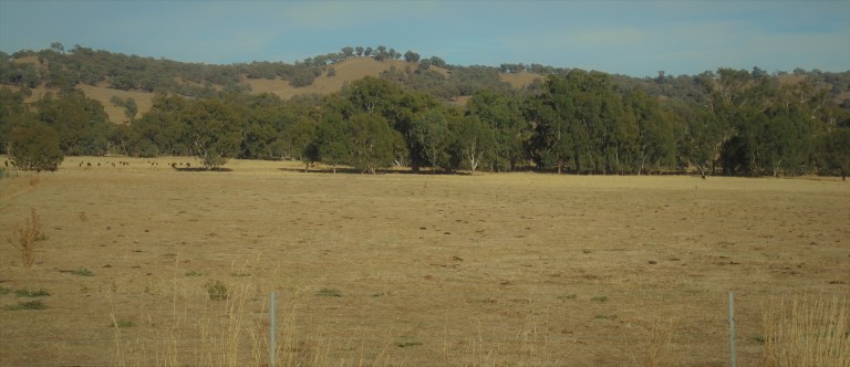
We ride into rolling hills along those amazing tree-lined roads. It’s the end of summer and the grasses are golden. The pale green of the eucalypt leaves complement those pale grasses. The only brightness in the landscape is the sky – the deep blue of a humidity-free high centred overhead. There’s no smoke hanging in the air this morning.

We roll up and down the hills. We have not a care in the world. The weather should be good for the duration of the ride. We have everything we need. We could plop down anywhere if we had to. I am happy and relaxed and just spinning away the kays.

There is very little traffic. There is a long line of shiny SUVs going the other way at one point. There must be 12-15 of them. I meet them as I’m flying down a hill – standing on the pedals. I think at first it must be a funeral. But then I realize it must be a church group. Everyone is very conservatively and nicely dressed. Inevitably, a male is driving and the female in the passenger seat frowns at me. Heathen! After the first throng, I’ll see six or seven more similar vehicles with similar occupants frowning at me for the next 45 or so minutes.
One of the things I love about Australia is the space. I think it is one of the hardest things for Europeans and East Coast Americans to get their head around. Even here, in these tightly bunched hills, everything is BIG. The sky, the roll of the earth, the size of the paddocks, the views from the hilltops and the overhanging trees in the road reserves all reflect an immense scale. I love riding through it and feeling so tiny and insignificant.


A quarter of the way through the day, we roll into Ladysmith. There is not much to Ladysmith. There’s a general store (closed today), a Memorial Hall and a park. There’s also a feedlot and some homes. There are a few people about today for a running and cycling event – but for us, it’s just a place to top up water. This is the last ‘town’ of any sort that we’ll see for the next 150 kms of our route.
We roll back out into the hills to find one of the new roads that’s laughed at me from the map for a long, long time – Livingstone Gully Road. Not far into it, I see an oncoming vehicle throwing up lots of dust as it comes toward us across the wide valley. They slow up. I think they are being kind about the dust. The driver stops. Window rolls down. The occupants are nicely dressed. They must be going to church. The man asks, with a frown, “Do you know where you are and where you are going”? That must mean I’m heading in the right direction. I tell him yes. The wife in the passenger seat says, with much worry and condemnation in her voice, “Be careful. There’s snakes. We have lots of brown snakes out here”. I nod and say, “thanks, yeah.” I guess they don’t see many cyclists out here (I see no snakes today – just, sadly, two dead blue tongues and one small, dead goanna).

We head down the gravel through the wide valley. The gravel is in decent shape and was probably regraded in spring (based on how much grass has regrown in the verge). I saw three vehicles there at the start of the road but won’t see anymore for the next 15 kms. We meet up with the tall trees and long grass of O’Briens Creek for a couple kilometres, then it’s just straight on across the long, flat valley with views to the surrounding hills. The predicted headwind picks up, but not until I’m almost all the way across the flats. Once I’m back into the hills, it’s not too much of a hindrance, and it actually keeps the few remaining nuisance flies away.


We re-enter the hills and have some climbing on rough gravel to do. In these 15 kms, we’ll see two cars. I am loving these very low-traffic, scenic, rural roads. It may be Easter long weekend, but this, right here, is heathen heaven.


I enjoy the long climbs and the views over Pinnacle Creek – a deeply incised tributary cutting a path through the rock. There are granite tors in all sorts of rounded and interesting shapes. I really wasn’t expecting anything this scenic or a road that would get us so high in the landscape. Good, good stuff.


Once we are to the top of the saddle, and just before we drop down to the creek at Pulletop, I yank out the phone and have a look at google maps. We are nearing my fatigue threshold and I need to figure out a place to camp for the night. It’s only 1pm, but I need to be done soon. I am trying really, really hard not to overdo things – and an 80km day in the hills with a light load is probably way more than enough. The weird tingly muscle stuff I get when the fatigue starts in has made its presence known.
I know there is a community hall and tennis courts at Burrandana a bit further up the road we’re heading toward. But I also know that there is a nature reserve nearby. I’ve ridden past both turn-offs on previous rides. They seem to be a similar distance from where I will join the main road. So I make sure that the turn-off to the nature reserve actually leads all the way there by looking at satellite view.

Then it’s down off the saddle at speed – flinging ourselves back into the depths of the landscape from the hilltops. The gravel is good and bad, and it’s all about picking the best line and leaving the grip on the bars fairly loose and using my legs as shock absorbers. We rattle Verne and Kermit to no end.
Down at the creek I happen to look over and see the old Pulletop rail platform. There was a train line that ran out to Westby from the Main Sydney-Melbourne line from 1917 to 1952. There is no trace of the tracks or line anymore, but some of the platforms and a couple station buildings have survived. Interestingly, it was railway workers burning off along the line that started a major bushfire in 1952. The fire burned more than 4,000 sleepers and the line never re-opened. That major blaze burnt out nearly all of the area we’ll be riding through the rest of today and tomorrow. The fire went all the way to Tintaldra and killed 10 people.


At the Cookardinia Road, I stop for a break in the shade of the trees. It’s a gorgeous day. There are no clouds and no people about. In the 20 minutes that I snack on popcorn and rice crackers, not a single car goes by. The only movement in the landscape are the swaying branches, bending grasses and the flight of insects.
I eventually get myself back out there and ride five kilometres up some terrible gravel to the reserve turn-off. Luckily, most of the time, there is an okay strip down the very edge as we ride up a wide tributary valley of Burkes Creek.
There is no sign for the nature reserve turn-off. They don’t ever advertise these. And so we find ourselves riding across another farmer’s paddock on an access track. The gate to the reserve is triple-padlocked. This is not a problem for a touring cyclist though. It does mean we won’t have to deal with any motorized riff raff and should have a very quiet night.


I’m disappointed by the reserve. It has been so flogged, it’s incredibly sad. I ride up the main track which is a very wide firebreak. I look down the two track options where it branches. They are also wide firebreaks. I don’t think there will be any better or more diverse bush up these, so I head back to an open area I saw on the way up.

I hang in the shade for awhile. Then I go for a wander among the regrowth. There is old rubbish – cans, bottles, timber-cutter equipment, etc. all over the place. I know this would have been all burnt out in 1952, and maybe subsequently, but that doesn’t explain why there are no trees over 18 inches in diameter. The humans have cut and cut and cut. It’s disgusting to me. I do see one stump with a diameter of at least 4.5 feet (!), so I know there would have been magnificent forest here before the Europeans came. If it hadn’t all been logged, there would be more diversity in the age of the stands, and there would be something bigger than 18 inches in diameter. Ugh. All I can think about is what a grotty and greedy species humans are with no concern for long-term futures.


It makes me think of the Midnight Oil song “River Runs Red” (in the video below… long instrumental to start before the lyrics start at 1.25).
I also love Peter Garrett’s t-shirt in this video – it sums things up perfectly for me in these tumultuous times: To sin by silence, when we should protest, makes cowards out of men. It’s from a poem by Ella Wheeler Wilcox.
RIVER RUNS RED
So you cut all the tall trees down, you poisoned the sky and the sea
You’ve taken what’s good from the ground
But you’ve left precious little for me
You remember the flood and the fall, we remember the light on the hill
There should be enough for us all, but the dollar is driving us still
River runs red, black rain falls, dust in my hand
River runs red, black rain falls, on my bleeding land
So we came and we conquered and found
Riches of commons and kings
Who strangled and wrestled the ground
But they never put back anything
Now I’m trapped like a dog in a cage
Wherever the truth is pursued
It must be the curse of the age
What’s taken is never renewed
I settle in for the night. It is quiet – except for some feral boar grunting and groaning in the distance for awhile. It’s a tough time to be a greenie, or anyone with progressive views and compassion for others outside of immediate friends and family. Will I live long enough to see the swing back to decency?

DAY 2
It’s cool. It’s crisp. The days still get pretty hot, but the nights are great for sleeping. It’s autumn in my part of Oz. The sun angle and the temperature are at odds. It should not be this warm at this sun angle. The leaves on the exotic deciduous trees should be turning, now that the sun is past equinox. It’s amazing how what you knew in the first couple decades of your life colour your instincts for seasonality for the rest of it. Of course, Aussies that have lived here their whole lives tell me it doesn’t feel right either. Here in Southeast Oz, the consensus is that summer lasts an extra month now and starts about a month sooner, too. Don’t worry, though, climate change is not real. If it was, the politicians would act on it. Hahahahahaha.
Back over the gate and back down those 5 kilometres of crap gravel. Then we are pedaling long, gentle hills to grand views at the top. We are completing the one section of this road we’ve not done before. We start in mostly cleared hills with long views up to 15 kms distant. Then we roll though some treed bits and down to the creek. We pass the old Westby train station and follow the meanders of the creek for awhile – deep down in the landscape with tall trees and open understorey. It’s very pleasant and I really like this section of road. We roll and climb and get great views. We see taller hills in the distance, partially clad in regrowth trees.


The pavement goes to crap once we roll into Greater Hume Shire, but we’ll only see two vehicles in 30 kms, so it’s not an issue except for the vibrating of my wrists. The low sun angle on those pale grasses and cropped remnants is soul-pleasing. It is all very gentle on the eye.


I get up to the freeway. And this is where the ride is make-or-break. In the 175 or so kilometres of this ride, there was only one place to get water – at about kilometer 25. However, I knew I would be crossing over a portion of the route on my drive to the start point. In one of those flashes of brilliance that you don’t normally get until AFTER an event, I came upon the idea that I could leave myself a water cache. Yippee – the route became do-able (no way was I lugging 3 days of water along)!
So Thursday evening, I pulled off the freeway and came up to this school bus and mailbox turnaround to leave 4 litres of water. There was plenty of long grass to hide it in. Brilliant! Except that a car pulled into the mailbox area just as I was exiting the grass on Thursday – so I’m not sure if they went to investigate what I’d been doing and found the bottles and removed them or not.

No worries – they are there! And there is no snake curled up somewhere in the grass on my way to retrieve them. I sit there for a bit and have a drink and a snack. I get logistics points for this ride!

Then it’s up the freeway for five kilometres over a couple gentle hills to Little Billabong Creek. I’ve got a much wider shoulder through this bit, and there isn’t much traffic, so it’s easy-peasy. At the road turn-off, there is an old community hall and tennis courts where you could camp if needed. There is even an overhang to provide cover.
The road is in good shape and escorts us across a wide flat valley as we skirt an oddly-shaped hill that stands out from its surrounds. It’s called Sugarloaf Hill. Eventually we meet up with a creek as we round the hill and the road becomes quite scenic off to the left. The wide road reserve with large remnant trees, the open woodland in the paddock adjacent to the creek, and the big hill behind, all make for a visual delight.

Our road gently starts to head up as we head back into the hills following the creek uphill. The Minimbah Fire roared through here in January 2014 and razed about 8000 hectares of pine and 4000 hectares of state forest and pasture. There is evidence of this all around – weeds in the paddocks, blackened tree bark, razed and piled dead pines and stubble-looking new pines growing on hills in the distance.

The road starts a serious climb to a high saddle. It’s about 29 degrees Celsius today, so it’s a pretty sweaty climb. But traffic is pretty light, too, and the two logging trucks I see are going the other way. So I just spin on up – starting to reach my fatigue threshold. It’s pretty steep in bits, but I’m enjoying the native forest and the deep gully on the left. I’m intrigued by where the fire went and what it skipped. I’m amazed at how much bare ground (formerly and future pine plantation) still exists four years on.


We get great views from the top before we dive back down to the Tumbarumba Road. This one can be a bit busy, so I’m happy to only meet about seven cars in the four kilometres I’m on it for today. I only hold up one vehicle on a downhill – and even then it was for well less than a minute. There is no way to get around a flying cyclist one-third of the way into the lane when there is oncoming traffic.
The climb to Gentle Annie Saddle is a grunting, sweating couple of kilometres. We make it, but we definitely know it is time to call it a day. So once I find a dirt track leading into the State Forest, I head down that. This area all burnt pretty hot and it’s very scrubby and blackened even now (it lies downwind of massive areas of pine plantation which would have generated intense heat before burning through here – reports were of flames 38 metres (!) high when it came out of the forest onto private land. Five homes were lost).

I have a bit of a wander – but once the track starts to head downhill, I stop. No thank you. I’m not climbing back up that. So I find an open area with some shade (hard to find when so much is burnt) from regrowth Blakely’s Red Gum and spend the afternoon enjoying the view of regenerating trees and part of the long Ben Lomond ridge in the distance.
This state forest was proclaimed a timber reserve in the 1800s and a state forest in the early 1900s. “Reserve” is a misnomer. It just meant a place where you can cut down all the big trees but leave the little ones (but not on a sustainable scale), instead of totally clear-cutting for agriculture and pasture. Those 1952 fires burnt through the forest, but only small scale burns were done in 2006 and 2008 before the big fire in 2014. Much of this State Forest was given over to pine plantations in the Southeast Regional Forest Agreements of the 1990s. Native forest really lost out in those agreements – the details are pretty shameful if you take the time to read them.
And so we hang out in another very flogged forest for the afternoon. There is so much evidence of illegal firewood ‘collection’ – they are actually cutting down trees, not just collecting dead wood on the forest floor. Ugh. I hope karma gets all those redneck bastards.

The stars aren’t too much of a show tonight – the moon is too bright. As I crawl out of the tent for my night-time entertainment, I note Orion high in the sky to the north. To the south, pretty high in the sky, is the Southern Cross. And here I am in some native Australian forest mixed in with pine forest. If you could ever set a scene for a dual citizen from North America, this would be it.
Whenever I smell pine, I’m immediately in America hiking down a trail in the Colorado mountains in my 20s. Whenever I’m amongst the eucalypts, I’m in Australia on a million different backroads in my 30s. Whenever I see Orion, I think of my Dad. It’s one of less than 15 constellations visible in both Northern and Southern Hemispheres. So it’s one we ‘share’. He has a relationship with Orion from spotting it in the early mornings before going to work. So I always think of him when I see it and feel connected to him even though we are very far apart. And the Southern Cross – well, that’s been my night-time camping companion for 20 years.

Tonight, the stars are not the show. But the bats are. With that level of moonlight, I delight in watching them flying all over the sky above me – weaving and dodging and squeaking as they scoop up all the mozzies and insects in their flight paths. Good on you, bats – thanks for the show.
DAY 3
Daylight saving ended some hours ago. But the sun still rises at the same time and gives a good pink sunrise as I pack up. We’re on the road at 7.15 or 6.15 am – take your pick. The Aussies have a much harder time remembering what to do with their clocks – since they don’t have ‘fall’, they don’t really relate to “fall back”. “Autumn back” just doesn’t do it.
We have a long, chilly downhill for two kilometres to Murraguldrie Creek. They’ve replanted a lot of the pine off to the left and sections of forest off to the right escaped the intensity of the fire compared to where we camped last night. It’s all logged and flogged, but it’s a bit more attractive. There are plenty of live and dead kangaroos around – it’s quite a stinky ride, even at this chilly temp. I see at least eight go hopping off the road as I go by. It doesn’t look like the most scenic forest ever, but I do think it is somewhere I’d like to come back explore in springtime on a mountain bike. There is always more to add to my bike-it list.


We then take the Eight Mile Road to Humula. This is an original route from settlement days linking Kyeamba and Humula Stations. If you google enough, you’ll find some really interesting history relating to squatters, free selectors and soldier-settlements from the 1840s to 1920s. Humans have always been greedy and willing to take revenge through the court system or less lawful ways. Disagreements between landholders back in those days make neighbourly disputes over barking dogs and overhanging trees seem quite trivial.

The Eight Mile Road is an undulating awful gravel through those tightly bunched hills. After we get past the pine plantation, it is a very pleasant ride. We have a couple short, steep climbs out of creeks, but we definitely have a downhill advantage heading toward Humula. I only get passed by one local in a ute, who patiently waits for me to negotiate my way up an eroded ascent before overtaking with a wave. This is a good ride and one I would do again (but probably never will), even with that crap gravel.


I’ve now ridden through Humula three times. It has a population of 124. There’s an old and disused pub, a citizen’s club, a couple churches, a Memorial Hall, a park, a school, a ‘golf course’, and a fire brigade shed. Yet, I’ve never seen a moving soul. I’ve heard dogs barking – but other than that, Humula has always proved eerily dead. It’s a shame. It’s got a nice setting – it sits on a couple creeks at a narrow point in the Umbango Creek valley. It’s backed by tall hills and has nice remnant trees along the valley floor. Yet, once the sawmill closed in the 1980s, that was the end of it. Now there are just a bunch of extremely poor-looking shacks with not-so-new cars sitting out the front (I assume people are attached to these – I’ve just never seen them).


The future rail trail from Tumbarumba to Rosewood is on the same rail line that passes through Humula. The section between there and here is very scenic. Maybe someday they’ll get that trail down to this town and breathe some life back into it. The anti-rail-trail farmers are very vocal in these parts though, so it will be a fight. Until then, Humula will exist in this state of semi-life.
The road is a gentle downhill for the most part to Umbango. The valley widens out with views to the tree-lined watercourse down below across flat paddocks. The tall ridgelines create scale and the sheep and cattle create the movement. The rail line is on the other side of the valley and hidden from view.
We cross over the creek at Umbango, cross the old rail line and then spend our final twelve kilometres climbing up and coasting down hills as we leave the creek valley down below. It gets extra wide down there as it meets up with Tarcutta Creek. I see two cars in the 30 kilometres heading down the valley this morning. The hills don’t seem so bad, but I’m sure they’d seem longer, steeper and more numerous if you were here in the hot afternoon and being annoyed by two dozen flies on your face.


My little ride is coming to an end. It has worked out perfectly. Two random campsites in two different forests far away from the maddening crowds. I have finished off the unridden roads on that one ‘blank’ section of my map. It won’t tease me anymore. The roads have had little traffic and the weather has been divine (I would prefer highs of 20-22C instead of 28-30C, but that is a trivial complaint). It has truly been a heathen heaven on this important weekend for the Christians. I did see two dead bunnies on the road, but I trust everyone got their chocolates before tragedy struck. It has been a fantastic ride to round out the month – now fingers crossed I escape the ‘post-exertional malaise’. We’ve got more roads to ride!
Weather looked stunning. Every time I have camped and/or toured at Easter (in NSW) it has rained heavily. Obviously I need to come further south…. Nice trip report! Catherine
Thanks, Catherine. Easter usually has warm, dry days here. When Easter falls later in April, the nights can be pretty chilly though. We are only six hours from you, but the weather patterns are very different. We definitely have hot, dry summers and cool, wet winters. March and April usually have warm, sunny days and not too much wind. Our ‘autumn break’ – when it starts to rain more over winter – usually comes around the end of April. It seems like the Anzac Day Dawn Service is often cold and rainy. It feels like such an extra affront, because it is usually the first really ‘wintry’ weather we’ve had. But, yes, Easter is usually quite nice! Em