

26-28 February 2021
120 kms (75 miles)
The thought of a ride is always on my mind.
If I am at work, and the day outside is nice, I consider the wind and which direction you’d hope to be riding if on tour on such a beautiful day. In my mind on those beautiful days, I can see the road flowing forth up a long valley or the views from any of the numerous forest roads in the region.
If the weather is poor, it will remind me of that day I rode 103 miles across the Montana plains in wind, rain and 42 degrees F. Or a couple times on tour waiting out a snow day in my tent in Iowa or Illinois in early spring.
Or I will get random memories from the thousands of rides I’ve done over the past 10 years that pop in my head at any ol’ time. Cycling memories are always there, and regardless of weather or health, I’m always planning the next ride.
So all week I’m thinking about a gentle little weekend ride that I can do from home. The car goes to the mechanic on Friday to get a towbar fitted, so I can mount the bike rack and start taking the mountain bike places. So where to go from Wodonga since we have no internal combustion engine to get us to a ride start?

Eventually we settle on a night by the river and a night in the national park.
DAY 1 – 25 kms
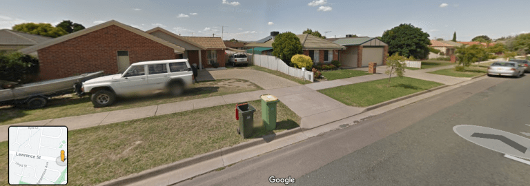
So that is how we find ourselves pedaling across Wodonga on a mix of roads at 2pm on Friday. Wodonga has more than 80 kms of bike paths. There are nice stretches that link up parks and reserves. But they all tend to line up along the creeks, which all run north-south. Finding your way east-west across town is more difficult. But I am comfortable in traffic when the vehicles are driving at city speeds. I’ve never ridden around this town much, but I know the basics of what streets to avoid.

There are plenty of people out and about. This is COVID-normal – you’d never know there was a pandemic engrossing the world – we remain so untouched here in everyday life. For now at least. But all the people going somewhere give me plenty of room on the road.
It’s the panniers. I always get more space when I’ve got a load. I do ride down Brockley Street, since it has a bike lane, but it’s a bike lane in name only. Really, it’s just the extra space in the parking lane for people to open their car doors. They’ve painted an inside line, which most cars’ tyres are sitting on, to make a ‘lane’. But really, I’m just riding the parking lane in direct line of ‘dooring’.

We wander on and I get a tour of the parts of Wodonga I’ve never been before. Wodonga is a bit like Canberra – just endless suburbs of various ages with hidden services here and there.


Finally, we make it out of town and ride along Plunketts Road. This is a frontage road to the freeway and a popular cycling route.

The wind is moderate and directly in our face. But it blows the flies away and the temperature is just perfect. It’s about 24C. The sun has that lower angle autumn feel now which evokes warmth and stability instead of searing heat and frying skin. It’s just been in the last week or so that summer has felt finished. We’ll still get some stinker days, but they won’t be the norm. Summer has turned.
Plunketts Road rolls up and down on the ends of alluvial detritus from the line of hills to our left. A quick recon of google streetview the other night indicated that there was an underpass that would allow us to get from this road over to the Old Barnawatha Road and down to the river. This would mean a bit less time on the Old Barny Road which is busier.
I almost miss the underpass. In my mind it was further along than this. Plus I don’t remember there being a bunch of little trees in that streetview image. But a lot of Oz street view images in rural areas date to 2008, so I suppose this little stand of little trees could be 13-years-old? Maybe there is more than one underpass? If I miss the only one, I’ll have to ride all the way down to the next freeway exit before I can cross, and then I’ll have to ride for a bit on a busy, shoulderless road.
So I decide to go for it. The track down to the underpass is rocky, eroded and loose. I stop close to the entrance when I see a strip of old police tape strewn among the weeds. Oh dear. Then, I see a metre-long brown snake slithering in front of me (I was distracted by the police tape!). Yikes! I wait for him to slither on over toward the police tape for a photo.

Man, that underpass looks long and dark. I roll up to the entrance. Oh dear. It is super gross. There is a pile of toilet paper sitting on top of a pile of human shit. There is all sorts of rubbish and broken glass. I get around all of this. I roll into the narrow darkness.

Oh dear. There is all sorts of rubbish in there. It’s dark. I can’t see much at all. The underpass also has a bit of a downhill slope to it, so we are quickly picking up speed as I try to direct the bike away from all the junk in there. We roll over all sorts of stuff – I’m not sure what a lot of it is, but there are definitely some wooden boards and bits of plastic storage tubs.
I fly along and over all that crap. I’m very afraid I’m going to run over a nail that is going to ruin the tyre. I just hope there is not more human crap among all that junk.
We fly out of the tunnel, just slightly out-of-control, and come to a skidding stop outside the underpass. That was just like Mr Toads Wild Ride at Disney World. The little cloud of skidding dust settles around me. Up closer to the main road is a guy standing next to a car. I roll on down the eroded dirt under the rail-line and toward the guy and the car.
That was THE dodgiest underpass I’ve ever encountered, and the guy next to the car is pretty dodgy, too. As I get closer, he turns away and doesn’t turn back to me. Obviously he doesn’t want to be identified. Drug deal. Illicit sex. Definitely something dodgy going on!
The Old Barnawatha Road heads across the floodplain. There’s a bit of traffic passing every minute or so, but everyone gives me room. As I get closer to the dirt road that I’ll take down to the river, I see the underpass I meant to use. So there are two, and the second one does look much, much better. (If you are riding out of Wodonga, it is right after the LOGIC exit sign on the freeway).
We turn down a series of gravel roads through pasture and red gums. It gives us another three new roads to mark off on the wall map. There’s a tint of green about from two big dumps of rain in January. For the weather bureau to have promised La Nina conditions since last June, it really only felt like La Nina for about three weeks in January. June-December was all below average rainfall and average or above average temps. It did not feel like La Nina at all.

The river reserve is large and has two main gravel loops on different portions of a large river bend. There are open and treed areas, and a herd of skittish cattle grazing the flats. I sit on the roots of a large red gum on the riverbank for a bit. A group of four fishing boats with canopies float by in a noisy parade of partying blokes. Each boat has about four guys and a bunch of camping gear.
As they pass by close to the bank, they say hello and I say hi in return. Then, one guy says, “How are the rope swings today?” I respond, “I think they’ve been cut”, as indeed the rangers have removed all the lower bits and there are just pieces of rope dangling from above.
The guy then says, “So what’s a young lady like you doing all alone out here in the bush.”
Ahem. I did not say what I wanted to say. Most of the guys I hang around are fairly liberal and modern in their attitudes toward women, so I forget that there are so many misogynists around.
I reply, “Same as you guys. Just out enjoying the day.”
He’s not sure what to say for a moment. Then he says, in continued misogynist fashion, “hey, can you do a back flip off there? We’ll come rescue you in the water.” The other guys laugh and smile. One guy gives a thumbs up.
Ahem. I reply, “Nah, too old to do foolish things these days.”
They don’t reply and have mercifully floated far enough away to not have to continue the conversation.

There are more boats going by and more cars driving into the reserve. Not all are coming to camp – some are just coming to swim, fish or jet ski. It’s the closest river access outside of Wodonga on the VIC side of the border. There’s a car coming or going every 10 minutes or so.
That’s a lot of noise and dust, so the guys and I ride back toward the entrance, away from the river. Everyone wants to camp on river frontage, so we’ll be far away from the noisy people, generators and smoke from bogan bonfires way over here.


We find a nice spot near an old river anabranch that is open but shaded. I pull out the tent ground sheet, spread it out between old cow pats and relax the rest of the afternoon away. I gaze at the sky in that perfect autumn weather and don’t think much at all. I nap a bit. And by the time the shade has receded, it feels nice to be in the sun. Goodbye, summer.

DAY 2 – 50 kms
There is the part of me that wants to get up early and get on the road near sunrise. There is also the sick part of me that wants to sleep forever and tries to convince the other side that we don’t really want to ride at all. We just want to stay here and sleep the day away in the shade. This side of me has the advantage that there is no sunrise. Well, nothing quite that earth-shattering, but the day does dawn cloudy, sun-less and cool.
The ‘let’s go ride’ part of my brain wins out. It is the same side of my brain that continues to dream big rides and always thinks we can do more than we really can. But it’s not asking for too many kms today… just some.
I pack the tent. I load the bike. We’re rolling at 7.35 am. Take that sick, lazy brain!

I roll back out to the main sealed road. There is an old road nearby on an original alignment that cuts off at an angle from the Old Barnawatha Road to the new Murray Valley Highway. There is a sign that says “NO THROUGH ROAD”, but I definitely remember from streetview that there is no fence on the other side.

So off we go. It is actually old seal underneath the grass and long weeds. We make good time. Until we come up to a bicycle-swallowing size pothole. Shit! Brake! I pull a foot out of the toe clip and aim for the shallowest bit, totally expecting to fall. But no, we roll in and out in a very quick kerthump. So yeah, maybe you wouldn’t want to take a passenger car down this with all of the overhanging grass and 18-24-inch deep potholes. But you could totally get a 4WD down it. However, it would definitely be quicker in a vehicle to just not use the cut-through. There are several more huge, deep holes, but all can be ridden around, and I am perfectly happy with my decision to go through on the NO THROUGH ROAD.
There is a big new truckstop at the end of the cut-through. I roll in and get a couple gatorades for later. Then we head out past the LOGIC centre which is an industrial development with a TAFE driving school, rail container exchange and a Woolworths Distribution Centre. It’s a fairly recent development with a palm tree-lined entrance. Beyond the distribution centre, the road stays sealed but narrow. The road name is Baxter Whelan. Wonder who he was?

Everyone at the truck stop is also using Baxter Whelan Road – I keep getting passed by the vehicles that were at the truck stop. This must be the cut-through back to the town of Barnawatha.

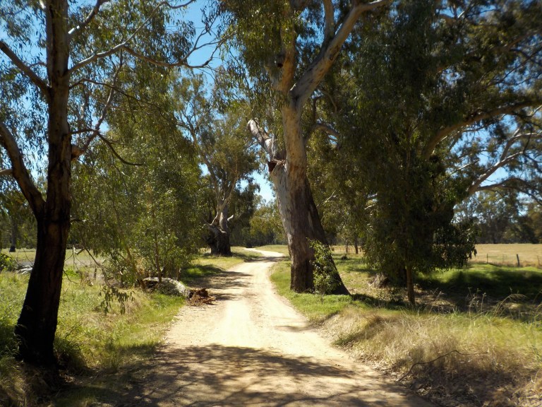
Soon enough I can turn off and roll down a series of gravel roads to town instead. It’s the same scenery and smells of so many roads I’ve ridden in the region. Luckily, the annoying sound of motorbikes accelerating and braking, which was obnoxious at the start of the road, recedes and we return to the rural quiet of mooing cows and grasshoppers jumping through grass.

Barnawatha is a tiny town with a post office/newsagent, petrol station and pub. It’s growing, though, as it is close to Albury/Wodonga and Wangaratta for commuting. I stop to fill up water bottles, as this is the last water source until we get back to Wodonga tomorrow. I also use the toilet.
This is the first time I’ve used a public toilet in almost 365 days. I’ve been avoiding them during the pandemic after a NY Times story on aerosols scared the crap out of me. We’ve had no virus up this way since last April… but for someone with the immense luck of getting two insect-borne diseases and lead exposure in modern day Oz, I’m not taking many chances given my rather dodgy and dysfunctional immune system!


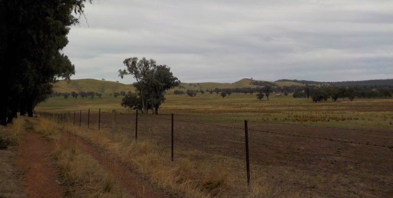
From Barnawatha we pedal up the Indigo Valley. It’s ringed by low hills. To the northeast are the hills that separate this valley from Plunketts Road and Wodonga. To the southwest are the hills that separate this valley from the Black Dog Creek valley. That row of hills and much of the valley floor burnt just a few days after we rode up this in 2015.
Today there is a tint of green in some places from the January rain, and many dams are close to full which is really uncommon for this time of year. Still, it makes the landscape feel more humane and as if we will escape the ravages of climate change for many years to come (we won’t; we’re already experiencing its impacts).


I’m going to pick up a couple new roads to get over to the national park. We first head up the DRY WEATHER ONLY (read: dirt, unformed two-track) Ironbark Road. It is aptly named – the Ironbark trees are scattered about through the road reserve. This area was impacted by the fires in 2015. However, the black scarring on the trees makes the fire look like it came from the direction of the road – which is the opposite direction as the main fire would have been. Just over the hill is the primary school for the valley, so I wonder if this was burnt in a backburn to protect the school from the main fire front.


It’s slow-going but pleasant, and there are certainly no vehicles. I’m constantly running over twigs and small branches – this is definitely the road to visit to find kindling – there are little sticks everywhere!


We then roll on over to Masons Gap Road and spin our way up. There is one quite steep bit, but most is very manageable. The biggest issue is keeping left with all the traffic passing, without getting into soft stuff that could cause a crash. In 4 kms, I’ll see 7 vehicles – this is the road everyone must use to go into Chiltern or out to the freeway to head toward Wangaratta. Less than half of the cars are polite and slow down so they don’t shower me in rocks and dust. I do acknowledge the nice people with a wave.

We find a very quiet and pleasant spot for lunch. The sun is trying to come out now around 11am, but it won’t finally burn through the clouds until around 4pm. No complaints from me – it keeps the temperature and sun exposure down.

Aaaaaahhhhhh…. how pleasant. This is why I ride – teeny little tree-lined roads with no traffic out in a valley surrounded by hills and quiet spots to rest and snack. I could ride roads like this endlessly. I like Greg’s view-blockers and the shade they provide.

We then roll on over to the national park and pick up two unridden roads on the park boundary.

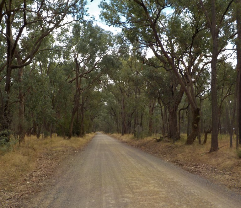
There are numerous fallen trees to clamber around, but the riding is gentle and easy. The forest is quiet. The motorbikes, which are usually numerous and noisy on the weekends, are strangely absent.

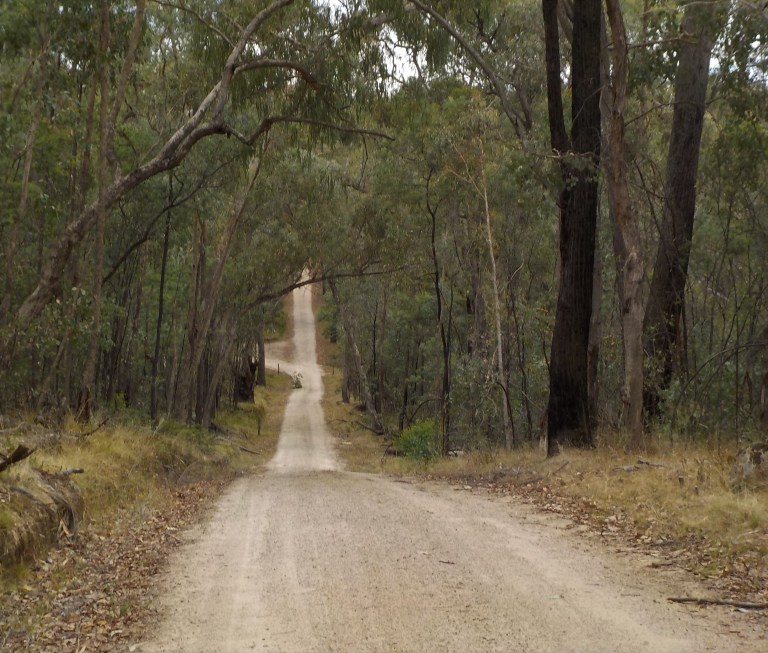
We roll through the forest with the sound of sticks pinging off bike parts and serenaded on occasion by melodious bird call. We gently climb with a small drainage off to the left until we are near the base of the large granite outcrop of Mt Pilot.

And then it is on through the forest on roads we’ve ridden before. We ride UP McGuinness Road, one of our favourite roads to fling down at high speed. The granite base here makes the road ride fast and smooth – though this road, and all the others I ride, have more erosion than the last time I was through and plenty of sand traps where the grade lessens for a bit here and there.


The sun stays hidden and a few times it is dark enough that it seems like it could rain. There’s no smell of rain though – just dust and the astringent scent of eucalypt.
We ride the rollers of Old Coach Road. I’m gaining elevation going this way, so the ups are steeper or longer than the downs, but I enjoy the spin and coast cycle as we work our way up and down. I only see four vehicles today, so it’s a quiet, moody day in the forest. My body is doing an amazing job today – I could not be happier with its performance.
We end the day on a spur of the main ridge between two drainages. I set up the tent so I can get away from the flies. It’s almost March and the March flies (you may call them deer flies or horse flies) are right on time. The bites raise huge welts and are intensely itchy, so I climb in the tent to relax out of reach of their little jaws. (The doc and I are pretty sure, based on symptom development, that it was a biting fly that gave me bartonella – normally it’s associated with ticks but has been known to have many vectors, including flies).


From this spot, I can look across the tight, narrow valley to the cliffs in the forest on the other side. The ridge over there is part of a reference area – which means there are no vehicle tracks and they let nature do its thing. It was severely burnt in the fire in 2015. The ridgetop is a long line of burnt trees that look like fuzzy sticks, as if a painter had a shaky hand when illustrating that landscape.

I enjoy the peace and quiet. I am pleased with my body. We climbed higher than 500 metres several times today and have probably done about 500 metres of climbing in total. That’s very satisfactory for now.
I listen to the kangaroos thumping past, stopping and tentatively advancing once they see the tent, then continuing on with large hops. It is warm and sticky, and I move the tent with the shade until the sun drops behind the ridge and another day orbiting the sun concludes. I never see anyone pass on the track – I’m so grateful to be this close to a major population centre and have this whole part of the park to myself tonight.
Days like today give me hope that I can get better and that I can kinda start thinking about 1-week sorties leading up to a long tour once I finish my job. These warm autumn days when the weather is perfect make you plan all sorts of things. You think about touring with a budget that reflects camping every day since it’s a joy to be outside. Really, the best time to plan and think about touring is on cold, rainy days. I think it makes for much more realistic ideas!
The kookaburras cackle away the end of day. Last light recedes as they chortle back and forth across the valley. And then it is dark. And I sleep.
Day 3 – 46 kms
It is late in the daylight savings season – only a month left of evening light. That also means the sun is late to rise. This makes it a little easier to get up with the sun for those of us who must pry ourselves out of the sleeping bag at any time before 8.30. I used to do this easily – I cannot tell you how many days in Wyoming I got up at 4.45am to try to beat the wind. With the fatigue and all the other crap now, it is hard to scrape myself out of bed at all on some days, and there are no days that getting up with an alarm are easy.
But I’m keen to get going today, so I’m pried out of bed, out of the tent and on the bike at 7.10am. I roll out of the park. The track goes around a spur and then cuts down through a gully with a bit of a long S-turn before a long straight downhill to the park edge.

A motorbike rider didn’t make the final turn back at the beginning of August and the decayed, shriveled tribute flowers, a couple bits of plastic, and the riders’ boots are all that remains of a life extinguished. How tough yet fragile we are as humans.

The long straight has plenty of sand traps, so I often ride up on the middle of the road out of the tyre tracks. It’s a bit rougher but still pretty walloping fast.

The road through the valley is painfully corrugated. It’s early enough I can ride all over the place trying to find the best line. I leave a very indecisive-looking and squiggly path that runs from side to side of the road.
The moon is huge and soon to set. I’ve appreciated it on this trip since I forgot my torch. See ya later, moon.

On through the corrugations and then onto a new road. We climb initially – out of the Black Dog Creek valley and back into the Indigo Creek Valley. There are views down the ridge to outcrops of boulders illuminated in the morning sun and across the valleys so weirdly green for this time of year.

The downhill is in rough shape and I vibrate and thunk my way down the hill. Poor Verne’s neck must get so sore on roads like this one. No wonder I saw so many cars over on Masons Gap Road yesterday. It’s the next road down the ridge and was in good shape. This one is crap – and I am very happy to see its end.

I can almost see my breath. It’s cool and quiet. The sun is low and blinding. There’s a whiff of mist still about, giving the morning a soft feel instead of stringent clarity.
Originally, I had thought about taking the gravel Spring Gully Road over the ridge into Wodonga. But after the really rough roads and the need to not overdo my legs and energy for the week ahead, I decide to ride around the ridge on the sealed frontage road. It might not be quicker, but it will definitely be easier.
So we cruise back down the Indigo valley and then make our way around and back into Wodonga. There’s little traffic out and the headwind (timed it well to get it going west on Fri and east on Sunday) isn’t terrible too often.

I just churn it out. I like this sort of riding on occasion. It’s the kind where you can concentrate on pedal stroke and the feel of your legs pumping up and down. There’s no traffic or road conditions to distract concentration, so you can just feel one with the bike, as if you, the engine, are just another component propelling movement.


Once into Wodonga, I try out some new roads. I don’t have a map or phone or GPS – I just wing it. I ride south for a bit, then east, not really caring exactly where I’ll end up. Eventually I will see something I recognize and can then recalculate the route home. This takes us through more neighbourhoods, past a church with a parking warden who sorta scowls at me when I wave, down a couple somewhat busy roads that thankfully have some space on the road I can occupy, and through a few roundabouts. I see bike paths going various places, but I’m never in a place I can get to them.
Still, I’ve always enjoyed the thrill of riding in traffic in a town of up to 100,000 people. I like reading traffic, lanes, obstacles and when to merge. It’s fun when you don’t know it all by heart. So I’m pushing hard and working my way through town. I do pass by some really nice parkland and will come back and show you these parks and paths sometime when every man, woman and their dog (literally) are not out for their Sunday morning stroll.
It was definitely not the most direct route home, but I got to see some more of Wodonga and put all the street names together with the mental map I’m building in my head. I love nothing better than knowing the landscape where I live and how all the dots connect. In the country, I love knowing what the other end of the road looks like, and what hills are in its view, when I roll past a crossroads. In the city, I love having a mental map of the town layout and knowing the different ways to get different places.
Of course, most of all, I just love being on the bike. I cannot imagine how difficult the last 3.5 years would have been had I not had something to want to recover for, something to drive me forward to do yet another medical test or try yet another new medication. I have been down a lot of dead ends (as if google maps bike function had plotted the medical path on roads long since subsumed by farmland or housing).
I’ve always been fortunate to have good mental health, and beyond a fortunate genetic makeup full of resilience, I’m sure the bike has been a big part of being able to ride out all the bumpy bits I’ve encountered along the way in life. How fortunate it is to be a cyclist and to have that identity when everything else has fallen to bits or been rearranged in ways one could never imagine. Regardless of illness, pandemic or work crap etc., I am a cyclist. And I ride.
So much of what you’ve written here rings true for me too: Almost everything makes me think of bike tours and day rides from the past and in the future. Laughing at what some towns call “bike lanes” which, I suppose, are better than nothing. If I had to choose between a riding over a nail or a pile of human shit, I’d take my chances on the nail. I would not confront a brown snake, but then, ALL snakes are as scary as a brown snake to me. But a sign saying “No Through Road” means almost nothing to me if I really want to go there. Bad horsefly encounters? Oh yes!
Thanks for mentioning my view-blocker opinion, but I would most certainly back off my dislike of view-blocking trees if we had things like those river red gums. VERY cool.
-Greg
I’m glad you could relate to the ride – it’s always nice to know my thoughts and experiences resonate with at least one other person. My next post has a very different attitude toward view-blockers…..
“Plan your trips on rainy days.” lol. I’ll do that next time. Maybe I won’t over schedule myself like I always do.
LOL, yes the possibilities seem endless on gorgeous days 🙂