

10 – 16 December 2022
289 kms (180 miles)
Total trip kms: 2933 kms (1822 miles)
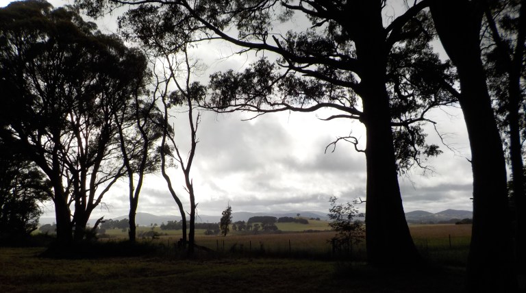
It is in the silence of the forest, when I can hear my heart beating and the quiet rasp of my lungs breathing, that I feel most complete. It is where I feel tiny but whole, finite but completely connected. It is among the trees that my thoughts branch out like an old growth eucalypt, scarred and knobby from time and experience but with fresh growth reaching for new heights. The consumerist world recedes and life becomes focused on the immediate here and now. The world expands to show me my tiny place within it but also recedes to the basics of movement, food, water and shelter. This is where I want to be. Always.
And so we’re heading east today, out of the built-up areas and agriculture to end our last couple weeks of Part 1 with a fair amount of time in the forest.
10 December 2022 – Castlemaine to Rushworth State Forest – Taungurung Country – 123 kms
It is still dark and the kookaburras haven’t even thought yet to chortle when we start packing up. It’s cold again and there’s been a heavy dew. The gardening gloves are needed yet again. What month is this?
There is no wind at first light as we ride the residential streets of Castlemaine past old cottages that have been fixed up to varying degrees. The aim is to get to our northernmost point in the ride today before the winds are forecast to pick up.
So it’s a long slow climb out of Castlemaine through the old buildings strung out in various mining townships that have since expanded into each other. There is mountainous forest off to the left where the Goldfields Track runs. I’m not taking a chance on it today, though, as I want to put in some kays and get over to another state forest area near Heathcote. The Castlemaine Diggings area could certainly use some more exploration though in the future, perhaps by car and foot more than by bike?
We turn off on Golden Point Road where a large grassy field along a creek set beneath the tall mountain is labelled as the “Monster Meeting Site”. The gold discovered along Forest Creek diggings became the world’s richest ever shallow alluvial goldfield. There was a huge rush of gold-seekers to the area. On the 15th of December 1851, 15,000 gold-seekers gathered here to protest a proposed gold license fee increase. This predated the Red Ribbon Rebellion in Bendigo (1853) and the Eureka Stockade in Ballarat (1854).
Today it is quiet and peaceful as the first rays of sun poke through low points in the hills to the east. We climb slowly through more lifestyle blocks tucked down in this tight valley which drops steeply to the creek.

The road winds through the forested hills before climbing to open paddocks where we emerge on the old highway. Then it’s on through some more steep rolling hills below the southern slopes of Mt Alexander. Our climbing legs are awake for sure now!
At the Mt Alexander turn-off (you can ride to the top), we get a long downhill before more rolling hills among the lifestyle blocks and the occasional vineyard. There’s plenty of traffic out already, so I’m glad I got a super-early start.

More hills – forested and cleared – and lifestyle blocks escort us north as Bendigo’s reach ever expands. I see several groups of cyclists out for their morning rides. They’ll be home and having coffee and morning tea when I’m only about ⅓ of the way through my day!


We pick up the O’Keefe Rail Trail at Longlea, just as I’m starting to get really irritated with the traffic. It takes off through the paddocks and delivers us to Axedale. The trail diverts from the rail line here to bypass the old trestle bridge over the Campaspe River. They’ve now got a bit of a convoluted path through town, along the river, over a pedestrian bridge, along the old highway and then up along the new highway before you eventually reunite with the old route again.


You can read more about the history of this line and see some photos of what remains of the missing bridge here: https://bendigokilmorerailtrail.com/history-resources/quick-history/
Axedale has a pub, general store/petrol station, public toilets, water refill station, bike repair stand, and a shady park. It also has a whole lot of crappy new homes set tightly together as people look to escape Bendigo. I stop for a 40-minute gut break and read all the interpretive history signs while I eat a banana.

Axedale saw huge flooding from releases from Lake Eppalock upstream back in mid-October. There is evidence of how high and strong the water was along the river. It is just mind-blowing. See some pictures of the flooding here: https://www.abc.net.au/news/2022-10-14/floods-in-axedale/14084636 and its aftermath here:
The pedestrian bridge is closed, as the gravel has washed out around abutment. Maybe it hasn’t been deemed structurally safe either – the water flowed well over it for at least 24 hours. This means you have to get out on the main highway. That’s okay though – the speed limit has been dropped to 40 kph, as they haven’t resealed some of the damaged sections yet. The floods completely lifted the pavement and stripped away the base in several spots.

The rail trail eventually rejoins its original route through a state forest which is a pleasant, shaded section. It then closely parallels the highway through open paddocks before crossing the far end of Lake Eppalock. There is then a bit more riding through scarred forest to Heathcote.

I meet an older, Melbourne couple up for the weekend to ride bits of the rail trail. The husband is on a new bike with pretty skinny tyres and is finding it challenging. As I get close to Heathcote, I can see why. They’ve freshly graded 2-3 kms of the track, and it is very soft and sandy riding. It’s a slow-go and I can see where the guy skidded out in the soft stuff a few times.
All in all, it’s an okay trail, but nothing special. Keeps you off the highway though.
Heathcote has one long main street along the highway. It’s very busy at lunchtime on a Saturday. I think it’s like Beaufort – it’s the spot where all the Melbourne people stop to pee and eat lunch on their way out of the city.
I get way-laid for conversations by the standard four or five people and then find a shady spot at the footy oval to plan out how I’m going to tackle the forest ahead. It’s 1pm, and the wind has subsided as forecast. It doesn’t get dark until well after 8pm. So I take a two-hour gut break, have a nap, eat some food and then start off into the forest.

I expect a climb to a ridge, but really, all of the climbing is right at the start as you leave town through open forest. You’ve got to climb around the end of the McIvor Range before turning off on the gravel Plantation Road. There is a camping area a few kms up this road, but I avoid camping areas generally, and most definitely on weekends. Besides, it’s just on 3pm, so we’ve got plenty of time to cover more ground.


For as busy as Heathcote was, it is very, very quiet out in the forest. I pass one couple going the other way on skinny tyre gravel bikes. That tells me the road stays in good condition, for awhile at least. Then, an hour or so later, I see a guy on a motorbike at the top of a long, gentle climb to “The Crossroads”.
Ahhhhh….. this is my favourite type of riding. I’m just cruising up and down gentle hills in open forest. To the right is national park. To the left is state forest. I really can’t see any difference in management or forest health though. It’s all just regenerating forest that has been flogged for a long time. However, it does look much better than any of the forest around Maryborough, Dunolly and Kingower we rode through last week.
The day wears on and we keep pedalling. It’s a long skinny forest trending southwest-northeast, and I think we should go a decent distance into it so that we have less we have to ride into a predicted headwind tomorrow.
And besides, I’m really enjoying myself and feeling just fine. It’s warm and my nose is not running with wind and cold. The road conditions are pretty good. It’s quiet. The birds are hiding from the heat. The sun’s late afternoon angle creates a golden light among all the vibrant green of new leaf growth in the trees. There’s no wind – I just slip through a landscape that seems momentarily suspended in time and movement. It’s incredibly peaceful riding, and I feel like I could just keep going and going with conditions like these.

Eventually, I tell myself after 120 kms we’ll start looking for a place to set up the tent. I don’t have a lot of detail on my map, and I’ve never really known where we were after “The Crossroads” intersection which helpfully had a sign telling me it was the crossroads but no signs telling me which roads were crossing there! I know we are on Scrubby Road, now, but just where we are along it, I’m not quite certain.
At km 123, I see a nice big clearing just a bit off the track. Surprisingly, there are no fire rings here, but a big open area in the forest is just fine for me. Fortuitously, I put the rain fly on the tent before I crawl in to read. There are light showers on and off through the night – they must be little cloud bands forming ahead of the trough. I am not sure though – I don’t have phone reception to check. And that is a very nice thing.
11 December 2022 – Rushworth State Forest to Euroa – Taungurung Country – 78 kms
We spin on through the forest. There is a picnic area with really nice and new infrastructure and some people camping. They’ve just started to stir; their campfire is smoky and low. I have really started to wonder on this trip how the state forests seem to have a lot of new infrastructure, but the sites managed by Parks VIC all seem to be rundown.

I get up to a more major gravel road that runs to Rushworth. I take a gamble on a small track signed as “Cemetery Track” since it goes east and that is the direction I want to go. It climbs through some scraggly forest into the Whroo Historic Area. The cemetery itself is in an open clearing within the forest. It’s quiet and peaceful. It probably wasn’t when the 400 or so people were buried here, but it is not a bad place to spend forever, at least not at this point. Whroo once had 15,000 people during the height of the gold rush here. There’s an old mine you can look at further up the road, but I don’t subject myself to that.


This road eventually comes out at a camping area. This one looks pretty nice – there’s individual campsites spaced throughout the forest, and some open sites that would be nice when the temp has you seeking sun. I think it would be more crowded here, but there’s no phone reception, and so many people have to always be connected these days that maybe it keeps the numbers down.
At this intersection, there’s a road sign for the Whroo-Murchison Road, which is what we want. But the road sign is placed at such an angle that I’m not sure which road it is suggesting is the correct one. The one it seems to indicate is the larger of the two roads, but it just doesn’t seem to be going the right direction. I think that is the road to Graytown which would eventually lead to Nagambie which is a bigger town, and would therefore bring more traffic, than the other road.
I stand there trying to make sense of it. Then I think, “Okay, disregard the road sign. Which way would you go if it was not here? What makes sense? You have a great sense of direction. You’ve found your way through the forest so far. You’ve not yet been lost on this trip. Which road do you intuitively think is right?”
I settle on the smaller road heading east, not the larger road heading south-ish. Eventually we come to another track where there are posts with road names and can confirm we are on the right road.
This road eventually becomes corrugated and sandy when it leaves state forest property. There are a couple utes which pass going the other way. They can’t help but slow down for me because it’s single-lane, and though I do get way over to the very left of my side of the road, I do not stop to let them pass. They don’t stop either, but they do have to slow down. Thank you, even though you didn’t mean it, because it reduces the dust significantly for me when vehicles slow down.
We pop out of the forest, the road becomes sealed, and after so much peaceful riding in the last 18 hours, I am not looking forward to the C-road. But the rail trail gods have been kind. Out there in those flat, open paddocks, there’s a rail trail. It crosses the main road just after I join it. I immediately swerve over to the entry. Who knows where it goes, but it does lead toward town!

It turns out that it only runs for 7 kms out of town and ends where a road crosses a paddock. It’s got sorta thick gravel that would not be fun on skinny tyres. But it takes us into town and keeps us off the busy C-road. It goes through a nice little wetland and over two large canals that are part of the huge Murray-Goulburn irrigation area.


There is not much to Murchison. A few blocks of homes, a school, a couple churches, a closed nursing home that looked like it was pretty new, and a block of buildings on the main street that face the Goulburn River.


It flooded here in October, and when you look at how deeply the river is incised here, it’s hard to imagine it overtopping those banks. But it did. And there’s an old pub on the floodplain on the east side of town that likely would have had water up to the second floor. There are massive areas of pushed-over trees and grass on the eastern side, and there are still heaps of debris (clothes, furniture, logs, grass, etc) strewn over the floodplain over there. Large dumpsters full of rotting household goods still sit outside the homes and businesses over there.
Murchison is a major commercial crossing of the Goulburn River for points south of Shepparton. Plus, it’s a major cut-through to get to Bendigo. So when the bridge was closed during the flooding, it really interrupted the movement of goods (particularly since the other river crossings were still closed, too). There is still a mass weight limit on the bridge, so no b-doubles for now. There’s a traffic guy hanging out by the bridge – maybe he’s there to prevent overweight vehicles from crossing?
I ride over the bridge and slow up a bunch of traffic behind me. Sorry, not sorry. I don’t have any other choice. Luckily, the car just behind me holds back all of the traffic and waits to pass until it is safe and clear. Thank you! Once we get past the floodplain, there is an ample shoulder that goes well beyond the turnoff to the freeway to Shepparton/Melbourne.
The wind is well and truly giving it a go now. It’s a northeasterly, so it’s a substantial quartering headwind when we are heading east and a decent quartering tailwind when we head south. Unfortunately, there’s more east than south to do. The wind is increasing in strength ahead of a cold front whose clouds will chase me all the way into Euroa.
So I fight into the wind most of the time, cruise with it down gravel lanes a bit of the time, and generally make my way southeast. We’re back into my radius of ‘local’ rides. On our way into Euroa, we’ll be on roads we’ve ridden before. The scenery is familiar, we’re almost ‘home’. I know these fields of wheat, barley and canola. I know these tree-lined roads with white and grey box eucalypts. I know these tiny creeks that find their way across a mostly flat landscape. I know those hills in the distance to the east. We are covering old territory now. And we’ll be back to our old habit of finding new roads over the next few days that we haven’t yet ridden, instead of having every road possibility be new as it has been over the past couple months.

The last bit into Euroa on Drysdale Road passes a bunch of free range chicken egg farms. The last time I rode this way in 2019, there were just a couple of very stinky egg farms along here. But, oh my, they’ve expanded. Big time. There are chicken egg farms, and a big compost facility, for almost the length of the road this time. You cannot hold your breath for 6 kms, but I sure tried. Smelly, smelly, smelly.
I book in for two nights at the caravan park. The front coming through this evening is predicted to be followed by heavy winds and more cold and rain tomorrow. I’m heading up into the Strathbogies, and that does not sound like fun riding at 500-800 metres. So we’ll do some bike maintenance and hand-washed laundry tomorrow. The following day is supposed to have a break in the showers in the morning before more rain that afternoon and the following day. There are very strong southerlies forecast for the rest of the week.
The woman in the office at the caravan park can’t believe I’ve been riding in the wettest spring on record. She thinks it’s very courageous and silly at the same time. She thinks I’m made of some really tough stuff. I tell her that, other than those four weeks of trying to avoid hypothermia, the wet has been manageable – it’s just required incredible patience. I also tell her it’s been a good thing in that all the 0 kay days have allowed me to regain 3-5 kgs of weight and that I need that so my base weight is a bit higher for when I head into the high country, as I’m very likely to lose weight on that part of the trip. She laughs and says, “who needs to GAIN weight!?”
So, it’s normally $35 for an unpowered site here. But if you rock up on a bike and take one of their tiny sites, you can have the spot for $27.50. Not bad – the camp kitchen here is nice, the showers and toilets clean, and the setting pleasant. I enjoy it all before the rain sends me into the tent for the evening.

12 December 2022 – Euroa – Taungurung Country – 0 kms
Rain. Followed by showers. Cold. Very windy. We just hang. I get all the bolts on the bike re-tightened. I clean the chain. I handwash my riding shirts and shorts and use the dryer, but it doesn’t dry them fully with $4 of coins, so I snuggle up to a lot of damp clothes tonight so my body heat will help dry them. I also talk to a heap of people (like 5 or so) about the ride. I am sooooooooo tired of talking to people!
13 December 2022 – Euroa to Strathbogie State Forest – Taungurung Country – 44 kms
We’ve ridden this road once before – in 2016 I think. This is the straight shot up into the Strathbogies from Euroa. There are curvier ways to climb up to the plateau that aren’t as steep, and I’ve explored most of those. But today we are just trying to get ourselves up there and to a campsite before the wind gets strong and the next round of rain comes.
There are clear skies to start, but the clouds advance as I climb up in the shadow of the plateau. The southerly swing is an easy grade, it picks up a bit as you do a bit of a switchback up to Kelvin View. Then it gets over 7 percent for a couple kms as the landscape opens up a bit. It is so, so green, and there is water running in rivulets in tiny little watercourses you’d never normally know were there.


Most of the traffic is going the other way to start. It’s everyone heading into town for school or work. But then there are some vehicles, mostly tradies, that pass from behind. Everyone is incredibly polite and gives me plenty of room. Thanks!
We ride up between the big trees that line the roads and look out over tall-grassed paddocks that run away in lumps and depressions to higher ridges in the distance. We pass the road to Strathbogie so we can mark off part of Creek Junction Road we haven’t ridden before.

This road runs east-west, and all the fractures in the granite run north-south, so consequently the east-west runs are the hilly ones. We climb in and out of the little creeks, and then get ready for a bigger drop to Seven Creeks.
Before I do this drop, I stop to put my raincoat back on for warmth, along with my gardening gloves. I built a lot of heat climbing, but I’ve been cold for several kilometres up on the plateau since the temp is in the single digits and the wind has started to strengthen.
Just as I stop, a farmer comes bumping out of the paddock on the other side of the road. He stops his ute and comes over to chat. He is super-interested in the bike and thinks it looks really flash. He loves the gearing and is surprised that bikes come with hydraulic disc brakes these days. He is also impressed that I’ve got bike tools, a tent, sleeping bag, cooking gear and five days of food on-board. He says, “Well, I guess you don’t really need much, and you’d get really good at packing it up over time.” He says the season has been pretty good, but the rains haven’t always come at the right times. He wishes me well and warns me that there is rain coming today.
Further along, near a school camp, there is a woman standing next to a group of teenagers by a paddock. They are looking at the cows. I ride by quietly, proud that I have enough fitness that I’m not gasping and looking like a fool as I pass by on a decent grade up the hill.
The woman eventually turns around, as do the teenagers. She gasps in delight, smiles and applauds. Aww, shucks, thanks. I wave in acknowledgement and keep pedalling, slowly putting distance between them and me.
I love riding the Strathbogies – it’s really fun ups and downs and there’s never much traffic. There are huge old trees lining the road, and it’s scenic with the rolling hills, cleared paddocks and sections of forest. (Just don’t look at all the pine plantations).


We turn onto McCoombes Road among tall trees lining the road beneath Mt Barranhet. The last time I came through here it had just been burnt in a planned burn and was looking pretty singed but is back to looking good again.

The road dives down to a creek, climbs out and then slowly climbs above the creek between the hills. It’s scenic and the road surface, though gravel, would be easy enough to ride on my touring bike. We climb to a high point with views over an open paddock filled with slabs of granite to the higher forested peaks to the east. To the west, the open paddocks lap up onto the open forest covering a low rounded hill.


From here we join the Old Barjarg Road. We fling down to a creek, crawl back out and note how scenic it was with regret that we couldn’t stop to take a picture as we zoomed by gaining momentum for the climb out of the creek.
I then head down through more open forest with tall, slender trees on a recently re-opened track. We then head down a curvy track to a campsite on the upper reaches of Brankeet Creek (if you’ve ridden the rail trail to Mansfield, you’ve passed the mouth of this creek as it empties into the backwaters of Lake Eildon).
Because of the high winds forecast for the next few days, and the rain to come this afternoon and tomorrow, I think it is better to stay in the camping area where there is a larger cleared area. You could still get smashed by a falling tree, but the chances are slightly less. It will be good to have easy access to water, too.
In the afternoon, the low, scuddy clouds clear out a bit, and there are a few minutes of sunshine here and there. An echidna appears and I watch it for a good half hour as it waddles about sucking up ants and insects out of dead wood around the place.

It is quiet and I enjoy just sitting there on the picnic table watching the wildlife and doing nothing. It is good to “just be” and I’ve gotten very good at being able to sit still and clear my mind. I’m still not good at guided meditation, but I can do ‘sitting in silence’ thinking about nothing really well now. And I’m getting so much better with the breathing exercises on this trip. I do them all the time and have been expanding my skills. I can notice a big difference in how calm I can settle myself now just with the different breathing techniques.

The rain comes soon after the sunny breaks. I have somehow timed it well to just get in an early dinner before the rain. So it’s off to the cocoon for breathing exercises, reading and journal writing before an early sleep.
14 – 16 December 2022 – Strathbogie State Forest – Taungurung Country – 44 kms
We just hang on the 14th. Showers come and go all day. Just when you think, “oh, it hasn’t rained in a bit, I should have planned to ride in the afternoon”, another shower comes along and gets the tent all wet again.
Somewhere in the late morning, two guys arrive in a 4WD. They ask me if I’m camping there tonight. They are deer hunters and are going to go off and look for deer but are going to come back here to camp tonight. Greaaat. There are heaps of other places to camp, and I think I’ve laid claim to the place – I’ve set up my tent down one end, my bike is next to a tree between the tent and the picnic table, and I’ve set up a wind shield for my stove on the picnic table using the leftover firewood.
But no, white guys can do whatever they like and are used to it that way. They make a cup of tea while they are talking to me, but don’t offer me any. They share some cookies with each other but not me, too. He does offer to boil the water I just collected in my pot from the creek. But that’s it. For so many people to be so generous on this trip, to take over the campsite and not even offer a cup of tea is pretty shit.
They do come back in the mid-afternoon. No deer. No sign of them. (I told them I hadn’t seen signs of them or heard them on this trip). The driver’s dog, Digger, is a Border Collie. And he sticks to me like glue. When I’m sitting outside, he is sitting right next to me. When I’m in the tent, he is outside leaning into the fly. The driver guy says, “Oh, he really likes you. He must think you need protected.” Well, that’s a first. Usually I attract all the needy guys attracted to my strength. I wouldn’t know what to do with a guy that actually wanted to look after me!
I talk to the two guys about deer hunting a bit, but I think it’s pretty rude that they park their ute right in the middle of my stuff by my bike. They don’t offer a beer or a drink or anything. Camping etiquette says that, unless it’s Christmas or Easter when you are allowed to squeeze in anywhere you can find, you generally go find somewhere else to camp if someone is already at a site. If you do stay, then you offer to share the fire or you offer a drink or something. But these guys don’t do any of that. Never mind, but it does nothing to improve my perception of 4WD guys. My negative experiences with them far outweigh the positive ones, unfortunately.
The next day, after the deer hunters have walked off somewhere to sit in the bush and wait on the elusive deer, I pack up and head back out to the Old Barjarg Road. The goal is to wander around on forest tracks we haven’t ridden before. We also want to go up to one of the highest peaks to a viewpoint. Then, we’ll go camp down near another creek and spend the afternoon checking out how a couple tracks might join which we could use in future rides.
And we do all of that.


We see not a soul. There are tyre tracks on all the tracks we ride, but we see no one. Ahhhhh….. We enjoy all of the huge trees and the sections of forest that have been left alone after thinning some years ago. We enjoy the crisp air that keeps the gardening gloves on all day. We enjoy the fresh, pungent and damp smell of eucalypts and wet earth. We enjoy the sound of snapping sticks and rocks ejected from the tire tread as we zoom down hills. I enjoy the sound of my heartbeat in rhythm with my breath as we slowly climb the hills. I love all of the granite boulders that outcrop among the bracken and the tree bases.


We enjoy the giant messmate stringybarks. There’s so few of the big ones left, but there are a few here and there, and I stop and gaze at their height in awe. I think about how jaw-dropping the forest would have looked prior to the 1830s with the old growth and a range of age classes growing beneath.


I look in dismay at the forest areas that have been clear cut in recent years. Not only did the move from selective logging to clear cutting remove any trace of sustainability to the forest operations, it has just decimated those sections of forest. What makes it particularly galling is that the wood has not been used for anything of high value – it’s all just woodchipped and sent overseas. To add insult to injury, the forest operations are government-owned and never make a profit. The taxpayer has been subsidising the environmental destruction for many years. Yes, I’m paying to destroy the forest!
Luckily, the activists here have managed to stop the logging. I’ve sent donations to the main Save Our Strathbogie Forest group each year, and they were victorious in 2019 in having the logging discontinued here because of the high endangered species populations.
I think about how VIC Forests is a government organisation, and how other government departments like the one I was in get restructured and duties reprioritised all the time. And the public servants don’t get any coddling when that happens. You resign, because the government is clever in how it restructures so they don’t have to give out redundancy payments, or you learn new skills and/or take on a new role.
So basically, all the timber mills and the loggers are public servants since the taxpayer funds them. So the government should just halt the logging and give them new roles as ‘conservation custodians’. Get the loggers to plant trees, do weed and pest control, and build and restore walking tracks. Get them to help in planned burns. And if they don’t want to reskill or take on a new role, well, they can go and find a job in the private plantation industry. Just like any other public servant would do when their department gets restructured or subsumed within another. I would be much happier with my tax dollars doing things to improve the environment rather than destroying it.
I also solve the problem of the admin staff. I think there should be a natural areas pass for all the parks and state forests. For $60 a year, or $100 for a family four, you get access to all the green bits. I’d be willing to pay that if the money was re-invested directly into the parks and forests and progressing First Nations management of Country. NSW already charges national park entry, so VIC could, too. Any charges already in existence for camping, etc would go on top of the Pass. So all the admin people at the timber mills and logging contractors could be redeployed to administer the Pass scheme. Yep, I’m full of great ideas. A little bit black and white but a good starting point though, eh?


The next day in the forest is similar to the first, only there is a bunch more sun. Ahhhh…. It’s still cool though, and the southerlies are still blasting.


I work my way down to the Wild Dogs Track. There is a lookout among the rock outcrops, but it is a little underwhelming. There were better views on the steep, rocky track that dropped us here.


There is a nice open area in the trees at the top of the track. It looks perfect for a dry campsite. I’ve got plenty of water, so we spend the afternoon soaking up the sun. It dries out all of our gear after four days of rain and showers, it charges up the phone and powerbank. And it charges up my energy reserves – a bit depleted after a lot of climbing over the past few days and the frustrations of yet more shit weather.

I had hoped to get down to do the Black Range southwest of Alexandra and the Murrindindi Scenic Reserve. But the southerlies have been blasting at 30-45kph, so I’ve had no desire to ride into that for a couple days to get down there. We’ll just have to save that for later.
Tomorrow we’ll head to Tolmie and further back into our radius of previous rides. I watch another echidna today for a while as I cook lunch. There is plenty of dead wood around, so it’s like a smorgasboard for that lucky creature. It ambles around for quite some time, completely oblivious to me just 5-10 metres away since I’m not making any noise.
The wind dies off with dusk and I watch the stars appear. The stargazing has been a bit limited on this trip, so I spend quite some time watching the satellites and shooting stars. I watch last light fade to the west and the purple skies of dusk turn black. The Milky Way appears, though it’s dotted by remnant clouds.
I enjoy feeling tiny amongst it all and enjoy being back in ‘home’ territory. Really, it’s this mountain forest track riding that I love the best, and I’m really looking forward to riding that almost exclusively in the new year. I’m feeling more confident in my body, my health, my bike and my ability to be self-sufficient for 10 or so days at a time. This is the riding I’ve always dreamed about and I think it is finally going to become a reality. The past 2.5 months have been a good test of my body and a good way to get familiar with my awesome Atlas, but the real fun is yet to come!
Sorry about the blank reply yesterday, I really struggle with my tablet at times. Anyway Mary and I spent a few days in one of the cabins at The Maldon caravan park this time last year and I am surprised that they are still in business. We also had issues with the female who was supposed to answer the phone.
Well, your reply along with Tony’s plus my experience pretty much all says that Maldon is being done a big disservice by the current caravan park operators! I hope you and Mary had a very Happy Christmas and have lots of fun travel plans for the coming new year 🙂
Here in Tassie we have the same problems with clear logging and a Forestry Commission (now renamed) that never made a profit. It also has not been able to get certification as resource neutral entity. The saw mills were closed some time back – with payouts to the owners. Now a mix of plain logs and wood chips pour out of the State and construction wood pours in from elsewhere. I like your ideas to solve this problem.
Good to see you back in the terrain you love.
Yes, VIC Forests can’t get the sustainability certifications anymore either. The Andrews government has promised to end native logging by 2030 but they are going hell-for-leather now to make up for it. There’s currently an injunction (probably why I didn’t see anyone at an active coupe near Tolmie) preventing logging, so things have been idle for a few weeks. It was brought about because they’ve been clearing so much illegally. They are also continuing to clear old growth forests using a loophole that allows them to say that the trees aren’t old growth – even though they are. It’s infuriating to me. Some of your ecosystems would have even less area and would be even more critical to preserve in the face of climate change. There is a tiny sliver of hope in the Fed Gov’s new EPA legislation, but I’m not holding my breath!
Hi Em, Your first paragraph for this section is especially well written and very moving. Mom asked me to copy it for her. i am relieved that you can once again ride and share your experiences with so many people. I read your sections at night when all of the daily distractions are a faint memory. Taking a vacation from myself is rare. I sleep well afterword. Love, Dad