

19 – 25 November 2022
225 kms (140 miles)
Total trip kms: 1949 kms (1211 miles)
Days 43-45 – Beaufort – Waddawarrung Country
I decamp early on Saturday morning, pay my $15 for the night and then go hang out in the Agricultural Society machinery shed for the morning and early afternoon. It’s where they would hold exhibitions and animals and such during their annual show (like a county fair in America).
I share the space with a large rat that scurries along the walls but is thankfully not friendly enough to come say hello. The rain starts around 10am, is heaviest between 11.30 and 1pm, and then breaks to showers for the rest of the day. The wind clangs the metal doors continuously and there are gusts to 70 kph.
I am grateful for the place to be dry until I can check into the motel. It is quite cold again today and being dry and out of the wind is something for which to be grateful. I make up some chicken noodle soup with some veggies which also makes me thankful for the stove so I can have hot meals to warm me up on these innumerable cold days.

They extend the high wind warning through Sunday. The showers come and go. Beaufort gets more than 30mm of rain when the forecast was estimating 7-20mm on Saturday. There is another 7mm on Sunday. I stay holed up at the motel. I get everything dry, get a Ramble post done and get my riding shirts and shorts sink-washed and reverse cycle air conditioner-dried.


Monday is the coldest day I can remember in my time in Oz, even in winter The high reaches only 7C. The wind chill is is minus 7.3 when I wander down to the shops to get some food for the following days at 11am. The wind warning is extended again today. The rain showers come and go in short bursts. I think if you were heading east, you could use those high winds as a tailwind and this day might be bearable. You’d get wet, and it is very cold, but you could fly along. But the only thing east of me is Ballarat and the outer suburbs of Melbourne. No thanks.
So we stay put and plot out where we are going for Tuesday. I am very appreciative of being dry, being warm and having somewhere safe to stay. The caravan park does not flood, and the storms that come aren’t severe. So I suppose I could have weathered it out down there, but that wasn’t a risk I wanted to take. The winds would have been very whippy, and there was no good shelter to hang out in down there. The little tent is fine to hang out in for days, as I found in Cavendish, but the sound of the wind flapping everything about at 70kph for hours would not have been too nice. I can say for sure staying at the caravan park would have been miserable, particularly in that freezing cold wind and rain on Monday. Seven degrees for a high? In Albury, the coldest days in winter will usually at least make it to double digits!
Day 46 – Beaufort to Waterfalls Picnic Area, Pyrenees State Forest – Dja Dja Wurrung Country – 55 kms
Today is a perfect social day. I do not speak to a soul. It is nearly a perfect traffic day. I see about 4 cars and one school bus between Beaufort and Amphitheatre, then one 4WD, one garbage truck and one railway worker truck between Amphitheatre and the turn-off to go around the range. Then, for the rest of the day, there is not a single car.
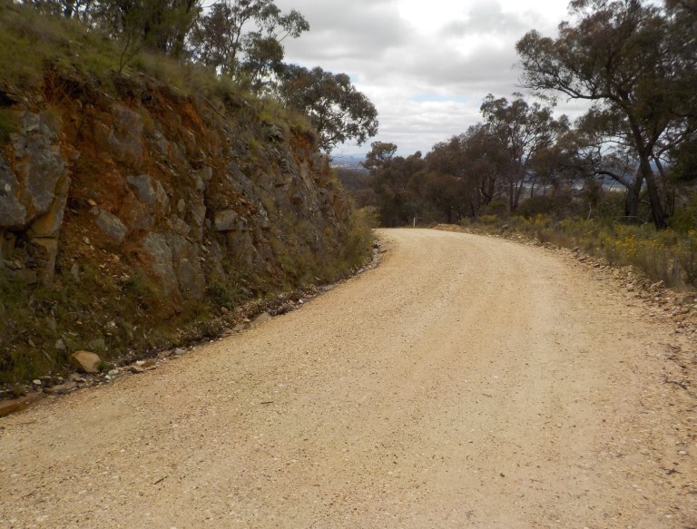
To start the day, we climb back up through the Main Lead valley that we sailed down on our way into town. The wind is supposed to be a very strong westerly, but it has forgot to set the alarm and I sneak my way up to the turn-off to Chute without any hassle.
There are several trees down close to the road from the past couple days, testament to the high winds, sodden ground and shallow root systems of some of the trees. We enjoy the open woodland on hills to the right and lower swampy ground and open paddocks with scattered trees to the left. It is picturesque and very green. What a phenomenal spring.

We climb through hills cloaked in trees on the upper slopes and enivronmentally embarrasingly bare on the lower slopes. We pop over a hill and down into Chute which is nothing but a few tiny old miner cottages and a timber mill. The valley is long and wide with rounded hills surrounding. If you ever wondered where Cyril, the guy who invented Vegemite was born… well, wonder no longer. It was here. And it might have been in one of those ancient cottages being swallowed up by all the grass growth and rambling rose bushes.
We climb gently through state forest from Chute. Water slips down slopes in places you’d never think it would slide. It courses down ephemeral creeks that don’t quite know what to do with all that water except spill it over the sides and down toward the road. Small ponds have formed in depressions and more erosion has occurred since September than in the past five years. Wildflowers grow long and leggy, pushing their spring season into early summer as they dip and sway in the wind that has finally awoken.

You don’t realise quite how much you’ve climbed in that quiet forest on that quiet road until you reach the crest and get a quick, fantastic view of rounded, bald slopes and valleys below that make up the upper reaches of the Avoca River.
There is a sign at the crest that points down a track. Now, my eyesight has gone middle-aged in the past 18 months. Like, it was good one day, and then one day it wasn’t. But I remained in denial for quite a while, finally conceding to reading glasses somewhere around nine months ago.
So my eyesight isn’t what it once was… but could anyone read that sign? As I get closer, I can tell that the letters are absolutely crammed on there with basically no space in between. That’s why it is so hard to read!
But should you ever want to visit a camel sanctuary, it’s down the track from the high point on the road from Beaufort to Amphitheatre. Today, though, I just think… poor camels, they seem like a hot, arid climate sort of animal, and it is anything but that today.
And so we swoop down off that high point and hit 60 kph on the downhill. Yee-ha! I don’t feel I put in enough effort to get that sort of reward. But take what you can get. You have had to put up with a bunch of inclement weather, so here is the payback.
We roll down into Mt Lonarch, a collection of houses and an old sawmilll and hayshed. To our left, peeking through trees, is the range we rode through in the Mt Cole State Forest the other day. Had the weather not gone to crap we would have bypassed Beaufort, and instead ridden up a valley and through some more forest to get to here. But we’ll save that for when we come back to hike those trails one day.

The mist catches us here and turns to drizzle-almost-rain as we pedal through the valley between the tall, rounded hills. It is really quite beautiful, shame about the weather. But you know, let’s see how many days in a row it can precipitate this round.

Amphitheatre sits on a major highway. It has a school, a CFA shed, a cluster of houses, a post office and once had a hotel/general store that is no longer. I think it still operates as a BnB. I head out to the recreation reserve in hopes of water. If I can source it here, I won’t need to head into Avoca later.


There’s a new community centre out there and a cricket oval with very tall grass. They have not started the season yet here – most likely because it’s just too squishy. There is a rainwater tank at the tennis shelter, so I fill up two litres, so that I have three total. There may be water at the campground, but who knows. I pop some treatement tabs in, have a snack and then cross over the main highway onto Richards Lane.

All of the ‘lanes’ and ‘dry weather only’ roads have been pretty unrideable on this trip. But this road isn’t listed as closed, and it links to some other roads that aren’t listed as closed, so I give it a shot. The worst that can happen is that I have to get off and walk the bike. At any signs of stickiness, I’ll hop off and keep the bike from getting bogged. If I can manage this road, it prevents several kays of shoulderless highway riding.
Well… it’s very muddy in spots. It takes off around a knobby hill and into an indent between that hill and some others that have more trees. The road has recently been regraded, so it is very soft. Much of it is very muddy and the tyre tracks through it are already calf-deep in places. But go, Atlas, go. We sink and float and power through the crud.

There are no road signs out here, so I’m just sorta following my nose and trying to look at the topo lines on the map and how that translates to the reality of the road before me. So many of these small roads look like driveways instead of roads, particularly at the moment when there is so much erosion everywhere that it doesn’t look council-maintained.
But we work our way across the valley tucked up beneath the Pyrenees Range to the north as we head east. At one point we have to get on the highway for maybe 500 metres, but then we can duck back onto tiny roads that skirt the main range and undulate on the apron of debris.
I see the last vehicle for the day at the rail line just off the highway, and then it is just me, the bike and dozens of wash-outs and water over the road. (The poor guys are in the pannier yet again because of the intermittent drizzle). I hook together a series of roads and climb and fall through open paddocks and bushland reserves. This is good stuff, it’d be primo if there wasn’t so much picking and choosing of lines needed to get through.


We work our way up Old Number 2 Creek Road with vineyards climbing the slopes of the mountain to our left and scraggly bushland with long grass along a creek to our right. Then we have a long climb up to the Waterfalls Picnic Area with bush on the left and private, cleared property in the valley to the right.


There is no one at the picnic area. It is drizzling again. So I shelter the bike under the toilet block overhang, go over and hide under the info board shelter while I read the history and features of the forest.

The tent goes up on the only bit of flat, high ground that isn’t under trees and has grass. There were once bollards to keep the vehicles off the grass, but the bogans have sawn them off or pulled them out of the ground. Consequently, the vehicles have torn up all the ground all over and there is just a lot of wet dirt around now, which would just be dusty dirt in summer.


We go up to the waterfall. The guys are very, very happy. They demand a float. I tell them if it stops drizzling, we’ll do a float near the campground later. I’m in awe of the amount of water that would have come through whenever the storms came through here. The water would have been flowing at least 12 feet deep at its height. It’s torn out sections of the creek bank, with grasses slumped down onto raw soil and rocks piled at the base. The power of that water is beyond my little brain’s comprehension.


There are a few sunny breaks of 3-5 minutes in the late afternoon and evening. No one comes to camp. We’re far enough away from everyone, and the nearest private property is not occupied today, so it is quiet. So blissfully quiet. No human sounds. Just the sound of intermittent drizzle on the tent, the roar of the wind in the trees high above, the white noise of the creek running below and a few kookaburras at dusk. Bliss. Bliss. Bliss.
Day 47 – Waterfalls Picnic Area to Cameron Track Campground, Pyrenees State Forest – Dja Dja Wurrung Country – 20 kms
It manages not to rain through the night, and I have some hope that I’ll be able to pack up a dry tent. But at 5.40 am, nature comes along with a spritzer and sprays the tent from above. It drizzles and rains off and on until 10.30am. Sigh….
I lie there thinking: When does drizzle become light rain? Is it the size of the droplets on the tent; is it when the fizz sound turns to a heap of individual drops instead; or, is it when the droplets actually start to run down the tent? When do light showers become ‘rain showers’?

We pack up and take off about 11am with wet tent and gear. Having the new low-end tent but still carrying the old MSR fly makes me really appreciate the higher end materials of the old tent. The MSR fly dries so quickly – the heavier North Face fly takes ages. I do like the little tent and wish I could find that simple design with lightweight materials. It just needs to be about two inches taller. But lightweight comes with fancy tent-specific pole designs, etc. Over 25 years of backpacking and cycling, I have concluded that there is no perfect tent. I do have a new lightweight, high-end tent waiting for me in Albury for the high country though.
The sun makes an appearance under partly cloudy skies for about 1.5 hours. It coincides with my climb up the range. So I get super sweaty, the flies cluster on my face, and then when I get up top, the clouds return, the air is chillier higher up and all the sweat make me cold. Of course!


There is a sign at the base of the climb that says there is a grader ahead. Well, I never see it, but I get to suffer through all of its work all the way up. The road is not soft, but it features slippery, big and loose gravel all the way up. It takes a lot of concentration to pick my way through it while also spinning up that monster grade.

We go slow, in granny gear the whole way and just adjusting the amount of effort put into the pedals. Wow – it is tough. There are grades over 12 percent I’m sure and it is pretty much continuous. Combined with the loose gravel with big chunky pieces of quartz, this is one of the harder climbs I’ve done.
Grunt. Grunt. But at least I have the road to myself and can weave along to get the outside apex of every corner. Progress is slow but there are good views out over the valleys and further afield as we go. Four kays into it is a lookout, but really the views are just as good as you ride.

All that slabby rock is because this uplift is on the mudstones, sandstones and other sedimentary rocks of the Ordovician. This geology is the same as home, for the most part. But slabby rocks make chunky gravel and I am so, so glad to have Atlas instead of The Wizard today.

Eventually we get to the top and hook into Main Break Track. The grading finishes and so we get better traction but heaps more erosion. The grades are a bit gentler as we go up and down the ridge from crest to saddle again and again. But there is still some good climbing in there and my quads are telling me it’s been a big climb.

I really enjoy the change in forest type from box trees on the lower slopes to the stringybark up top.And for some reason, I just like this forest better than Mt Cole. Perhaps there is a slightly different assemblage of plants since we are on those sedimentary soils rather than granite. I’m sure some of it is because there are fewer clear cuts and less fire-impacted stands visible from this main road. Whatever the case, I really enjoy this ride up today even though it is a tough one.
What I most enjoy is looking out across all the folded ridges that run in chaotic lines away from the main track. There are so many folds and so much complexity in how time and water have dug into the uplift. When you look at things on a map, or when you look up to a range from a road below, it looks like one long hill. It’s only when you get into it that you realise the complexity and just how many spurs and valleys and gullies run this way and that. I love seeing the map and its topo lines come to life before me.

I need water. Like many places, this forest had a lot of mining, in addition to grazing and logging, so I wasn’t super keen on treating creek water at the campsite last night. Plus, the creeks are running quite turgid with lots of organic matter making them foamy. There should be a rainwater tank at a camping area just a couple hundred metres off the main track. So the idea is to go down there, get water and see what that site is like. My legs say we could be done for the day if the campsite is nice.
And yes, that’s a really nice campsite with no one else around. This state forest caters to trail bike riders with marked tracks and a specific loading/unloading area. And so I’m sure it can get crowded and noisy. The campsite has huge bonfire size fire rings built by previous campers, and there’s a bit of rubbish about, but there is no one here and it is a really nice spot. A clearing in the trees provides views over to other ridges within the park, over the valley at Elmshurt and over to Ben Nevis and the Mt Cole range we rode the other day. With the rounded hills and broad-leafed vegetation in the distance, it reminds me of the Smoky Mountains or somewhere in Tennessee.

The rainwater tank is full and there is a good spot in the shelter for cooking out of the ever-present wind coming through that clearing. So there we go, we are staying here for the night. It is already chilly, and I expect it will get below five degrees tonight, since we are at 690 metres. BUT… I can rug up with all my gear to enjoy this silence and the nice views.

And yes, this was the perfect day. I did not see or have to talk to a single soul. I did not see a single vehicle in three or so hours on the road. I was in the forest for all but 2.5 kms. And I get this campsite all to myself for the night. The forest is all mine, and I’m far enough away from roads and private property that I don’t hear any human sounds for the whole time I’m in the forest. Bliss. Bliss. Bliss.
Day 48 – Cameron Track Campground to Stony Creek Nature Reserve – Dja Dja Wurrung Country – 65 kms
Fog has swallowed the mountain whole. So it’s not rain, but everything is fully wet anyway. Sigh….
I don’t know how far we are heading today, so I let the fog lift and just hang in the tent for awhile. Of course, when fog lifts from the valley, it gets stuck sometimes at higher elevations, and that is the case today. The fog doesn’t lift to a nice, sunny day, it just lifts to a layer of cloud that won’t break up til noon.
So we ride the rest of the forest in the cloud with sunny breaks here and there. There is a bit more climbing, but the range tops out around 720 metres, the road tops out at 705 a few times, and so we did almost all of the climbing yesterday.
The guys are in the handlebar bag again finally and they are ecstatic about that. Verne directs me around all the gully and track erosion and points me away from the sandy bits. I cannot imagine how long it will take to fix all the roads and tracks throughout the state. It will literally be years I’m sure. Every gravel road has some damage, some roads have damage every few hundred metres.

The rest of the forest is as pleasant as yesterday, and there is only evidence of fire in one three hundred metre section. Other than that, it is just really nice open forest of different ages with views into the distance through the trees from higher points.

We cruise down the Warrenmang Road. You can’t get up too much speed because you’ll inevitably get to road damage that could cause you some issues if you hit it at high speed. Plus there is more of that super slippery gravel, so we keep things under 40kph the whole time.
I turn off on Cactus Track and head across several sections of water puddled in lakes across the road on private property. I manage to keep my feet dry, but it’s a close call a couple times. Then we head into a conservation area that is open and grassy with box trees on the flats and in the valleys. On the hill tops, the ground vegetation is quite shrubby and herby under box and ironbark trees. The trail bike riders have made some tracks through here, but it is still a good ride. The cockatoos are terribly loud though, probably louder than trail bike riders, and they tail me and scream at me all the way to a divide.

We work our way through the forest, pop out the other side onto a laneway adjoining private land and wonder just how long we can go without seeing a car. We haven’t seen one since around 10am on Tuesday. It’s now 11am Thursday.

I’m out on a main highway for a few kms. Still no cars. There are views up to the end of the range and over to the St Arnaud (Kara Kara) Range. We’re going to skirt the high points of that one today and then ride along its lower slopes closer to town. The roads down this end are advertised as steep 4WD, and given how bad the erosion and damage has been on 2WD roads, I’m not thinking that sounds like much fun. I don’t think I have the legs to do that really steep stuff today anyway.
My car-less streak ends at 11.30am when I see a ute towing a trailer near Barkly. Still, I haven’t spoken to anyone since Monday, so at least that streak continues.

There is a short steep climb over Barkly Gap. It nearly kills me. The 12 flies buzzing my face would be very happy about that I’m sure, as it would allow them to lay eggs in my eyes. It’s the first day on the tour that flies have been terrible. I make it to the top, gasping and grunting and snotting toward to finish. But then we get kays and kays of gentle downhill through a valley edged on one side by the forested slopes of the national park. The other side of the valley is rounded hills with clumps of trees that get sparser as we head down valley and the ridge grows shorter.


The sun is now fully out. What a nice ride. I haven’t seen a single car. I can’t go too fast though because this road has had water across it every few hundred metres. So there are ditches and rough stuff that mean you can’t just cruise it the whole way.

My speechless three days comes to an end as I come upon a woman in a ute herding sheep my way. But does a simple “Hello” as we pass count?

I then ride up into the national park on a gentle grade. I am following a council truck where every so often the guy stops, jumps out, and places a plastic red bollard or cone by the roadside where there is somewhat significant road damage. Is this to alert drivers or to tell the grader where to work? It’s not obvious, and you are already to the damage by the time you see the cone, etc. I can’t imagine there are many cones left in stock at the moment. And I’m certain there’s not a single “Rough Surface” sign available at any council anywhere in the state.
There is a picnic area shown on my map. This is to be my lunch stop. But when I get there it is just an old picnic table languishing in a bunch of weeds. There is the wheeled ring out of a microwave sitting on top of the table, just in case you can use one of those.

The mozzies are atrocious, so I spray myself with insecticide and get into my blue blob outfit. It is not a nice, pleasant picnic area like I had envisioned, but just some rough gravel and that poor picnic table by the roadside. The map showed a fireplace, and even though I’m not going to make a fire, I can sometimes use them to shelter my stove within. But I can’t find a fireplace or the remains of one.
I cook up some porridge with protein powder, peanut butter and honey. Happy Thanksgiving! What I am most thankful for is my health. I feel nearly normal again, and I cannot tell you how amazing that is after such a long struggle that I wasn’t sure might ever actually end. It is also the one-year anniversary of having my gallbladder removed. I’ve had no issues since, as long as I take the bile pill before eating, so I’m very thankful to be so healthy now.
We roll on through the forest which is the mangy left over bits once the logging, mining, grazing and general flogging finally ceased. It’s a box ironbark forest regenerating from extreme soil disturbance and probably near total clearing. Give this forest a few hundred years, too, and it might not look quite so scraggly.


We haven’t seen any vehicles, but I head down a side track and then trek 200 metres through the bush, first with the gear, then carrying the bike, to a spot on a little knoll that’s hidden from the road. The mozzies are friendly and hungry. Back into the blue blob outfit.
I set up the tent, get the solar charger working on my phone, and make some dinner with the mish mash of stuff left in my fork bags. It finally feels a bit like late spring today with the sun, mozzies and warmth. And we didn’t get rained on today!

Day 49 – Stony Creek Nature Reserve to Wedderburn – Dja Dja Wurrung Country – 85 kms
Today I am certain that the tent will dry once I get it set up at day’s end. It’s going to be sunny and 25. It’s a ripper of a day. Blue skies, nice temps and a weather pattern I recognise. Tomorrow is forecast to have a front come through. And today, ahead of that, the wind is a southeasterly. It will swing northeasterly, then northerly tomorrow ahead of the front. I know this weather – maybe, finally, we are going to get some weather I can understand.
I roll through the rest of the forest and then take a very busy back road into St Arnaud. It’s a mining town, too, that looks to have hit its high point in population and building construction in the early 1900s. You can tell it is a mining town, though, by its streets that go every which way away from the main drag.

The mining money did give the town a nice little botanic gardens – one of the first in the state in 1854.


The narrow main street is like a snapshot from 1910. Seriously, if you want an intact, early 1900s streetscape, this is the town for you. There’s about five blocks of brick buildings with various fancy and unfancy facades. Unfortunately, there’s not a lot of businesses in them, and I wonder just where people must travel for work and their ‘big shop’ stock-up grocery runs.


The IGA is nice and a good size though. An enthusiastic guy comes up to me, with toilet paper under one arm and a slab of beer under th other, and my speechless quiet streak ends. He asks the where from and to questions and looks at the bike with great interest. When I say I’ve got 6-12 months to ride, he asks why don’t I ride around Australia instead of all over VIC.
I tell him that I think that ride is more for when people want to be able to achieve the goal and to say they’ve done it. It’s not a wander around and see things in detail sort of ride. You’d miss so much along the way if it wasn’t right on the A1. Plus, I get spoiled on tiny roads where I see no cars for hours at a time. I couldn’t imagine riding with heavy truck traffic, road trains and other traffic day after day on inadequate shoulders. It’s just not my sort of ride. I think I would find it boring, too, since I don’t really care much for coastal locations.
He thinks this is fair enough. He says he hadn’t thought about it that way. Some day he plans on doing the lap around Oz on his motorbike, but now maybe, that is something to reconsider. He can’t believe I’ve ridden up the Pyrenees and can do 100 kay days. He says, “But you are such a teeny thing – you must be sooooo strong.”
I laugh and tell him I’m pretty fit at this point and that mentally I’m pretty tough. But ‘teeny”? I’ve never been teeny in my life. I’m 5’8” and think I’ve got myself back up to close to 125 pounds. Normally I like to sit on 130. That’s where I feel strong but not like weight is holding me back on the bike. Being underweight is just as bad for your heart as being overweight, so I’ve really tried to get the weight back after losing so much in those months before gallbladder surgery when I puked up most everything I ate. I do NOT think you would ever describe me as teeny, but maybe the bike just looks extra big with those fearsome tyres, and that makes me look ‘teeny’ by comparison.


I spend some time eating and figuring out how to get to Wedderburn. The wind is not going to be overly helpful, and I don’t want to bump through heaps of rough stuff on damaged gravel all afternoon, so I try to find a way that will let me make some time on chipseal but also allow me to really see the landscape on some backroads, too.
A woman walks by and says, “ah, you’ve got a good day for that”! I say, “Yes. Finally”! She says she never knew you could get Seasonal Affective Disorder in late spring, but she thinks the whole state is suffering from it. No more rain!, she says.
I take a C-road toward Charlton for awhile. There is very little traffic, and I can go 10 minutes or so and not see a vehicle. Why doesn’t anyone want to go to Charlton? Maybe the mozzies will carry you away up there.
It is noticeably drier up here on the northern side of the Great Dividing Range. The grain crops don’t look to have suffered as much and look just about ready for harvest. There is much evidence of high rainfall in the road damage and very full dams, but gosh, there is grass that has cured, and the landscape looks more brown than green.

There are gentle undulations with trees on the tops of the hills and grain crops down below. Sometimes the grain crops look like waves lapping up on a shore of a hilltop, the trees poking above the grain stalks. It is an agricultural landscape with very long sight lines and the sense that forever starts about here. We are right on the western edge of the goldfields of central VIC and the mallee country of western VIC.

The gravel road I thought I’d take toward Wedderburn doesn’t even have a road sign – just a sign saying “Fire Access Road”. Okay, so they don’t maintain that one much anymore, so we’ll give that a miss given the current amount of damage on roads that normally get a fair bit of maintenance.

So we cruise on up to Yeurngoon and are amazed at the detailed history displayed in a shelter next to the hall. There is a brand new looking war memorial out the front and the whole story of European settlement down to favourite past-times over the years on the sign boards inside.


Then we strike off to the east, working our way past large hills with granite outcrops and flat plains in between. Thank goodness for the quartering headwind at times because those flies are bothersome since I’m not used to them.

But gosh, it’s nice to have a sunny day and no worries about trying to get somewhere before it rains. The idea today was to get up to Wedderburn and check out the hills and veg in the conservation reserves up here. Then we’ll use the wind ahead of the cold front to sail all the way back south to Avoca tomorrow.


As I crest a ridge and start the drop into town, I see a very nice white gravel road taking off into one of the conservation reserves. Ah, this reserve also has some named hills on my map! Maybe we can ride along through there, climb a hill for a view, then come into town from the southwest instead of northwest. It will give me a chance to look at the mallee vegetation type a little bit, too.
But, of course, you know that good gravel only lasted 300 metres, and then we are onto stuff that is not 2WD. But still, I wander through the forest toward the ‘hills’, only to find once I get to one that I AM on the hill, relative to town, and there is no granite outcrop for a view. We’re on the sedimentary soils, and all that is at the top of the hill is a mining mullock heap, some ‘cultural artefacts’, and disturbed soil.
I should have known from the map, which details where you can and can’t go prospecting/fossicking, that the granite outcrops are the reserves where you can’t prospect since the granite has no load-bearing veins. And the areas where you can prospect is on the adjoining sedimentary stuff. This is not a granite hill. Nevermind, we did get a good taste of that today as we rode, but my expectation of finding a good view is dashed.


Wedderburn is an old mining town that sits at the bottom of a long U-valley between forested hills. It looks a bit rough, but like many of the towns I’ve been through, the main street has got some funding and been spruced up a bit with kerbing, tree plantings and some murals. There is one pub, a petrol station, a couple cafes and a museum on the main street. There is a large memorial garden just off the main street and a consolidated primary/secondary school. Along the bottom of the valley, a very large drain runs through town with walking paths on either side. Most of the homes are cottages of various ages with various levels of maintenance. It’s a bit hardscrabble, but given the average rainfall and the barren soils, I’m not sure you could do neat and pretty even if you tried.


The caravan park sits in a shallow bowl between gentle treed slopes. It’s a little rough-looking, too, but it has a very new amenities block. Most of the sites are full with long-term residents, permanents, and a bunch of people here to go prospecting. As I ride around looking for somewhere to put the tent, it dawns on me that now would be a very good time to go looking for gold. All those heavy rains will have done a lot of hard work moving rocks and soil around in the creeks and hillsides, so some nuggets might have been unearthed with nature’s help. The park is full of 50-70-year-old men that look like they’ve spent a good deal of time doing hard, outdoor work. One man is actually panning some of the stuff he’s collected today.
I can’t find any marked unpowered sites. The caretaker is away, and when I rang him to ask about a site, he said to just go find a site and we’d settle up later. So I just make a spot on one of the few patches of grass available near a covered shelter/BBQ area and figure it should be okay.
When the caretaker arrives later, he doesn’t mind at all where I’ve chosen. He apologises for the terrible mosquitoes, but I tell him I’m DEETed up and don’t think there is anywhere to escape them this summer. He comes over later to look at the bike. He’s really interested in all the specs and I offer to let him take it for a spin, but he declines. I’ve been working on cleaning the drivetrain for the past 45 minutes. It’s not nearly so gunky now, but the bottom bracket is definitely grind-y and could use a good clean and lube. Hang on, bike, we’ll get you in for a service in Bendigo soon-ish!
The caretaker can’t believe I’m out riding alone. He thinks I’m very, very brave. I tell him I’ve been doing this for 25 years or more, so I’m comfortable with it. He still insists it’s brave to go alone. “It’s good to have self-confidence and all, but there are a lot of ways to come unstuck,” he says.
He is quite impressed with my bike knowledge and experience on the road, but most impressed with my solo travel and what he calls my ‘gutsy’ attitude. He is also very impressed with my elbow scar, showing me his, which are keyhole scars from tennis elbow surgery. He thinks my tennis elbow had to have been really bad to have an eight-inch scar. When I tell him it is actually a dislocated elbow, with a matching scar on the underside, from coming off the bike, he is REALLY impressed. Please note, I don’t tell him it is from when I was a kid. I also negate to show him MY keyhole surgery scars on my abdomen from last year, hehehehehe.
The caretaker heads off to solve a kitchen issue before my head gets too big from his accolades. I get back to business cleaning the bike and trying to show it some love since it’s been so good to me. All evening, the smell of pot permeates that little bowl of a site. There’s nothing like a joint after a hard day of prospecting, I guess.
Even though the park is pretty full, everyone is quiet, except the one guy who puts on a 50s to 70s rock compilation CD and provides the whole park with a concert. Why is there always one? But at least with a compilation disc, you only have to listen through one Air Supply song instead of a whole album. Luckily, he gives it up around 9.30pm and I fall asleep quickly there on the grass with all the hopeful miners dreaming of turning up gold. I’m just happy to have had a golden day of sunshine and a weather pattern that might be a little closer to what I know for this time of year. The past few days out of Beaufort have been pretty much exactly what I want a tour to be.
This is quite a saga, Em. It sounds like you’re really at the end of the world. I noted the comment about your eyesight suddenly worsening though. Have you had an eye exam recently to check for cataracts? Mine developed quite quickly.
Thank you, Scott. Luckily, I don’t have cataracts or any symptoms for them. I can see fine at night, etc. I’m sure my eyes slowly worsened over time, it’s just that one day I got fed up with squinting and stopped being in denial that my eyes did the thing that everyone’s do when you get to your 40s. So reading glasses it is, and thankfully that’s all I need for now (well, I’m supposed to wear some fancy prism glasses for a bad case of convergence insufficiency, but that is only a problem when my eyes are tired, and I can solve it by just closing one eye when needed). My dad has had lots of eye issues (3 detached retinas, etc), so I have been getting them checked every couple years.
Hi Em, After reading your latest “Unscripted” saga I am totally “worn out”. That’s what excellent writing does, totally immersing the reader in the story. Your photography compliments your narrative very well and your smile in the pictures is a welcome reminder that you are “gutsy” as the fellow stated. We receive the same question almost every day, where did she get this determination? I do enjoy the town pictures. Thanks for the one of the old car service center. The murals were interesting, too, and perhaps a bit haunting. We are looking forward to the time when your ride becomes less laborious !!! Love, Dad
Hi dad, I suggest just reading one day out of each post at a time. Then it is not so exhausting. I just can’t post each day, so they all get lumped into one big post each week. But you don’t have to read the whole post in one go! Bike got dropped off today, I’ve restocked food supplies, put together a care package for Don who is stuck in a covid lockdown at his nursing home, and am getting ready to head back out Thursday.
Sometimes I enjoy a good challenge from the weather. Sometimes I even seek out a little rain or snow to ride in. But, my god, day after day after day of that crap would drive me nuts. Yet, there you are with that gutsy smile your dad mentioned.
That was a fine streak of conversation-less-ness you had going there. Bliss, bliss, bliss. Too bad it had to come to an end.
Good closing paragraph too, but did you have to use such foul language? Air Supply is like a swear word in my music vocabulary.
The weather has finally come good for the most part – as you’ll see in the next post whenever I get it finished. Yes, I was starting to be a bit over the rain and cold… however, it did keep the flies and mozzies under control, and you can at least see rain coming on a radar. With bushfires, you don’t usually get that sort of warning and it’s not always so predictable about how they’ll track. Do you know Air Supply is Australian? We profusely apologise for unleashing them on the world.