

26 November – 2 December 2022
440 kms (274 miles)
Total trip kms: 2389 (1484 miles)
There’s a somewhat famous quote at the end of the movie “Back to the Future” where Doc says, “Roads, where we are going, we don’t need roads”! Doc says this in response to Marty’s concern that they didn’t have enough road to get the Delorean up to 88 mph to launch into time travel. As the movie ends, the Delorean lifts its wheels and flies away.
Well, I’ve been thinking of this scene when I think about what makes a great tour for me – just being out on forest roads amongst the trees and hills. So when I get stuck in towns (taking pics of buildings)… well, that’s not a whole lot of fun for me. I enjoy looking at buildings when I’m in town to resupply, but if I’m just riding from town to town, well… that’s pretty boring for me.
So when I’ve been thinking of what makes a good ride, my head says, “where we’re going, there are no buildings”!
So it is only appropriate that I mentioned the Back to the Future quote in my reply to Greg’s comment on a previous post the other day. Little did I know that in a couple days I would end up riding for a while without buildings OR roads….
26 November – Wedderburn to Avoca – Dja Dja Wurrung Country – 86 kms
But the roadless day is not today. Today is an early pack-up while the prospectors remain in bed and the early morning mozzies are still a bit slow.
Today we are heading south to Avoca, doing a U-turn basically and heading all the way back to where we were close to early this week. The wind is going to help us.
And we are going to beat Google.
As much as people love to despise the giant tech firm, their route timings are pretty spot-on most of the time. I beat the route timings when I drive and walk, since I often drive faster than the speed limit and walk faster than your average human.
However, I never make the estimated travel time when I’m on the bike. Google does not factor in hills, headwinds or bike type in its calculations. At least that I can tell. It’s just distance and an estimate of you travelling at 20kph. I don’t average 20kph fully-loaded on hills and gravel. So yeah, I’m usually at least 15-30 minutes slower than what google says it will take to ride a certain route.
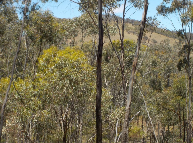
The wind isn’t helping us to start. It’s still got an ENE bent to it as we head southeast through open paddocks that look so dry compared to most of the places we’ve been lately. We ride up and down the gentle undulations in the low-angle sun rays, progressing toward an area of more trees instead of just scattered trees along fence lines.

We climb through a conservation reserve on rough roads through revegetating box-ironbark forest. Then we have some rural roads – some sealed, some not – all to ourselves as we cruise through the rolling topography.


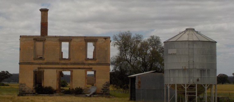
The wind slowly swings to the north and becomes a help to us after Bealiba. This little town has a block-long main street with a building about to fall down on the first corner. The pub was established in 1857 but is no longer open. The only open business is the post office/newsagent that seems to be doing a pretty good trade in weekend papers on this Saturday morning. I stop long enough to have a drink of water, but then continue on. We’ll end up coming back through here at the end of the week.


There’s a bit more traffic on the road than there normally would be… or so it seems. I’m making assumptions about traffic patterns in a place I’ve never been! But the Victorian state election is on today (thankfully, the incumbent government is returned to leadership with a solid thumping of the opposition). So there seem to be a lot of people out and about travelling to the nearest polling centre.
The second half of the ride is pretty flat. And the wind is now helping us sit up in the high 20s kph-wise without too much effort. The Pyrenees and Kara Kara National Park we rode through last week come into view in the distance as we make our advance on Avoca.


The flat land is still boggy in places from the floods in October. I guess the weekly dumps of rain have prevented soggy from becoming sun-baked. In one area, there is debris caught in the tops of fences which stands about boob-height. One particular creek has debris caught in fences for 750 metres to the east and over a kilometre to the west. The creek is currently way down in its banks about knee-deep. The amount of water that would have been flowing down when it spread out over 1.75 kms of adjacent land blows my little mind.


The river at Avoca flooded, too, and came up right under the bridge. There is still some damage to be seen, but there were only a handful of homes flooded. They built the town on the high banks, and the caravan park sits away from the river, so most of the damage is just some park infrastructure.

Avoca is busy, and yes, there is a flurry of activity at the community hall where people are voting. There’s plenty of people out and about on the footpaths, and the cafes are busy. I go in the teeny tiny supermarket to get some food and am glad to be wearing a mask. It is incredibly cramped and there are at least 10 customers in there. The check-out line goes seven deep down the chocolate aisle! But I get some veggies and peanut butter and hope my stink doesn’t deter too many people (I haven’t done real laundry in two weeks, and my shoes have taken on a bacterial load that stinks of submersion and sweat).
I stayed at this caravan park in 2013 when I rode to the Grampians. There was a pretty brand new amenities block then, and they were doing major upgrades to the power supply. So the place was all ripped up, and the ‘could-not-care-less’ non-resident caretaker just told me to find wherever I could that seemed safe (there was tons of heavy equipment moving around). I ended up sort of marooned near a hose reel, thinking that if I was near a pole of some sort, they might not reverse over me. The charge for an unpowered site was $25 which seemed incredibly steep at the time. I wasn’t terribly impressed.
Today, the resident caretakers are a nice couple who lived in Queensland for most of their lives. They tell me to camp wherever I want in the unpowered sites. And they charge me…. $25. With so many things going up astronomically in price, inflation has not budged on the pricing here. Take the wins when you get them.
So the idea was to get here before the afternoon storms and then hang out tomorrow doing laundry and a ramble post while the weather precipitates again. There is a nice indoor camp kitchen here with some outdoor covered seating that will be perfect for sheltering from the weather.
And so we do get to Avoca and get the tent set up before the afternoon storms (it dumps three mms of rain over an hour or so). And we do beat Google today, too… by about 43 minutes 🙂

27 November – Avoca – Dja Dja Wurrung Country – 0 kms
Today is laundry, a wander through the farmer’s market (mostly crafts and food stalls – no good veg), and writing up a ramble post. It does rain again in the afternoon – another few millimetres. Let’s see how many days this rain streak goes.
In the gallery below, or any gallery of pics I post, you can tap/click on a photo and it will bring it up in a tab so you can click through all of the gallery photos.


28 November – Avoca to Mt Beckworth State Park – Dja Dja Wurrung Country – 78 kms
It is cool and windy, but there is sun. It hasn’t been windy all night long though, as the tent is covered in dew on the outside and condensation on the inside. I pack it all up wet and head out while the sun still shines. We’re off to see some volcanoes today!
We ride through more rolling paddocks lined with trees, climb to a high plain of volcanic lava, drop to a creek running along the lava flow margin, and then find ourselves back on the main highway.

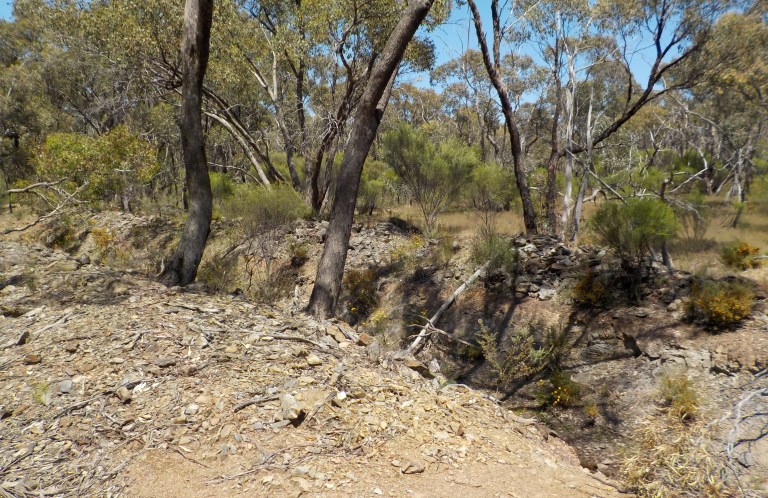
We only have a 100 metres or so on the highway before we turn off on Moores Flat Road. This takes us along a valley and then into the forest where we ride up and down through skinny trees and scarred land from all of the mining that took place in the area.


The clouds come in, and the landscape dulls down to greys and light greens. I wander through the forest, out to a main road and into the forest again to see a quartz reef. I didn’t map this route out, I just read some directions on the Talbot tourist website and wrote this down on my map which doesn’t have this level of detail: “McIntyres, Mia, turn left”. I don’t have kms for each road or even all of the road names. This may have worried me in the past, but I’m comfortable with that level of vagueness now. So I ride until McIntyres turns into Mia Mia and then turn left when Mia Mia comes to a T-intersection. And that works.
The reef titillates my geology nerd within. This is the largest remaining pure quartz outcrop in Victoria. The outcrop runs for more than 750 metres surrounded by trees that throw branches in scraggly directions. There is a mine shaft here, but there was no profitable gold to be found, so the quartz remains instead of being destroyed and crushed in the quest for wealth. The quartz stands five or six metres high and invites you to clamber around a bit to have a look. If only the Dja Dja Wurrung stories about this feature had also survived!


We retrace our steps and ride through more forest into Talbot. The road is lined with all manner of non-manors. All sorts of shacks and sheds and pre-fab buildings line the road in properties that say ‘compound’ instead of ‘weekender’. There are no fancy gates here, just basic sheds or caravans that have had annex after annex added over the years. It’s a little bit creepy and maybe a little bit hippy.
Talbot is an old gold-mining town. There were rushes in the area in the early and mid-1850s, but the rush that established the town came in 1859 along what is now the street of Scandinavian Crescent. At least 15,000 people were drawn to the area. The rush subsided by the following year, but the town continued, albeit with less people. The mining ceased by the late 1880s, but some of the buildings remain (part of the town, and a chunk of buildings down one end of Scandinavian Crescent were lost in bushfires in 1985).


After taking some pictures of town, we head out to see our volcanoes! We’re going to have a look at the slopes of Mt Greenoch, a composite volcano of scoria and lava flows.

We ride over the northern flow and get glimpses of the deep mine shafts sunk through the scoria on the mountain-side. If we were game to ride a shoulderless, very busy road between Maryborough and Ballarat, or we were willing to climb over a barbed wire fence, we could climb up to the crater. But I’m not willing to do either of those, so we just have a look up as we cruise by.

Then we get a super steep and fun drop to a creek that runs along the base of the volcano. Then we cross over a main road and start to climb past another volcano – Mt Glasglow.
I do have one concern. There is a NO THROUGH ROAD sign a little way up this road. But it is at a road junction, and by the way it is placed, I can’t tell if it is for this road or a small driveway-looking road on the other side of the sign. Or maybe it’s meant for both!
I consult my paper map, another paper map and google. They all suggest I can hook together roads that hook up with Wattle Gully Road which then comes out on the Mt Cameron Road. I’m going to have a bit of climbing to get through all of this, and I could get a fair way down before I run out of road, so I don’t want to have to retrace all of that.
But let’s go for it and see what happens. Sometimes when they say NO THROUGH ROAD, there is actually a road reserve that is still accessible and you can still make it through if you don’t need an actual unformed road to traverse. Although, sometimes, the road has been ‘closed’ and resumed within a farmer’s property and is not accessible.
Yet we are out here for adventure and ‘rambling out yonder’, so let’s go see what the road brings.

The road brings scattered old homesteads on the lava flows, a view of the lucky people who live on the Mt Glasglow volcano, and roads that become less and less travelled. Weeds start to poke up and the road gets narrower and narrower.

I get up to the corner of a nature reserve that features a swamp, and there is a fence across the road in the direction I want to go. It has a latch, but it is not locked. The “Wattle Gully” road sign is still there for that direction of travel. Hmmm…..
If there is a fence here, that means there will be more further ahead. Will one be locked? The road heading south looks somewhat well-travelled. But Google shows that road going through the middle of a swamp further up. Like literally through the water.
Now, in most years, I would not bat an eye at a road that supposedly goes through a swamp. It will just be grass and dirt. But this year, if there is water that COULD be somewhere, it WILL be there. And overflowing into other places, too.

But let us go ramble, and see what is ahead on the unfenced road. I’m thinking this road leads to someone’s property and things will deteriorate after the property driveway.
And that is exactly what happens.


It’s not every day that you get the chance to push a bike through a swamp. For 1.3 kms.
Roads? Who needs roads?
I quickly figure out how to read the grass. I need to keep the bike up on the high points instead of in the wheel ruts. Because wheel ruts have deeper bits, what would be potholes when the swamp is not so swampy. So I try to keep the bike up on the high side of a rut and my feet on another. But there are still parts where I’m in water more than halfway up my calf. Of course, I’m trying to do this all by feel, because I can’t actually see my feet or the ground under the water.

Wet feet again. Fully submerged for more than a kilometre. But no leeches.
Slop, slop, slog, slog. The mozzies are just nuts; the flies are having a go, too. But when you are calf-deep in water, you aren’t stopping to take your shoes off and put on your rain pants.
I can tell where we need to go. It is sloppy a lot longer than you might think it would be. The water has reached up the very gentle slope quite some ways. But eventually we reach higher ground and start to approach a house. Those folks might be a bit surprised to see a person emerging from the swamp. But never mind, the road reserve curves away and then we find ourselves at a sign showing just where we’ve been.
There’s a rutted, muddy two-track from the sign to a sealed road. I’m not quite sure where we’ve popped out, but the road we encounter continues to go south, and that is the direction we need to go.

So we follow this road as it dives steeply to a creek that runs through a gorge between lava flows. We climb slowly back out and then cruise on toward Clunes before dropping down a steep decline to the creek in town.

Clunes was the site of Victoria’s first gold strike in 1851. The gold rush went on to sites all over central and north eastern Victoria through the late 1800s. The gold rush in Clunes subsided by 1893, but the town’s old buildings have remained largely intact. Its streetscape has featured in many movies including Mad Max and the 2003 Ned Kelly film.


After a cruise around town, I take off for Mt Beckworth State Park. It’s a push into the wind up and down some lava flows and past an eruption point.


The climb into the park is very eroded and there is a sign stating that 4WD is advised for what is normally a 2WD road. That just means there is a lot of bumping in and out of erosional features and concentrating on picking a line as we climb up to the Corks campground.

When I get there, I see that the toilet block has been wrapped up in tape and is closed. What? The website said nothing about this. It said the other campground was temporarily closed. But nothing about this one. I am thinking if the toilet is closed, then that probably means the campground is closed. Like that 3-year ‘temporary’ closure back at Cobbobonee NP.
But oh no, no way, I’ve put in a heck of a lot of kms and elevation gained to get here today. For goodness sake, I slogged through a freakin’ swamp for more than a kilometre to get here. So, CLOSED, no way are you closed!
I have images of Chevy Chase in the movie Vacation punching the moose in the nose, and then kidnapping the security guard to take them on all the rides, when they rock up to Walley World and find it closed. So, no, no, no, I’m staying here tonight.
It’s a pretty bleak campground. It’s sodden and there are no nice-looking campsites. There would be little shade in summer. However, it’s cold and cloudy, so we just plop the tent down on the one piece of high and flat-ish ground. You’d never camp there right next to the road in the sun when there were other people around, but it seems the best spot right now.

The weather has been very grey and threatening all day. But there are a couple three-minute sunny breaks in the early evening. The hourly forecast suggests it should clear to partly cloudy around 8pm.
But that’s when the rain starts. And continues on and off all night long. This stretch of days with rain so far: 3.
29 November – Mt Beckworth State Park to Craigie State Forest – Dja Dja Wurrung Country – 64 kms
The morning dawns misty with clouds slow to break up. I hike to the top of the mountain. I sit around and hope for the clouds to lift.
Nup. Not gonna happen in a reasonable time.


So I head back to Clunes and then head back toward Talbot. We don’t slog through the swamp, this time, but roll around on high volcanic plains and then through some state forest instead.


From Talbot, we take back roads and forest roads toward Maryborough. I’m following a Central Goldfields cycling map. It’s fairly well signed, but I get off of the marked route at some point and just keep kinda heading north.
Eventually we pop out by the Maryborough water supply reservoir. Then we finally see a sign pointing toward the Aboriginal Rock Wells. I’d planned to look at these today or tomorrow, so we head down that road, backtracking a bit to the south.


I follow the walking track over to the Battery Dam Historic Site- the old gold mining battery where they processed all the quartz and rock to extract the gold. You could not get a starker contrast between adapting to the environment and destroying it. Just a couple kms apart.


I cook up dinner at the picnic tables at the historic site. Now this is what I consider a picnic area, not that decaying picnic table in the weeds by the roadside back at Kara Kara National Park.

Then we wander down the road a bit, wander into the forest and find a flat-ish spot for the night among the spindly ironbarks.
Feet still wet, but it did not rain today.
30 November – Craigie State Forest to Daisy Hill State Forest – Dja Dja Wurrung Country – 55 kms
Today is meant to be a short day. I need to charge stuff. And it is sunny and should be sunny all day. Plus it is very windy and I need to slow up a bit, or I’ll get to Bendigo before I need to be there.
So today we first ride through more forest and into Maryborough. We check out the Gold Era buildings which seem so extravagant for such a tiny town. It just shows how much money moved in that 40 or 50-year period of gold extraction and environmental destruction. The town lacks any really nice parks that I can find and feels a bit industrial.


The visitor info woman is super helpful and super excited about what I’m doing. She loads me up with just about every print-out and brochure for the area. I’m really just after a Cycle Goldfields map that is a bit bigger than the A4 copy I printed at home.
I do get the really nice Cycle Goldfields brochure that is listed for $5 on the shelf. It’s a big map and has print readable without reading glasses. The woman goes over and grabs one and says, “Oh, you can have one of these! You’re a genuine cyclist and we want you to have them. We just put a price on them because we get buses of senior citizens and they just scoop up everything, even if they won’t use it.”
The map has all of the suggested routes around the Goldfields near Maryborough on one side, and all of the forest tracks recommended near Dunolly on the other. It’s well-done.
On the ground, the Dunnolly tracks are better marked, but they are all still easy enough to follow. I do not follow any of them completely but link various bits with other tracks. Still, it’s a fantastic initiative and these routes would be a great way to try out bikepacking. You could trial different packing strategies but never be too far from water or supplies if you were nervous about such things. Or you could go out with five or six days of food, as I’ve done, and just resupply water in towns.
We ride through more flogged forest, check out another very full reservoir and have a chat to a guy getting ready to set up yabby traps. He’s a bit dodgy-looking, and wearing glasses in a style popular in 1986, but he seems intent enough on the yabby traps that I don’t feel threatened.

Next up is the archway for an old pumphouse at the Grand Duke Mine in Timor. From 1869 to 1896, this mine produced 216,000 ounces of gold worth 885,000 pounds.
The ground was very wet in this area, so water needed to be pumped out to safely access the gold. The pump engine was the largest of its kind in Australia and comparable in size to just two others in the world. During the last seven years of its operation, it pumped out 2,000 gallons of water per minute which made it the longest and most continuous wet mine in the state. There were also four main shafts, a 20-head battery, 12 Cornish flue boilers, and 8 iron puddling machines.


And then we fight with the wind on very quiet gravel roads that could be all mine if there weren’t tyre tracks already there.

I come over one rise and see a mob of sheep spilling onto the roadway from a nearby paddock. Then I see the ute and four-wheeler rounding them up. So I stop in the shade, eat a protein bar, and wait for the round-up to progress.
The guy on the ATV sees me and zooms up to me. He is a really nice-looking guy. He’d go great on “Farmer Wants a Wife” if he is not already attached. He says to me, “Hey, mate, we’re not going far, so you can just follow along behind.”
I say, “Thanks, no worries.”
When he hears my voice, he realises I’m a chick, and his whole demeanour changes. His voice softens and he says, “Yeah, we won’t be long. Have a good ride.” Then he zooms off back to herd the sheep to the next paddock. All up, it’s about 20 minutes of riding along at 4kph.

As I climb and descend the golden hills, I have a feeling my rear tyre may be going squishy. Slowly. So I keep riding, keeping the pace up, hoping I can get to a campground in the state park before I need to fix the puncture.
And so we have a bit of extra bounce over the road damage as we traverse a long, flat valley before a climb through forest and then a long, hot, flat road with houses along it. We cut over to the state park on a tiny lane that I’m hoping goes through (it does, but didn’t look particularly promising).

The campground is open bush under young ironbarks and skinny little box trees. There are 3 or 4 caravans parked up in the ‘shady’ sites near the toilets. And a caravan and a tent over in the sunny sites. It’s not all that attractive. The sun feels good today, but it would be pretty unattractive in summer.
I take a picnic table near a caravan that’s been set up there long-term with wafts of rotting wood and canvas making their way over to me when the wind shifts on occasion. The owner is away. The weirdo guy in the tent, who was pacing about holding his head when I rolled in, is dragging his tent over to another site.
I get the tarp spread out to dry, the powerbank and phone charging in that full, mid-day sun and then go about fixing the flat and getting myself very dirty. I can find the puncture. The temp is good for patching, so I do that instead of swapping out for a new tube. I then patch the other tube while I’m at it – there hasn’t been a day warm enough when I had time to do that one before today.

I then go over to the water tank, fill my little nylon bucket and proceed to have a bucket bath while the patches adhere and the tarp dries. Ah, it feels so good to be really clean. We’ve only been getting wet wipe baths the past few nights. I then wash my shirt in the water, set it out to dry while I pack up, and then slip the wet shirt back on. It keeps me cool as I ride through more forest and mining mullock heaps and more forest.
Around 5pm, I see a nice flat spot at the top of a hill next to a very big hole. They obviously went after a fair bit here. There are parallel deep dig lines on either side of the big pit, and there is some current mining activity way further down on private property near the main road. We’re some 700 metres or so from there, so that was a big lead or reef!


I finish up charging the phone. I’m really impressed with the solar panel. I’ve had so few times I could use it so far, but I’m excited about how it can keep me going and going and going. Like a little Energizer Bunny who only needs to go into towns to get food and can stay totally off-grid.
This bodes well for the high-country riding to come. I’m so excited about those possibilities. I’ve been carrying six days of food for most of this ride (not because I need to, but just to practice packing and carrying that weight) and could easily carry more. So if I can keep my phone and powerbank charged, and the creeks will still carry water in the high country this summer (which is 90 percent likely), then the only things that tie me to going into towns is the desire for a proper shower and laundry, and to resupply food. I’m liking the possibilities. Always looking forward.
1 December – Daisy Hill State Forest to Moliagul Historic Reserve – Dja Dja Wurrung Country – 80 kms
Today features more forest tracks, more cleared and flogged and mined landscapes, and more recovering, box-ironbark forest. We first ride back into Maryborough and fill up four litres of water.
The gallery shows you some more public buildings,etc in Maryborough we didn’t show you yesterday.


Then we’re off through more forest and tiny back roads toward Dunolly.

I see an ancient guy with an ancient horse hooked up to a harness racing buggy. I stop so I don’t spook the horse. I think we all age another five years before they finally get to me. The old guy wonders what I’m doing. He tells me Dunolly is close by. I’m sure now that the horse is old enough not to spook, but the old guy, who doesn’t quite seem to have all his mental faculties left, tells me they have to get out for exercise every day. I think his back is permanently hunched from sitting in one of those buggies. I’m sure he has good stories from his prime years which are long gone now. Those stories are probably really the only thing he remembers now for very long. We bid adieu as the flies all launch up into the air like electrons around a nucleus as we both move forward and away.
I stop in Dunolly for a long gut break. On the days that I can, I do try to stop and have a 45-minute to 1-hour break after 2.5 or 3 hours of riding. Long rides are pretty terrible for your gut health. I head up to the park to eat after I look around the main street. It looks pretty much exactly as it did in 2013 when I rode through here on my way to the Grampians. The only difference that I can see is that the Royal Hotel is no longer operating.


We head out of town and climb and fall over the gentle hills of scraggly forest. We see no vehicles for the whole time we are in the forest.


The wildflowers are going off, carpeting the floor in a shaggy gold like the 1970s carpet in my childhood bedroom.


As we pop out at the Bealiba Reservoir, we find ourselves in an algebra problem: if cyclist X is travelling at 15kph from the east, 4WD Y is travelling at 70kph from the west and dodgy ute Z is also travelling from the west at 80kph, then who reaches the picnic table on the east side of the reservoir first?
Yeah. Me. Cyclist X.
I’m sure the people in the 4WD could see the picnic table site from the other side of the reservoir and thought it’d be a good spot. But then, out of the forest, pops this cyclist who lays claim to it.
The 4WD people then go over and let their dogs out near the toilet block rather than the next little clearing further up. Okay, whatever.
The dodgy ute continues to advance very slowly across the dam wall. In the back of the ute are perched two huge German Shepherds. There is very loud doof-doof music emanating from the cab of the ute and reverberating across the countryside. The sound system is easily worth 10 times more than the crappy, little old ute itself. It’s incredibly disturbing and loud in that quiet place.
They come up and back in right behind me. I swear I can feel the base music thumping in the wood beneath my arse on the picnic table bench.
The dogs jump out and come toward me. The slightly overweight hippy-looking dude with more dreadlocks than teeth says to me, “just don’t try to touch the black one.” Yeah, no worries.
I continue to inflate the guys floaties, because they were going to get a float while I had a snack. But now I’m worried about the dogs eating them. So I finish my snack, hoping the doof doof guys and their dogs leave. They don’t. They just hurl rocks into the water for the dogs to chase.
Eventually they move over enough that I put the guys out to float. I guard the guys a bit.
Then, I go over to the hippy guy and the guy with liquor in a Schweppes bottle and say, “Okay, so what’s the music? I need to know since it will be a soundtrack in my little video.”
They tell me it’s psy-trance. That’s psychedelic trance music – a form of electronica dance music. The Schweppes guy is Robbie from Frankston. He’s classically trained but performs this sort of music under the name Instant Alien. He is a music producer and works with heaps of bands and artists. He is very excited to get out with his campervan and cat for a bit. The cat hasn’t been out in ages (because cats go places?). The psy-trance music is ‘performed’. They are actually creating the music as they go, combining all of the sounds. It’s not DJing.
The hippy guy is an events promoter. He just moved here about 3.5 months ago. He’s looking forward to hosting ‘birthday parties’ here at the reservoir for 200-300 people. It’s such a peaceful setting.
Whoah-boy, there’s only one toilet. I cannot imagine that tiny, quiet little Bealiba is ready for hundreds of people to turn up for a bush rave. It’s a four-block town where you might go days without seeing a soul. It’s old farmers, etc. And they are going to hold huge bush doofs here – bush raves with techno music and hundreds of people?
It makes me think of another Michael J Fox scene from Back to the Future where he plays the modern rock on the guitar at the school dance and everybody just stops dancing and looks at him and he says, “Guess you’re not quite ready for that.”
Poor Bealiba. They’ve got no idea what’s coming!
I chat with the Robbie and the hippy a bit longer. They talk about how the bush trance music is so appropriate because everything resonates at a certain frequency. The trees resonate. The rocks resonate. And all I can think as they explain this is that the bush resonates at a much lower, quieter frequency than techno.
They go on and their talk (hippy guy is high and music producer guy is off-his-face drunk) makes absolutely no sense to me. They could be talking in a foreign language for all I know. It totally reminds me of the time at the Great Sand Dunes, as I packed up my bike, where I overheard the two guys talking about communicating with extraterrestrials. (Which is hilarious, because when I look up Instant Alien later on facebook, the dude is totally into UFOs and conspiracy theories).
We have a good conversation, even though I’m sure we live in different realities. As nature girl as I am, I have no hippy in me. I don’t mind the techno music, but it doesn’t ‘resonate’ with me. Give me punk music or classical music. Those are the ones that give me tingles and describe the two-tone flow of my life.
They thank me for coming over to chat and are happy to have made a new friend. I’m just happy their dogs didn’t eat my crew in their floaties. And it was certainly informational. But gosh, Bealiba, watch out!
Bealiba has a water refill station at the rec reserve so I top up my supply before heading back out.


Back into the forest for a bit, down the main road for a bit, and then back into the best-looking forest I’ve seen in all of this Central Goldfields cycling the past few days. There are ironbarks that might be 45-years-old instead of 30. The undergrowth looks healthy and diverse. There’s not much evidence of recent fire. The gullies are a pleasure to pick our way up the eroded tracks. Of course, this isn’t one of the suggested cycling routes, but we’ll hook into one at some point. My map doesn’t have any track names, so I’m just heading the direction I think I need to go.
Yeah, this area, and the stuff between Goldsborough and Bealiba are the choice forest areas of all those I ride through over this week.
I eventually hook back into the track that is the suggested cycling route, and before I know it, I am at the Welcome Stranger monument. The barren hillside devoid of vegetation is the dead giveaway, even before we see the picnic infrastructure and monument itself.

The Welcome Stranger gold nugget is the world’s largest alluvial gold nugget ever unearthed. There had been several gold rushes in the area from 1853 to 1855, but the guys that found the nugget were working near the gully that had been the main site of workings in the past.
“On the morning of Friday 5 February 1869, Deason was breaking up soil on the claim when he hit what seemed to be stone. After hitting it a second and third time and clearing away the soil with a pick, he saw gold. The nugget was only 2.5cm (1 inch) below the surface; after clearing away more dirt Deason broke his pick handle in an attempt to lever it from the ground. He finally resorted to a crowbar.”
“As the nugget was too large to be weighed on the bank scales, Archie Walls, the blacksmith was called in to cut it into smaller pieces. The total weight of the nugget, including what was obtained from the crushed quartz and other pieces broken off and given away to friends, was estimated at 72.5 kg (2332oz). It was considered a shame that in all the excitement no-one thought to photograph the nugget, and the only sketches made were drawn from memory.”

I have a look around and decide that the little picnic table down the hill would be a good spot for the night. I don’t see any signs prohibiting camping anywhere. There is a rainwater tank up in the main picnic area, so I’m able to have a good bucket bath to feel clean again. The solar panel tops up my phone while I cook dinner, and then I bed down on the very hard ground (the first place I can’t get the pegs in more than a few mms on this trip).

The sunset glows for a long time – nothing spectacular, but then again, I am more than happy for a sky without clouds and just a long slow burn as dusk gives way to night.

2 December – Moliagul Historic Reserve to Glenalbyn State Forest – Dja Dja Wurrung Country – 77 kms
Moliagul, in the height of the gold rush, had a main street a mile long. Now it is just two houses, the old pub, and a public toilet block. The cemetery is now a very long way out of town, since town stretches about 150 metres.


We turn off into another state forest, another one that is lucky if it has trees more than 30-years-old. The first bit we ride through feels particularly flogged with some areas looking like they were cleared within the last 20 years.
My map has a couple spots noted on it as where the Dja Dja Wurrung liked to camp during the Gold Rush era. By the time the gold rushes came, the clans had already been decimated back in the 1830s as the squatters arrived and the government put police and money into the ‘Frontier Wars’.
So I ride along feeling quite sad and trying to comprehend just what it was like for the First Nations peoples. It wouldn’t be just about losing your way of your life and your family. Their relationship with the land was not one of possessive attachment. The ‘country’ was a living thing that was part of them, part of the stories of Creation and how the world came to be. It was something that was to be cared for like a family member. That responsibility of caring for country was the driver for all custom, lore and life.
So to see your ‘country’ absolutely decimated so quickly, to see the land completely stripped of all of its trees and the ground ripped apart and left gaping… it is not just dispossession, it goes so much deeper to a level that I just cannot begin to understand.
As I go further into the forest, and weave through areas where water has just sheeted across the open forest floor instead of running in rivulets to creeks, I think about how we value this land today. Now, be advised that my undergraduate degree was in Natural Resources Journalism. It was sorta like a double degree where I took classes in forest management, recreation management, etc. Yet I also took classes in newswriting, publication layout and design, etc.
Part of learning to write about natural resources management inevitably included economics classes. And I had to take so many of those (recreation economics, environmental economics, natural resources economics, etc), that I would have ended up with an Economics Minor had I taken just one more econ class.
In those classes, I learned that there were direct and indirect values. Direct values were things you could measure in dollars, e.g. the price you would get for the timber if cut down. Indirect values were things that could not be directly measured in dollar value.
Indirect values included option, existence and bequest values. Option value was how much you valued being able to visit a place like this state forest. Existence value was how you valued that place just to be there, whether you could ever visit or not. And bequest value was how you valued being able to pass on that place or thing to future generations. (These values actually underpin much of the wording in America’s 1967 Wildnerness Act).
So, in economics, you can’t just indirectly value a place and make policy based on a place being highly valued in indirect ways. You have to try to put a dollar value on it, or ‘what would you be willing to pay to pass on that place to future generations, or ‘how much would you be willing to pay to visit a place’? Everything has a price.
There were lots of economic methods devised to try elicit dollar values for indirect values, so they could be put in cost-benefit analyses. There were things like the travel cost method and something around ‘ecosystem services’ (i.e. the forest’s ability to provide clean air, offset carbon emissions, etc).
I was only 19 or 20, but I could see such huge flaws in this way of thinking. Some things are priceless (even without a Visa card). To me, it seemed like some places were so unique or so biodiverse that they deserved protection regardless of opportunity cost (e.g. the dollar value foregone by not harvesting the timber). I didn’t have the worldly experience or knowledge of neoliberal theory or understanding of politics at that age to see how the western world had shifted to living in an economy instead of a community. But I knew all that stuff I was learning didn’t sit right.
None of it sits right still. But as I ride, I think about how maybe option, existence and bequest values don’t capture the breadth of indirect values. I think there should be another one called reparation value or restoration value. It would capture the value people place on returning a decimated landscape back to health. (Now, of course, what is ‘healthy’ and the merits, and even capability, of returning a landscape to pre-colonial status is controversial, but I’m not worried about that aspect here).
So, as I’m riding, I’m thinking about this indirect value and how you would achieve it by altering definitions for conservation status under various land tenures. I’m thinking about the value and opportunity cost of a moratorium on clearing. No more offsets. If it’s growing, you can’t cut it down, etc.
So for those kilometres in the forest on our way back toward Dunolly, I fantasise about what the policy would look like that would allow these forests to return to grandeur and glory. I fantasise about a world where indirect values don’t have to have a dollar value inflicted upon them. It’s a fantasy world where a landscape would be protected simply because it has indirect values and not because the proxy dollars determined by some crazy econ method came up trumps in a CBA.
I fill up four litres of water in Dunolly and then take off through the forest again toward Tarnagulla. These tracks are steeper and much rockier, and you have to ride up the rock shelves where the overlying gravel is gone. It requires more concentration and muscle than any of the other areas ridden over the past couple days.

I hook into another Cycle Goldfields route, the blue one, but I’m riding it backwards. They only have the arrows on posts set up for the direction of suggested travel. At one point I see that the route has come from a small track that is also a 7km signposted walking track. So I head that way. MISTAKE! It is pretty narrow and not well-used. You just ride over lots of sticks, rocks and prickly things that would likely cause a puncture later in the year at a different growth stage. The track is very rough and all it shows you are lots of mullock heaps along a creek. And, boy, have we already seen a lot of that!
We are going so slow through all the obstacles that the mozzies are able to hover about, land and bite. And then, at the end, the two-track disappears and you have to negotiate an overgrown single-track with acacia trees at eye-thumping height. Then you have to dismount and get your bike in and out of two incised creeks before pushing your bike up a short, steep hill into a camping area. Ugh.
So if you are doing the route out to the historic Waanyaara area, just stick to the Wet Gully Road. You can still go see the old town site, cemetery, camping area, etc. You just miss the boggy, overgrown walking track that follows the creek past old gold diggings.
The camping area has a fair few people in it – looks like some long-term campers out prospecting and some weekend warriors getting a headstart. I stop to wet down my shirt with the rainwater tank water, then we head on through more flogged forest to Tarnagulla.


My memory of Tarnagulla from 2013 was that it had one tumble-down main street and the darkest public toilets ever. That memory is accurate. However, down the back of the park with the public toilets, they have built a community centre. In the community centre, there is a cafe with incredbily reasonable prices. The portions look decent, and the food looks good. They have salad bowls for $7 and full meals for $12. Consequently, every old person in the district is there to get a cheap meal. Who cares if the food is good, as long as it’s a deal!
I negotiate through the old people to find that the poor cafe is down two staff members due to Covid today, so the remaining two are completely run off their feet. Had it been quiet I might have gotten a salad bowl, but I might be a senior citizen myself before they get to it, so I just get the orange juice I had originally come in to purchase. But should you be in Tarnagulla, check it out, it looked like a good thing to support. And I had at least three people come over to chat with me. So you won’t be lonely.


We ride out on some chipseal for a bit among crops starting to be harvested. The fields are golden and dried out up here. In the distance we can see Mt Bealiba and Mt Moliagul that we rode under yesterday.


We can also see the granite hills in Kooyara State Park ahead of us. The tracks and campgrounds are closed, so we won’t be visiting there. They were already closed before the rains and flooding, so I hadn’t planned to go there anyway. Back in 2019, those attractions were closed ‘temporarily’… still closed. I’m finding there is a big disparity in facility funding in Parks VIC vs DELWP (i.e. state forest)-managed reserves on this trip!
We turn off the sealed road that leads up to Rheola and take off toward the Kingower State Forest. I have no detailed map for this one, so the idea is to head into it, and wander around in a northwesterly direction and then figure out where we are when we pop out on the other side.
It’s a box-ironbark forest with absolutely no ironbarks. It looks pretty rough in the first few kms. We happen upon “Orchid Dam” but don’t see any orchids around today. The guys go for a float, and I play them one of my favourite ‘preludes’, thinking that this music has to resonate with the forest frequencies much more than techno music.
We continue wandering north-ish and find some much better looking forest as we climb to a low point in the range. Then we get a really nice, long downhill through forest that degrades in quality again as we get to the lower slopes. The erosion damage isn’t too bad on this track, so we just fling through all of it at speed. Yee-ha!

We come skidding to a yield at a t-intersection, finding ourselves out the back of the old school. The last major gold nugget find was just here back in 1985. A guy with a metal detector found the ‘Hand of Faith’ nugget just a few inches below the surface, renewing hope that still pervades that there are still huge finds out there waiting.


I don’t have a destination for tonight, but I’m thinking somewhere in the Glenalbyn State Forest would set us up nicely to go up to Mt Korong first thing in the morning. I don’t have detailed maps for this area, just some main sealed and gravel roads are shown on my map. I don’t feel like pulling out my phone. And the locals have removed all the road signs from the posts. So I just continue to work my way north and west.

We find ourselves on a very narrow, almost non-existent track for a while. It is in really bad shape, and the track is completely washed out in its four creek crossings. I start to wonder if this is the one closed road I saw listed in the area. Since I don’t know the name of the track I’m on, I can’t say (it is not the closed road, I determine later). But you definitely aren’t getting down this in a 2WD vehicle.


We get up to more forest. This is technically a section of the state park and not the state forest, but there are no closure signs. For awhile we are on Paterson’s Track and Ingle-something track. We bump along and only have one section where the creek is still running full and running in adjoining creek beds that would normally never have water. The creek is using the road to move between these water courses, and it takes 5 or so minutes to negotiate all that without dumping the bike or getting my feet wet.
We then hit the edge of the forest at a main gravel road. We see a sign for Sunday Morning Hills Road. Finally, I know where I am! This road leads over to a camping area. Let’s head down there and see what’s up. It’s likely to have caravan people with generators, but we’ll keep an eye out on our way. It’s getting to be 4pm, and we’re close enough to Mt Korong now that anywhere will be fine for a campsite from here on out.

I ride through the scrub and can hear a caravan generator a couple hundred metres before I get to the camping area. It turns out to be two couples with two large caravans and 4WDs. They are hogging two of the three picnic tables (but aren’t using either). Their yappy dogs come running at me as I arrive. (They can’t hear me coming because of the generator noise).
I roll over to the remaining picnic table so I can cook up dinner. It’s much easier to cut veggies and organise the stove, etc on a table instead of on the ground. Another campervan arrives and drives down to a somewhat shady area. The generator couple finally turns off the generator, and one man makes the comment, “Oh, you don’t really hear it when it’s on, it’s just when you turn it off that you realise it was making noise.” HA! They then proceed to fire up a chainsaw so they can cut up wood to start a campfire. It’s 30 degrees today – you really don’t need a campfire….
After I finish up dinner, I head back down the road 500 metres to a spot I saw on my way in. There’s a little bee site where apiarists leave their hives a hundred or so metres down a tiny sidetrack. There are no bees there today, though, so it’s a nice little spot for me. The kangaroos are curious, though, and they come quite close before casually hopping away.
I get the tent set up without the fly and climb in to escape the mozzies. I have gotten soooooo dirty today. I’ve also gotten very sweaty. I haven’t had a proper shower all week. My riding shirts are so dirty and stained. Sheesh – I almost can’t stand myself. You’ve never seen wet wipes so brown after use on arms and legs!
I forget to get a campsite picture for you. This often happens in these bush sites because I’m hurrying to get the tent set up at night, and then taken down in the morning, so I can get in the tent or get on the road and escape the mozzies!
Tomorrow we start making our way toward Bendigo. I’ll meet Nigel there. He is coming down to buy a truck tray and will spend a couple days to get it set up for his truck. He’s bringing me a resupply of my thyroid meds and my Strathbogie maps. I’ll get the bike serviced while I’m in town. I’ll also have a better look around.
I’m going to send the tablet back with Nigel, so this is the last post you’ll see from me until Christmas time. I’ll catch up the journal when I get back to Albury.
I’m going to see how I feel about riding without the tablet. I’m thinking I might leave it behind for the high country portion of the trip. I just haven’t been using it much so far. I pull it out once a week to do the ramble post and that is it.
So I incessantly worry about it, but don’t use it much because I don’t want to expose it to high or low temps or high humidity or dust, etc. Because I’m outside so much, this means I rarely use it. I just worry about it.
The tablet also takes up a lot of space in the pannier because I have it in a water-resistant laptop bag that has a foam cushion in it. This then sits within a proper drybag. So it takes up a heap of pannier space and weight and I’m not sure I can justify that for the amount that I use it.
I’m starting to think taking along a tablet is a luxury for a more sedate trip on smoother roads and roofed accommodation where the electronics aren’t so constantly exposed to the elements and so much bouncing around!
So I’ll talk to you again around Christmas-time…..
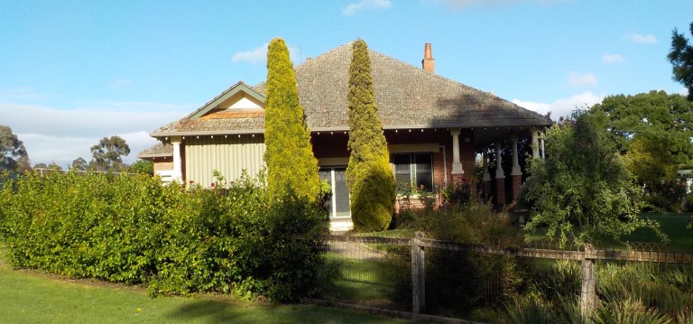
Thank you for another mind-boggling ramble, Em. You deserve more than a free map!! Once again, I got immersed in the scenery and history of the fragile land. It is amazing that so many really old structures are in such good condition. Thanks for the vehicle images and yes, an old race car for a yard ornament might make it easier for people to find our home. The house numbering system here is notoriously difficult to follow. We do really enjoy your posts and hope you’ll resume when possible. Love, Mom and Dad
Okay, so I love a reading about multiple days at a time. The hard part is remembering all the comments I wanted to make along the way. (There I go again–thinking only about ME.”) But if you get rid of the tablet, that will mean even longer distances between posts. Still, I understand. I carried my mini-laptop on my recent December mini-tour. After several hours in the cold, it did not serve me well at all.
Do Australian libraries have computers for public use? I used libraries to update my journals every couple of days for my first few tours. I’m seriously considering going back to that system.
Thanks, Greg. I figure if I post multiple days at a time, readers can skim the whole thing, read the whole thing or come back to it and read a day at a time. Plus, I just couldn’t get phone reception and good weather much more frequently than that on the first part of the tour!
I can see how your mini-laptop didn’t like those temps! I find my phone and little camera both do not like temps much below about 37F. They tend to be slow and the battery goes quick below that – and your temps are considerably colder than that. I think going back to the library visits is not a bad idea for your upcoming tours. I often visited libraries to download my camera photos onto a USB stick on my 2010, 2013 and 2014 US tours. So that would work well for you I’m sure. I’m not convinced that posting everyday on the road is even all that healthy. It really is good for your mental health, and for not getting addicted to the 24 hour news cycle and constant connection, if you get off grid and away from the laptop every now and again.
So the library thing is a great idea but probably not feasible here. It would likely have been do-able with some planning on a weekly basis on the part of the trip I just completed. But the next bit will be quite remote, so not really an option. Over here, you have to come across a town of about 5,000 to 6,000 (which is a BIG rural town here) to have a good chance of a library or council service centre with internet access. Anything smaller would be really hit and miss. A lot of them just get a bookmobile type service. The other issue for me is that doing a post in a library would take me pretty much all day, and I still don’t do anything indoors where I have to be inside for more than 15 minutes. COVID is off the radar for most people, but catching it could relapse all the crap I’ve emerged from, so obviously I’m extra cautious and still wear a mask indoors everywhere, etc.
I had already been thinking that I would not take the tablet along on the next bit of the tour, simply because I will have to do river crossings and the weather can be pretty intense at times in the high country. But the first part of the tour had much worse weather than I would have predicted, and based on that experience, and what I had to do to protect the tablet (I still damaged the screen a little bit even with the major measures I took to keep it safe from cold, wet and vibration), I think it is probably not a good idea to take it on even rougher tracks and deeper water crossings! Sorry, but you’ll just have to experience the ride after the fact. I still have been writing in my journal every day with pen and paper. Like you, I find this deeply satisfying in a way that typing it up on the computer does not. I’ve found I really, really like being disconnected 🙂
That’s okay with me if you write it all up at the end of your tour. I look forward to binge-reading your each and every episode.